Atsinanana rainforests
| Atsinanana rainforests | |
|---|---|
|
UNESCO world heritage |
|

|
|
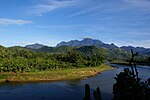
| Marojejy National Park |
|
| National territory: |
|
| Type: | nature |
| Criteria : | (ix) (x) |
| Surface: | 479,660.7 ha |
| Reference No .: | 1257 |
| UNESCO region : | Africa |
| History of enrollment | |
| Enrollment: | 2007 (session 31) |
| Red list : | since 2010 |
The Rainforests of the Atsinanana are one of the UNESCO -listed site of World Heritage in Madagascar . The World Heritage Site includes six national parks in the Atsinanana region and on the eastern coast of the island. The world heritage site has been on the Red List of World Heritage in Danger since 2010 .
registration
The rainforests of Atsinanana were added to the list of UNESCO World Heritage in 2007 based on a resolution of the 31st session of the World Heritage Committee. This makes them one of the second world natural heritage sites in Madagascar after the Tsingy de Bemaraha Strict Nature Reserve .
The reason for the entry states, among other things:
They show an outstanding biodiversity worldwide and have an exceptionally high proportion of endemic plant and animal species. The proportion of endemics is around 80 to 90 percent, endemic families and genera are common. The multi-part site is composed of a representative selection of the most important habitats of the unique rainforest biota of Madagascar, which includes many endangered and endemic plant and animal species.
The entry was made on the basis of criteria (ix) and (x).
(ix): The rainforests of Atsinanana are relic forests that are located on steep terrain along the eastern slopes of the Madagascar Mountains. The protected areas contained in this multi-part site are crucial for maintaining ecological processes that are necessary for the survival of Madagascar's unique biodiversity. The biodiversity reflects Madagascar's geological history and geographic location. It is the fourth largest island in the world and was separated from the other land masses at least 60 to 80 million years ago, so most plants and animals have developed in isolation. Forests have also provided an important refuge for species during recent climatic changes and will be essential for the adaptation and survival of species in the face of future climate change.
(x): The proportion of endemics within this site is approximately 80 to 90 percent for all groups, endemic families and genera are common. Madagascar has an exceptionally high number (around 12,000) of native plant species and is one of the few countries known for its “megadiversity”. The site is also important for the world's wildlife, especially primates, are represented five families of Malagasy primates, all endemic lemur families , seven endemic rodent species, six endemic carnivorous species, as well as several Fledertierarten . Of the 123 non-flying mammals in Madagascar (72 of which are on the IUCN Red List of Endangered Species), 78 occur within this site. The crucial importance of this site is underscored by the fact that only 8.5 percent of the original forest cover in eastern Madagascar is left through deforestation and the site protects key areas of the remaining habitat.
The individual sub-areas
The World Heritage site is divided into thirteen sub-areas, which in total encompass a protected area of 479,660.7 hectares .
Web links
Individual evidence
- ↑ Original name in English Rainforests of the Atsinanana , French Forêts humides de l'Atsinanana , German translation according to the World Heritage List. In: www.unesco.de. German UNESCO Commission, accessed on June 21, 2017 .
- ↑ a b c Rainforests of the Atsinanana. In: whc.unesco.org. UNESCO World Heritage Center, accessed June 21, 2017 .
- ↑ Decision: 34 COM 7B.2. In: whc.unesco.org. UNESCO World Heritage Center, accessed June 21, 2017 .
- ↑ a b Decision: 31 COM 8B.9. In: whc.unesco.org. UNESCO World Heritage Center, accessed May 4, 2017 .
- ^ Rainforests of the Atsinanana. Maps. In: whc.unesco.org. UNESCO World Heritage Center, accessed June 21, 2017 .


