
Reinbach (Ahr)
|
Reinbach Reiner Bach |
||
 Top level of the Reinbach Falls |
||
| Data | ||
| location | Sand in Taufers municipality , South Tyrol , Italy | |
| River system | Etsch | |
| Drain over | Ahr → Rienz → Eisack → Etsch → Adria | |
| River basin district | Alpi Orientali | |
| origin | Confluence of Bacherbach and Knuttenbach near Rein in Taufers 46 ° 56 ′ 41 ″ N , 12 ° 3 ′ 48 ″ E |
|
| muzzle | at Sand in Taufers in the Ahr coordinates: 46 ° 54 '52 " N , 11 ° 57' 53" E 46 ° 54 '52 " N , 11 ° 57' 53" E
|
|
The Reinbach (also Reiner Bach ) is a left tributary of the Ahr in South Tyrol , Italy . It rises in the Rieserferner-Ahrn Nature Park above Rein in Taufers and flows through the Rein valley and the Tobel Gorge with the Reinbach Falls . It flows into the Ahr at Sand in Taufers and drains further via Rienz , Eisack and Etsch into the Adriatic Sea .
The Reinbach is best known for its spectacular three waterfalls in the Winkel (Kematen) district of Sand in Taufers. The upper and middle Reinbach falls are around 50 m high, the lower around 10 to 15 m. The lower step is located under a mighty rock head rising to the north, which is sometimes referred to by the locals as "Christ's head" due to its anthropomorphic shape .
While the lower two cases are of natural origin, the upper case level is the result of a partial derivation of the Reinbach to generate electricity (Toblwerk).
The three waterfalls are accessible via a hiking trail, which can either be climbed from Winkel or descended from the ravine. In 1985 there is a church dedicated to St. Station path dedicated to Francis was built, which ends in the former castle chapel on the so-called Kofel above the ravine.

Before and look at the upper waterfall

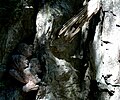
Top case level

Medium case level

Reinbach Falls 1981 - lowest fall level

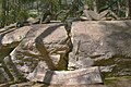
Lower Reinbachfall with station of the Franziskus-Weg (Deluge)


Franziskusweg

Beginning

Sister sun

The portiuncula
God's fire

moon and stars
make peace

God's creation

Francis Cross

Sun and rain

Teach us to consider ...
God welcomes us
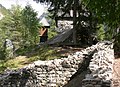
Castle ruins with chapel

In the chapel

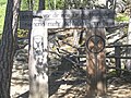
Station of the Franziskusweg at the upper entrance

Station of the Franziskusweg at the upper entrance

Station of the Franziskusweg at the upper entrance


Web links
- Reinbach on the website of the South Tyrolean Environment Agency