Reiteralm (Styria)
The Reiteralm in Pichl-Preunegg , municipality of Schladming , is a mountain in the upper Ennstal in Styria .
Winter season
The ski area is located on the north side of the Gasslhöhe ( 2001 m ) and extends up to an altitude of 1741 m . As in the neighboring ski area around Schladming with Planai and Hochwurzen, there are also two combined ski mountains Reiteralm / Fageralm , which are only connected by a ski bus line.
The Reiteralm, together with the Hochwurzen , the Planai and the Hauser Kaibling, form part of the 4-mountain ski area in the Schladminger Tauern , the former having a common valley station with the Reiteralm. The entire ski area is part of the Schladming – Dachstein ski region of the Salzburg Ski amadé winter sports area .
The main entrance to the ski area is the valley station of the Silver Jet in Gleiming. There are also lifts to the ski area from Pichl (Reiteralm I double chairlift) and Preunegg (Preunegg-Jet).
Lift operation
The Reiteralm has
- 2 cable cars (Silver-Jet, Preunegg-Jet)
- 3 chairlifts (6-seater Gasselhöhe chairlift, 4-seater Sepp'n Jet chairlift, Reiteralm I double chairlift)
- 10 tow and practice lifts (Reiteralm lift III, Mulden lifts, Haseck lifts, connecting lift, practice lift, practice meadow)
Slopes offer
Most of the 23 km of slopes are marked in red, as are all the important runs and all valley runs. Blue marked pistes can be found predominantly in the area of the practice area at the mountain station of the Silver Jet. Also marked in blue are several pull ways for bypassing medium and difficult sections of the slopes. Several rather short sections of the slopes at various locations in the ski area are marked in black.
Summer season
The Reiteralm enjoys increasing popularity in the summer season. The Prunegg Jet cable car was in operation from May 31 to October 13, 2019 on designated days and times. In summer the Reiteralm can also be reached via a 12-kilometer toll road . In summer 2019, the toll for adults without a discount card was € 4 per person.
In summer the Reiteralm is popular for mountain hikes .
Below are some examples of mountain hikes:
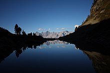
From the Reiteralm to the Spiegelsee : This is an easy and very popular hike. In just under an hour it leads to the Spiegelsee (middle Gasselsee), in which impressive reflections of the Dachstein massif can be admired when the wind is blowing .
Three mountain peaks can be climbed from the Reiteralm in three to four-hour mountain hikes (also as a circular hike): Gasselhöhe 2001 m above sea level. A. , Rippetegg 2126 m above sea level A. (spelling Rippeteck e.g. on the weather protection box for the summit book , currently mostly written in Rippetegg ) and Schober 2133 m above sea level. A.
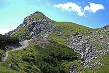
From the Reiteralm to the Gasselhöhe : The Gasselhöhe is the summit that is closest to you as seen from the Reiteralm. At first gently rising, the route follows a short steep section. The hiking time is about an hour and the path is taken by a comparatively large number of hikers in summer. In winter the path is suitable for a snowshoe tour.
From the Gasselhöhe to the Rippetegg : A very beautiful high path leads from the Gasselhöhe to the Rippetegg. It offers a variety of views of the Gassel lakes and the Dachstein massif, which lie far below. The hiking time is about an hour. At the end of the high trail, a relatively steep and moderately difficult ascent to the summit cross awaits the hiker . Surefootedness and special attention when wet is required.
From Rippetegg to Spiegelsee : From Rippetegg the path leads steeply down to the Gasselseen. The descent takes about half an hour and requires surefootedness. After the descent, there are two options: the way back, on a comparatively easy path past the Spiegelsee, to the Reiteralm or additionally to climb the Schober.
Detour: Ascent of the Schobers :
The ascent to Schober takes place south of Spiegelsee at the crossroads to Rippetegg. You should allow at least one hour for ascent, rest and descent.
The ascent of the Schober is at the transition between mountain hiking and mountaineering . For the ascent and descent, a high level of surefootedness and a head for heights are required. In some places you need your hands to move forward. When the surface is wet, the inspection can be dangerous and retreating can be difficult, especially if the weather suddenly falls.
Web links
Individual evidence
- ↑ a b Reiteralm Bergbahnen GmbH & Co.KG: Reiteralm and Fageralm. Retrieved October 28, 2019 .
- ↑ a b Schladming-Dachstein Tourismusmarketing GmbH: hiking map excerpt from the Reiteralm. Retrieved October 28, 2019 .
- ↑ a b Schladming-Dachstein Tourismusmarketing GmbH: Gasselhöhe. Retrieved October 28, 2019 .
- ↑ a b Schladming-Dachstein Tourismusmarketing GmbH: Directions to the Reiteralm Höhen-Rundweg. Retrieved October 28, 2019 .
- ↑ Rudolf Widmar: Gasselhöhe 2001m, Rippeteck 2126m & Schober 2133m. Retrieved October 28, 2019 .
Coordinates: 47 ° 21 ′ 34 " N , 13 ° 35 ′ 42" E


