Rikasicha
| Village
Rikasicha
Рикасиха
|
||||||||||||||||||||||||
|
||||||||||||||||||||||||
|
||||||||||||||||||||||||
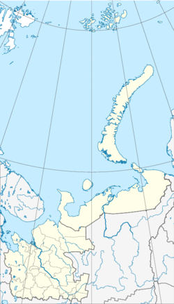
Rikasicha ( Russian Рикасиха ) is a village ( derevnja ) in northwestern Russia . The place belongs to the Arkhangelsk Oblast and has 1877 inhabitants (as of October 14, 2010). Rikasicha belongs administratively to the Primorski rajon .
geography
Rikasicha is located about 20 kilometers southwest of the Oblast capital Arkhangelsk . The place is located in a swampy area on the left bank of the Northern Dvina within the Dwindeltas around 20 kilometers from its confluence with the White Sea . Rikasicha is the administrative center of the municipality of Primorskoje selskoje posselenije ( Приморское сельское поселение ), which, in addition to Rikasicha, comprises eleven places (six uninhabited, including four train stations or stops) with a total of 2690 inhabitants (as of 2010).
history
Rikasicha became the administrative center of the Primorsky rajon instead of Arkhangelsk following a resolution of the All-Russian Central Executive Committee on March 2, 1932 . In 1938 it also became the administrative center of the Primorsky selsowet ( Приморский сельсовет ). In 1955 the administration of the Primorsky rajon was transferred back to Arkhangelsk.
Infrastructure and traffic
Rikasicha is located on the Russian M8 highway between Arkhangelsk, about 20 kilometers away, and Severodvinsk, about 16 kilometers away .
There is a battery in the south of the village .
Individual evidence
- ↑ a b Itogi Vserossijskoj perepisi naselenija 2010 goda. Tom 1. Čislennostʹ i razmeščenie naselenija (Results of the All-Russian Census 2010. Volume 1. Number and distribution of the population). Tables 5 , pp. 12-209; 11 , pp. 312–979 (download from the website of the Federal Service of State Statistics of the Russian Federation); Čislennost 'naselenija po municipal'nym obrazovanijam i naselennym punktam Archangel'skoj oblasti, vključaja Neneckij avtonomnyj okru Itogi Vserossijskoj perepisi naselenija 2010 Goda (population number of municipal structure and places the Arkhangelsk including the Autonomous circles Nenets results of the All-Russian census 2010.) Table (Download from the website of the Federal Service for State Statistics of Arkhangelsk Oblast)
- ↑ Law on the Status and Limits of Territories of Municipal Constructions of Arkhangelsk Oblast. / "О статусе и границах территорий муниципальных образований в Архангельской области" Word file, Russian; Reviewed on April 20, 2013
- ↑ Population of the municipal entities and localities of Arkhangelsk Oblast including the Nenets Autonomous District Results of the All-Russian Census 2010 on the website of the State Statistical Office of Arkhangelsk Oblast ( Memento of the original from October 7, 2014 in the Internet Archive ) Info: The archive link was inserted automatically and not yet checked. Please check the original and archive link according to the instructions and then remove this notice. (Russian); Retrieved April 20, 2013
- ↑ Постановление ВЦИК от 02.03.1932 "Об изменениях в административно-территориальном деленкии Северно" (Russian) "Северно" (Russian); Retrieved April 20, 2013
- ↑ Article Primorskoje selskoje posselenije on the official website of the Primorsky rajon (Russian); Retrieved April 20, 2013
- ^ History of the Primorski rajon on the official website of the Primorski rajon (Russian); Retrieved April 20, 2013


