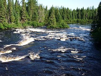
Rivière Vermillon (Rivière Saint-Maurice)
| Rivière Vermillon | ||
| Data | ||
| location | Lanaudière , Mauricie in Québec (Canada) | |
| River system | Saint Lawrence River | |
| Drain over | Rivière Saint-Maurice → Saint Lawrence River → Atlantic Ocean | |
| origin |
Lac Launay 47 ° 15 ′ 40 " N , 74 ° 6 ′ 43" W. |
|
| muzzle |
Rivière Saint-Maurice Coordinates: 47 ° 38 ′ 43 " N , 72 ° 56 ′ 39" W 47 ° 38 ′ 43 " N , 72 ° 56 ′ 39" W |
|
| Mouth height |
243 m
|
|
| length | approx. 160 km | |
| Catchment area | approx. 2670 km² | |
| Discharge at the level below Rivière des Prairies A Eo : 2640 km² |
MQ 1983/2000 Mq 1983/2000 |
39 m³ / s 14.8 l / (s km²) |
|
Location of the Rivière Vermillon in the catchment area of the Rivière Saint-Maurice |
||
The Rivière Vermillon (atikamekw: acopekihikan sipi) is a right tributary of the Rivière Saint-Maurice in the administrative regions of Lanaudière and Mauricie in the Canadian province of Québec .
The river has its origin in Lac Launay . It flows mainly in an easterly direction and finally flows into the Rivière Saint-Maurice 25 km north of La Tuque . The Rivière Vermillon has a length of 160 km. The river drains an area of 2670 km². The Barrage Vermillon-Deux is located 5 km above the estuary .
Individual evidence
- ^ Commission de toponymie du Québec: Rivière Vermillon
- ↑ Water Survey of Canada: Station 02ND001 ( Memento of the original from December 24, 2010) Info: The archive link was automatically inserted and not yet checked. Please check the original and archive link according to the instructions and then remove this notice.
- ↑ Water Survey of Canada: Station 02ND003 ( page no longer available , search in web archives ) Info: The link was automatically marked as defective. Please check the link according to the instructions and then remove this notice.

