Rivington Reservoirs
| Rivington Reservoirs | |||||||||
|---|---|---|---|---|---|---|---|---|---|
| The Lower Rivington Reservoir | |||||||||
|
|||||||||
|
|
|||||||||
| Coordinates | 53 ° 37 '27 " N , 2 ° 34' 18" W | ||||||||
| Data on the structure | |||||||||
| Construction time: | 1850-1857 | ||||||||
| The Upper Rivington Reservoir | |||||||||
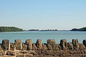
The Rivington Reservoirs are two reservoirs west of Rivington and east of Adlington in Lancashire , England . The Lower Rivington Reservoir is the southernmost of a chain of three reservoirs that stretch for 6 km. It is separated from the Upper Rivington Reservoir to the north by the 267 m long Rivington Embankment , over which a road runs . The Anglezarke Reservoir connects to the Upper Rivington Reservoir in the north .
The River Douglas is diverted into the Lower Rivington Reservoir through a canal.
The reservoirs were built by Thomas Hawksley between 1850 and 1857 to supply Liverpool with water. The supply system also includes the Rake Brook Reservoir he built and the Lower Roddlesworth Reservoir , which are connected to the Anglezarke Reservoir via The Goit Canal .
The River Douglas is channeled into the Lower Rivington Reservoir. The water is drawn from the Anglezarke Reservoir, through which the River Yarrow also flows.
Web links
- Rivington Reservoirs on Pastscape of Historic England
Individual evidence
- ^ Rivington Reservoirs (main scheme) on Engineering Timeline, accessed October 22, 2016


