Rockenstuhl (mountain)
| Rockenstuhl | ||
|---|---|---|
|
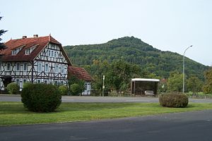
View of Motzlar (2012) |
||
| height | 529 m above sea level NN | |
| location | Thuringia , Germany | |
| Mountains | Rhön | |
| Coordinates | 50 ° 40'59 " N , 9 ° 57'1" E | |
|
|
||
| Type | Basalt cone | |
| rock | basalt | |
The Rockenstuhl is a 529 m high basalt cone in the Thuringian Rhön - the so-called Soisberger Kuppenrhön . The mountain is now part of the urban area of Geisa, previously it belonged for a few years to the Thuringian community of Rockenstuhl, which was only formed in 1994 . It is located about five kilometers south of the core town of Geisa within sight of the Hessian-Thuringian border.
history
Already in the 12th century a castle was built on the mountain by the Fulda monastery and given as a fief to the later lords of Rockenstuhl . The Rockenstuhl was of great strategic importance for the monastery, and from 1327 the castle was the center and seat of the Rockenstuhl Office in Fulda . When in 1265 some of the castle men had conspired against the monastery and holed up in the castle, Prince Abbot Bertho II had to recapture it with a siege. Under Prince Abbot Heinrich VII. Of Crane gaps (Craluck) a Holy was 1354 Pankratius chapel dedicated built and maintained by a Vicar Parish Schleid.
In the Renaissance period , the prince abbots of Fulda used the Rockenstuhl as one of their hunting seats. During the Peasants 'War and the Thirty Years' War , the inhabitants of the surrounding villages sought protection behind the walls of the castle. The buildings are said to have been destroyed by fire or lightning strike in 1699, only small remains of the wall remained from the ruins. Some finds that were recovered during construction work and excavations are shown in the Geisa local history museum.
After the mountain was inaccessible in the restricted area near the border for decades, it can now be reached again on various hiking trails. A refuge for hikers with a barbecue area, viewing balcony and information boards as well as memorial plaques for the botanists Adalbert Geheeb and Moritz Goldschmidt was built on the mountain top .
Historical educational trail "Geisa-Rockenstuhl"
The historical Rockenstuhl educational trail is an 11-kilometer circular hiking trail that leads from Geisa via Schleid to the Rockenstuhl.


