Rushikulya
| Rushikulya | ||
|
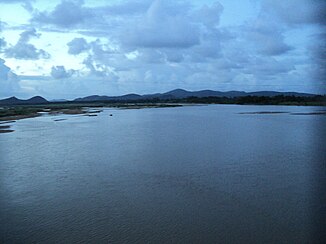
Rushikulya near Berhampur |
||
| Data | ||
| location | Odisha ( India ) | |
| River system | Rushikulya | |
| Headwaters |
Rushyamala Hills ( Eastern Ghats ) 19 ° 52 ′ 49 ″ N , 84 ° 3 ′ 1 ″ E |
|
| Source height | approx. 1000 m | |
| muzzle |
Bay of Bengal Coordinates: 19 ° 22 '26 " N , 85 ° 4' 44" E 19 ° 22 '26 " N , 85 ° 4' 44" E |
|
| Mouth height | 0 m | |
| Height difference | approx. 1000 m | |
| Bottom slope | approx. 5.9 ‰ | |
| length | approx. 170 km | |
| Catchment area | 8963 km² | |
| Left tributaries | Bara | |
| Right tributaries | Jarao | |
| Small towns | Asika , Surada | |
| Communities | Daringbadi | |
| Residents in the catchment area | 3,229,060 (as of 2011) | |
The Rushikulya is a river in the Indian state of Odisha .
The Rushikulya rises in the Rushyamala Hills , a mountain range of the Eastern Ghats , in the Kandhamal district . It flows in a predominantly southeastern direction through the Ganjam district and flows north of Chhatrapur into the Bay of Bengal . Cities on the river are Daringbadi , Surada and Asika . Important tributaries are the Padma, Boringanalla, Joro, Badanadi, Baghua, Dhanei and Ghodhado. Its mouth has no delta.
The Rushikulya is about 170 km long. Its catchment area covers 8963 km².
Individual evidence
- ↑ a b River Basins of Odisha . Dept. of Water Resources, Govt. of Odisha.
- ↑ a b c River System & Basin Planning (PDF 174 kB) Dept. of Water Resources, Govt. of Odisha.
