
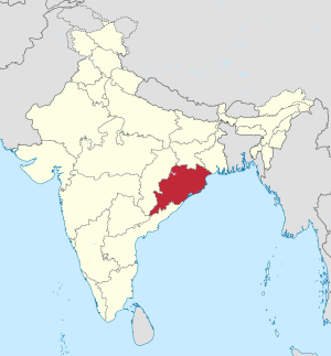
Odisha

|
|
| status | State |
| Capital | Bhubaneswar |
| surface | 155,707 km² |
| Residents | 41,947,358 (2011) |
| Population density | 269 inhabitants per km² |
| languages | Oriya |
| governor | Ganeshi Lal |
| Chief Minister | Naveen Patnaik ( BJD ) |
| Website | http://odisha.gov.in/ |
| ISO code | IN OR |
 .svg) |
|
Odisha , until 2011 Orissa ( Oriya ଓଡ଼ିଶା Oṛiśā ), is an Indian state with an area of 155,707 km² and 42 million inhabitants (2011 census). The capital of Odisha is Bhubaneswar . The official language of the state and the mother tongue of over 83 percent of the population is Oriya .
geography
Odisha is bordered by the states of Andhra Pradesh in the south, Telangana in the southwest, Chhattisgarh in the west, Jharkhand in the north and West Bengal in the northeast. To the east lies the coast of the Bay of Bengal .
Biggest cities
(Status: 2011 census)
| city | Residents | city | Residents | ||
|---|---|---|---|---|---|
| 1 | Bhubaneswar | 837.737 | 6th | Sambalpur | 183.383 |
| 2 | Cutack | 606.007 | 7th | Baleswar ( Balasore ) | 118.202 |
| 3 | Rourkela | 540,000 | 8th | Baripada | 110.058 |
| 4th | Berhampur ( Brahmapur ) | 355.823 | 9 | Bhadrak | 107,369 |
| 5 | Puri | 201.026 | 10 | Balangir | 98,238 |
| Source: Census of India 2011. (PDF; 154 kB) | |||||
population
Demographics

According to the 2011 Indian census, Odisha had 41,947,358 inhabitants. Between 2001 and 2011, the population grew by 14.0 percent and thus a little more slowly than the national average (17.6 percent). Compared to the rest of India, Odisha is relatively sparsely populated and not very urbanized: the population density of 269 inhabitants per square kilometer is below the Indian average of 382 inhabitants per square kilometer. Only 16.7 percent of the state's residents live in cities. The urbanization rate is thus lower than the overall Indian average of 31.2 percent.
73.5 percent of Odisha's residents can read and write (men 82.4 percent, women 64.4 percent). The literacy rate thus corresponds to the national average of 74.0 percent (as of the 2011 census). In the period from 2010 to 2014, the average life expectancy was 65.8 years (the Indian average was 67.9 years). The fertility rate was 2.07 children per woman (as of 2016) while the Indian average was 2.23 children in the same year.
The Adivasi (members of the indigenous tribal population) make up a significant minority among the inhabitants of Odisha . The 2001 census classified 22.1 percent of the population as scheduled tribes . The Adivasi live almost exclusively in rural areas. In districts like Malkangiri , Mayurbhanj , Rayagada or Nabarangpur , they make up the majority of the population. The largest Adivasi groups are the Khond , Gond , Bhumij , Bhuiya , Oraon , Paroja , Kisan , Bhumia , Binjhal and Koya .
With a value of 0.580, Odisha reached 25th place among the 29 states of India in the human development index in 2015 and is thus below average.
Population development
Odisha census population (within today's boundaries) since the first Indian census in 1951.
| Census year | population |
|---|---|
| 1951 | 14,646,100 |
| 1961 | 17,549,500 |
| 1971 | 21,944,625 |
| 1981 | 26,370,270 |
| 1991 | 31,659,740 |
| 2001 | 36,707,900 |
| 2011 | 41,947,358 |
languages
| Languages in Odisha | ||||
|---|---|---|---|---|
| language | percent | |||
| Oriya | 83.2% | |||
| Hindi | 2.8% | |||
| Kui | 2.5% | |||
| Telugu | 1.9% | |||
| Santali | 1.9% | |||
| Urdu | 1.7% | |||
| Bengali | 1.3% | |||
| Other | 4.7% | |||
| Distribution of languages (2001 census) | ||||
The main language of Odisha is Oriya , which belongs to the Indo-Aryan language family . According to the 2001 census, it is spoken by 83.2 percent of the population as their mother tongue and is the only official language. The rest of the population speaks a variety of other languages. Various Dravidian and Austro-Asian languages are spoken among the tribal population, including Kui (2.5 percent), Santali (1.9 percent), Ho (0.7 percent), Munda (0.7 percent), Kurukh (0.6 Percent), Savara (0.5 percent), Gondi (0.5 percent), Malto (0.4 percent), Mundari (0.3 percent) and Kuwi (0.3 percent). There are also smaller numbers of speakers of the languages of Odisha's neighboring states: Hindi speakers make up 2.8 percent of Odisha's residents. This also includes the regional languages Sadri , Chhattisgarhi , Laria and Kurmali spoken by parts of the Adivasi population , which are counted as Hindi dialects in the census. In addition, 1.9 percent speak Telugu and 1.3 percent of the population speak Bengali as their mother tongue. Urdu (1.7 percent) is common among the small Muslim minority Odishas . As in all of India, English is ubiquitous as a communication and educational language.
Religions
| Religions in Odisha | ||||
|---|---|---|---|---|
| religion | percent | |||
| Hinduism | 93.6% | |||
| Christianity | 2.8% | |||
| Islam | 2.2% | |||
| Other | 1.4% | |||
| Distribution of religions (2011 census) | ||||


Odisha is strongly Hindu . Hindus make up the vast majority of the population; according to the 2011 census, their proportion is 94 percent, well above the Indian national average. The god Jagannatha , to whom the Jagannath temple in Puri is dedicated, enjoys special veneration among the Hindus in Odisha ; small copies of the cult images from the Jagannath Temple can be found in village shrines, but also on house altars. Another specialty is the - still practiced in some rural regions of Odishas - worship of the Matrikas and the Yoginis , both of which are in a certain proximity to long-extinct Tantristic cults and differ from Orthodox Brahmanism .
In Odisha there are also smaller minorities of Christians (3 percent), Muslims (2 percent) and "other religions" (1 percent), which also include the traditional animistic beliefs of the Adivasi .
The Christian minority is mainly composed of converts from the tribal population and the "casteless" ( Dalits ). Due to the conversions of Hindus to Christianity is to violence by Hindu nationalist arrived groups against Christians. In the second half of 2008, after the killing of Swami Lakshmanananda, which was wrongly first accused of being Christians, and shortly before elections in and around Odisha, religiously motivated pogroms against Christians and churches, in which at least 59 Christians were killed, around 4,000 buildings were set on fire and more than 50,000 people fled for fear of persecution.
history
In classical Indian history there was the state of Kalinga , which had been so bloody conquered by Emperor Ashoka that he allegedly converted to Buddhism out of repentance. After the end of the Maurya empire, Kalinga rose again under King Kharavela (from 183 BC), a conqueror who conquered Pataliputra in his twelfth year and at the same time adhered to Jainism .
But this state development of Kalinga was forced by external pressure, the influence of Magadha and did not last . At the time of the Gupta, there were again several small principalities in the part of the country that did not show any state-building approaches. Little Hindu kingdoms only gradually began to develop from tribal principalities. B. that of the Mathara (2nd half of the 4th century) and that of the Sailodbhava (early 7th century).
In the 8th century Orissa began to consolidate a state with the Bhaumakara dynasty, which already had a fully developed administrative system with civil servants and copper-plate inscriptions, but still granted autonomy to the village communities. The Somavamshi dynasty continued this policy. Unite five ancestral lands in Orissa under their administration.
At the time of the Islamic invasion ( Delhi sultans ), Odisha asserted herself among the Gajapatis ( lords of the elephants ) of the eastern Ganga dynasty, especially Anangabhima III. (ruled 1216-1239) and his son Narasimha I (ruled 1238-1264). The latter built the Konark Sun Temple . Even in the 14th century, the Ganga kings represented a power factor until they were finally replaced in 1435 by the Suryavamshi dynasty founded by King Kapilendra (r. Approx. 1435–1468) , which lasted until 1534.
The time of the Hindu kings ended in 1568 with the capture by the Orissa (Afghanistan) Karani Rulers Bengal , which in turn from Grossmogul Akbar I was eliminated (reg. 1556-1605) so that the Orissa Mogul Reich was attached. After the Second Marath War 1803-1805, the area came under the rule of the British East India Company . Partly it came under direct administration, partly the princely states remained as protectorates .
In 1912 the province of Bihar and Orissa was formed from the western area of the Bengal presidency . On April 1, 1936, this province was divided and Orissa gained the status of an independent province. When India became independent, the province of Orissa was established on August 15, 1947, to which most of the princely states united in the Eastern States Union were incorporated on January 1 . With the entry into force of the Indian Constitution on January 26, 1950, Orissa became a federal state of the Indian Union (see History of India ). Since November 4th 2011 he has been called 'Odisha'. This spelling corresponds better to the pronunciation of the country name in the national language Odia .
politics
Political system
The Legislative of Odishas consists of a unicameral parliament , which is composed of 147 members, who are elected in single constituencies according to the relative majority suffrage. Elections take place every 5 years. If a member of parliament leaves prematurely, a by-election will take place in the constituency concerned. As in the other states, the affairs of state are carried out by a chief minister who heads the government. However, representatives of the highest state authority is the Indian President appointed governor ( Governor ), whose role, however, usually limited to purely ceremonial acts. However, the governor has the important task of appointing the Chief Minister and thus entrusting the formation of the government.
Odisha's supreme court is the Orissa High Court , located in Cuttack .
Parties
| Distribution of seats after the 2014 parliamentary elections |
|
|---|---|
| BJD | 117 |
| INC | 16 |
| BJP | 10 |
| CPI (M) | 1 |
| SKD | 1 |
| Independent | 2 |
| total | 147 |
Historically, the Congress Party (INC) was the dominant political force in the state for a long time in independent India . However, there was a certain tradition of independent regional parties right from the start. In the 1950s and early 1960s, Ganatantra Parishad existed here , a conservative party in which former ruling princes played a certain role. At the beginning of the 1970s, Biju Patnaik , the father of the later Chief Minister, tried to found a new regional party called the Utkal Congress , which was only successful for a short time. In 1998 Naveen Patnaik founded the Biju Janata Dal (BJD) party as a local split from the India-wide Janata Dal party . The BJD has been the dominant political party ever since, and its chairman, Naveen Patnaik, has been the state's uninterrupted chief minister since 2000. The popular Naveen Patnaik enjoys the reputation of a politician who takes effective action against corruption in public life and has promoted the development of the state.
Historically, the communists in Odisha were of a certain importance, and they were more strongly represented here than in most other states. However, in parallel with the general decline of the communists since roughly the 2009 national election , their importance has declined sharply. The largest party in India, the Hindu nationalist Bharatiya Janata Party (BJP), only plays a comparatively minor role in Odisha.
Administrative division
Odisha is divided into the 3 divisions North , Central and South with 10 districts each and the administrative offices in Sambalpur, Cuttack and Berhampur.
Divisions
Odisha is divided into three divisions - North , South and Central - each comprising 10 districts. Each of the three divisions is headed by a Divisional Commissioner whose task is to control the districts subordinate to him with regard to financial income and administration.
| Surname | administrative seat |
Districts |
|---|---|---|
| North Division | Sambalpur | Angul , Balangir , Bargarh , Deogarh , Dhenkanal , Jharsuguda , Kendujhar , Sambalpur , Subarnapur , Sundargarh |
| Central Division | Berhampur | Baleswar , Bhadrak , Cuttack , Jagatsinghpur , Jajpur , Kendrapada , Khordha , Mayurbhanj , Nayagarh , Puri |
| South Division | Cutack | Boudh , Gajapati , Ganjam , Kalahandi , Kandhamal , Koraput , Malkangiri , Nabarangpur , Nuapada , Rayagada |
Districts
The 30 districts (population and density as of the 2011 census) are:

| No. | District | administrative seat |
surface | Population (2011) |
Ew./km² | division |
|---|---|---|---|---|---|---|
| 1 | Angul | Angul | 6,390 km² | 1,271,703 | 199 inhabitants / km² | North |
| 2 | Balangir | Balangir | 6,568 km² | 1,648,574 | 251 inhabitants / km² | North |
| 3 | Baleswar | Baleswar | 3,805 km² | 2,317,419 | 609 inhabitants / km² | Central |
| 4th | Bargarh | Bargarh | 5,845 km² | 1,478,833 | 253 inhabitants / km² | North |
| 5 | Bhadrak | Bhadrak | 2,507 km² | 1,506,522 | 601 inhabitants / km² | Central |
| 6th | Boudh | Boudh | 3,098 km² | 439.917 | 142 inhabitants / km² | South |
| 7th | Cutack | Cutack | 3,932 km² | 2,618,708 | 666 inhabitants / km² | Central |
| 8th | Deogarh | Deogarh | 2,945 km² | 312.164 | 106 inhabitants / km² | North |
| 9 | Dhenkanal | Dhenkanal | 4,451 km² | 1,192,948 | 268 inhabitants / km² | North |
| 10 | Gajapati | Paralakhemundi | 4,330 km² | 575,880 | 133 people / km² | South |
| 11 | Ganjam | Chhatrapur | 8,205 km² | 3,520,151 | 429 inhabitants / km² | South |
| 12 | Jagatsinghpur | Jagatsinghpur | 1,669 km² | 1,136,604 | 681 inhabitants / km² | Central |
| 13 | Jajpur | Jajpur | 2,899 km² | 1,826,275 | 630 inhabitants / km² | Central |
| 14th | Jharsuguda | Jharsuguda | 2,115 km² | 579,499 | 274 inhabitants / km² | North |
| 15th | Kalahandi | Bhawanipatna | 7,905 km² | 1,573,054 | 199 inhabitants / km² | South |
| 16 | Kandhamal | Phulbani | 8,043 km² | 731,952 | 91 people / km² | South |
| 17th | Kendrapara | Kendrapara | 2,642 km² | 1,439,891 | 545 inhabitants / km² | Central |
| 18th | Kendujhar | Kendujhar | 8,308 km² | 1,802,777 | 217 inhabitants / km² | North |
| 19th | Khordha | Khordha | 2,811 km² | 2,246,341 | 799 inhabitants / km² | Central |
| 20th | Koraput | Koraput | 8,827 km² | 1,376,934 | 156 people / km² | South |
| 21st | Malkangiri | Malkangiri | 5,780 km² | 612.727 | 106 inhabitants / km² | South |
| 22nd | Mayurbhanj | Baripada | 10,431 km² | 2,513,895 | 241 inhabitants / km² | Central |
| 23 | Nabarangpur | Nabarangpur | 5,299 km² | 1,218,762 | 230 inhabitants / km² | South |
| 24 | Nayagarh | Nayagarh | 3,896 km² | 962.215 | 247 inhabitants / km² | Central |
| 25th | Nuapada | Nuapada | 3,863 km² | 606.490 | 157 inhabitants / km² | South |
| 26th | Puri | Puri | 3,479 km² | 1,697,983 | 488 inhabitants / km² | Central |
| 27 | Rayagada | Rayagada | 7,073 km² | 961,959 | 136 inhabitants / km² | South |
| 28 | Sambalpur | Sambalpur | 6,610 km² | 1,044,410 | 158 inhabitants / km² | North |
| 29 | Subarnapur | Subarnapur | 2,337 km² | 652.107 | 279 inhabitants / km² | North |
| 30th | Sundargarh | Sundargarh | 9,723 km² | 2,080,664 | 214 inhabitants / km² | North |
Local self-government
Odisha has 5 municipal corporations , 45 municipalities and around 65 Notified Area Councils .
Municipal Corporations:
Municipalities:
- Anandapur
- Angul
- Balangir
- Baleswar
- Barbil
- Bargarh
- Baripada
- Basudebpur
- Belpahar
- Bhadrak
- Bhawanipatna
- Biramitrapur
- Brajarajnagar
- Byasanagar
- Choudwar
- Deogarh
- Dhenkanal
- Jagatsinghpur
- Jajpur
- Jaleswar
- Jatni
- Jeypore
- Jharsuguda
- Joda
- Kendrapara
- Kendujhar
- Khordha
- Koraput
- Malkangiri
- Nabarangpur
- Paradeep
- Paralakhemundi
- Pattamundai
- Phulbani
- Puri
- Rajgangpur
- Rairangpur
- Rayagada
- Soro
- Subarnapur
- Sunabeda
- Sundargarh
- Talcher
- Titlagarh
- Umerkote
economy
Odisha is a resource-rich region and holds 20% of India's known coal deposits, 25% of India's iron ore deposits, a third of the bauxite reserves and most of the chrome ore reserves . Odisha owns large metallurgical plants and makes high ongoing investments in the construction and expansion of aluminum plants, steel plants, oil refineries and port capacities. Odisha was the first Indian state to promote the privatization of electricity networks. Eight Special Economic Zones (SEZ) have been established. The intensive industrialization has caused some resistance in the population, which is deeply rooted in agriculture. The companies Mittal, Tata, Vedanta Resources and Birlas in particular received negative attention because of allegations of human rights violations. According to the Ministry of Statistics and Program Implementation, Orissa's gross domestic product rose by more than 500% from 1990 to 2005.
| year | GDP in USD |
|---|---|
| 1990 | 109.040 |
| 1995 | 271.180 |
| 2000 | 387.280 |
| 2005 | 670,900 |
In Odisha's only large seaport in Paradeep , 33 million tons of freight were handled in the 2005/2006 reporting year, and 38.5 million in the 2006/2007 reporting year. About a third of this was coal and almost 30% iron ore, i.e. H. the port handles most of the export of Odisha's most important raw materials. This makes the port the eighth largest port in India in terms of total throughput (as of 2007) and the fastest growing in the period from 2004 to 2007. The Padang Industrial Area is one of the six Petrochemical Investment Regions (PCPIRs) in India. Odisha's largest refinery complex is to be built here on 284 km². In addition, the smaller seaports in the two cities of Dhamra and Gopalpur are being expanded.
literature
- Andrew Sterling: Orissa. Its geography, statistics, history, religion, and antiquities . London 1846 ( digitized )
Web links
- Official of the Government of Odisha Website (English)
- Country portrait of Orissa by Uwe Skoda and Christoph S. Sprung at suedasien.info
- The temple architecture of Orissa (by Dr. Bernhard Peter)
- Temples in Odisha (Orissa )
- Orissa Research Project of the University of Tübingen
Individual evidence
- ↑ a b Census of India 2011: Provisional Population Tables and Annexures. ( Memento of June 29, 2011 in the Internet Archive ) (PDF; 437 kB)
- ^ Census of India 2011: Provisional Population Totals - India - Rural-Urban Distribution. (PDF; 8.1 MB)
- ^ Indian States by Life Expectancy 2010-2014. (PDF) Retrieved March 19, 2018 .
- ^ Fertility Rates. (PDF) Retrieved March 19, 2018 .
- ↑ Census of India 2001: Orissa. Data highlights: The Scheduled Tribes. (PDF; 43 kB)
- ^ Sub-national HDI - Area Database - Global Data Lab. Retrieved August 12, 2018 .
- ^ Population of Indian States | Indian states population 1901-2011 - StatisticsTimes.com. Retrieved March 19, 2018 .
- ↑ Indian census 2001
- ↑ Census of India 2011: Population by religious community.
- ↑ Nirmala Carvalho Orissa pogroms: police clear Christians from the death of Hindu religious leader In: Asia News of May 11, 2011.
- ↑ msnbc.msn.com - of which at least 39 are officially recognized in Odisha, the rest outside.
- ↑ BBC News: Arrests over India church attacks . September 15, 2008. , indianexpress.com
-
↑ Orissa now Odisha, Oriya becomes Odia in The Times of India of October 24, 2009;
Orissa celebrates Odisha. In: The Times of India. November 5, 2011;
March 31 deadline for Odisha spell check. In: The Times of India. November 6, 2011. - ^ Election Results - Full Statistical Reports. Indian Election Commission, accessed on March 11, 2015 (English, election results of all Indian elections to the Lok Sabha and the parliaments of the states since independence).
- ^ Kunal Pradhan: The man who tranformed Odisha: Naveen Patnaik: The man who transformed Odisha. indiatoday.intoday.in, December 20, 2013, accessed on March 12, 2015 .
- ^ About Department. Revenue and Disaster Management Department, Government of Odisha, accessed April 2, 2017 .
- ^ Census of India 2011: Provisional Population Totals. Paper 1 of 2011: Orissa. (PDF; 2.5 MB)
| Today's states |
Andhra Pradesh • Arunachal Pradesh • Assam • Bihar • Chhattisgarh • Goa • Gujarat • Haryana • Himachal Pradesh • Jharkhand • Karnataka • Kerala • Madhya Pradesh • Maharashtra • Manipur • Meghalaya • Mizoram • Nagaland • Odisha • Punjab • Rajasthan • Sikkim • Tamil Nadu • Telangana • Tripura • Uttarakhand • Uttar Pradesh • West Bengal |
|
| Union Territories |
Andaman and Nicobar Islands • Chandigarh • Dadra and Nagar Haveli and Daman and Diu • Delhi • Jammu and Kashmir • Ladakh • Lakshadweep • Puducherry |
|
| Former states |
Ajmer • Andhra • Bhopal • Bilaspur • Bombay • Coorg • Hyderabad • Jammu and Kashmir • Kachchh • Madhya Bharat • Mysore • Patiala and East Punjab States Union • Saurashtra • Travancore-Cochin • Vindhya Pradesh |
Coordinates: 20 ° 0 ′ N , 85 ° 0 ′ E