
Haryana
 |
|
| status | State |
| Capital | Chandigarh |
| founding | November 1, 1966 |
| surface | 44,212 km² |
| Residents | 25,351,462 (2011) |
| Population density | 573 inhabitants per km² |
| languages | Hindi |
| governor | Satyadev Narayan Arya |
| Chief Minister | Manohar Lal Khattar ( BJP ) |
| Website | haryana.gov.in |
| ISO code | IN-HR |
 .svg) |
|
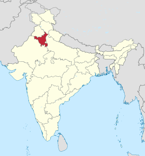
Haryana ( Hindi हरियाणा IAST Hariyāṇā [ hʌrɪˈjɑːɳɑː ]) is an Indian state with an area of 44,212 square kilometers and a population of 25.4 million (2011 census). The population density is 573 inhabitants per square kilometer.
The capital Chandigarh is also the capital of neighboring Punjab , on whose border it lies, and is directly administered as a union territory by the central government in New Delhi .
With a value of 0.687, Haryana achieved 9th place among the 29 states of India in the Human Development Index in 2015 .
geography
Haryana borders in the north on the state of Himachal Pradesh , in the northwest on the Punjab and Chandigarh , in the southwest on Rajasthan , in the east on Uttar Pradesh and on the Union Territory of Delhi . The largest city in the state is Faridabad .
Biggest cities
(Status: 2011 census)
| city | Residents | city | Residents | ||
|---|---|---|---|---|---|
| 1 | Faridabad | 1,404,653 | 8th | Yamunanagar | 216,628 |
| 2 | Gurgaon | 876.824 | 9 | Panchkula | 210.175 |
| 3 | Rohtak | 373.133 | 10 | Bhiwani | 197,662 |
| 4th | Hisar | 301,249 | 11 | Ambala | 196.216 |
| 5 | Panipat | 294.150 | 12 | Sirsa | 183.282 |
| 6th | Karnal | 286.974 | 13 | Bahadurgarh | 170.426 |
| 7th | Sonipat | 277.053 | 14th | Jind | 166.225 |
| Source: Census of India 2011. (PDF; 154 kB) | |||||
history

In the summer of 1947, India and Pakistan were given independence from the British colonial empire by London , and the Punjab was divided between India and Pakistan. In 1956, the States Reorganization Act followed another large-scale redrawing of the boundaries between the Indian states. The previous state of Patiala and East Punjab States Union was annexed to the Punjab. In this state of Punjab, the Hindus formed the majority of the population. Political leaders of the Sikhs wanted their own state with a Sikh majority. As a result, on November 1, 1966, the part of Indian Punjab, the majority of the residents of which spoke Hindi and adhered to Hinduism , split off from the rest of the state and became a separate Indian state under the name Haryana .
The name Haryana is very old, although the etymological roots are disputed. Different meanings such as “Abode of Vishnu ” or “green land” and others were derived from different Sanskrit roots .
Part of the population of the Punjab and Haryanas are descendants of the Jat people who immigrated centuries ago . The members of the Jat group form a kind of caste or social community in Indian society today. Members of the Jats have repeatedly called for the Indian government to classify them as “other disadvantaged caste” ( Other Backward Classes ). This is associated with privileges such as the reservation of government agencies, university places, etc. In this context, there were repeated unrest, strikes and boycotts, some of which caused considerable economic damage, e. B. in February 2016.
population
Demographics

According to the 2011 Indian census, Haryana has 25,351,462 inhabitants. This makes Haryana one of the medium-sized Indian states. In terms of population, it ranks 18th among the 29 states of India. With 573 inhabitants per square kilometer, Haryana is more densely populated than the Indian average, which is 382 inhabitants per square kilometer. Between 2001 and 2011, the population grew by 20 percent, a little faster than the national average (18 percent). The areas bordering Delhi in particular are experiencing rapid population growth due to the expansion of the megacity. Accordingly, Haryana's degree of urbanization is now 35 percent, above the national average of 31 percent. The gender ratio in Haryana is extremely unbalanced: there are only 879 women for every 1000 men, while the corresponding value for India as a whole is 943. Among the 0 to 6 year olds there are only 834 (India: 919). Haryana has the largest surplus of men of any Indian state.
76 percent of the residents of Haryana can read and write (men: 84 percent, women: 66 percent). The literacy rate is only slightly above the Indian average of 73 percent. Between 2010 and 2014, the average life expectancy was 68.6 years (the Indian average was 67.9 years). The fertility rate was 2.12 children per woman (as of 2016) while the Indian average was 2.23 children in the same year.
Population development
Haryana census population (within today's boundaries) since the first census in 1951.
| Census year | population |
|---|---|
| 1951 | 5,674,400 |
| 1961 | 7,591,190 |
| 1971 | 10,036,430 |
| 1981 | 12,922,122 |
| 1991 | 16,464,600 |
| 2001 | 21,083,900 |
| 2011 | 25,753,081 |
languages
| Languages in Haryana | ||||
|---|---|---|---|---|
| language | percent | |||
| Hindi | 87.3% | |||
| Punjabi | 10.6% | |||
| Urdu | 1.2% | |||
| Other | 0.9% | |||
| Distribution of languages (2001 census) | ||||
The main language of Haryana is Hindi , after which the state was formed in 1966. Hindi is the only official language of Haryana and, according to the 2001 census, is spoken by 87 percent of the state's residents as their mother tongue. Most people in Haryana speak one of the dialects that are grouped under the umbrella term Haryanavi .
In addition to the Hindi-speakers there is a larger minority of speakers of Punjabi (nearly 11 percent). Most of the Punjabi speakers are descendants of Hindus and Sikhs who were expelled from what is now Pakistan's Punjab after the partition of India in 1947. Urdu , the Muslim variant of Hindi, is common among parts of the Muslim Haryanas . As everywhere in India, English is ubiquitous as a lingua franca and educational language.
Religions

| Religions in Haryana | ||||
|---|---|---|---|---|
| religion | percent | |||
| Hinduism | 87.5% | |||
| Islam | 7.0% | |||
| Sikhism | 4.9% | |||
| Other | 0.6% | |||
| Distribution of religions (2011 census) | ||||
The vast majority of Haryana's residents are Hindus . According to the 2011 census, they make up 88 percent of the state's population. There are also minorities of Muslims (7 percent) and Sikhs (5 percent).
Around 1900, the proportion of Muslims in today's Haryana was around a quarter. As a result of the violence following the partition of India, the Muslim population was almost completely driven from parts of what is now Haryana. At the same time, many Hindus and Sikhs fled from what is now the Pakistani part of Punjab to Haryana. The Muslim population is particularly high today in the districts of Gurgaon and Mewat in the south of Haryana, where the Meo , a caste of Muslim farmers, settle. The Sikhs are mainly concentrated in the northwestern districts on the border with the state of Punjab.
politics
| Distribution of seats after the 2014 parliamentary elections |
|
|---|---|
| BJP | 47 |
| INC | 15th |
| INLD | 19th |
| E.G | 1 |
| SAD | 1 |
| HJC | 2 |
| Independent | 5 |
| total | 90 |
The legislative assembly ( legislative assembly ) of Haryana consists of a single chamber, which comprises 90 deputies. The main political parties in the last elections were, among the national parties, the Congress Party (INC), Bharatiya Janata Party (BJP), Bahujan Samaj Party (BSP), Communist Party of India (Marxist) (CPI (M)), and by the local parties Indian National Lok Dal (INLD), Haryana Janhit Congress (HJC) and Shiromani Akali Dal (SAD). The last election to the Parliament of Haryana took place in 2014 and was won by the BJP. On October 26, 2014, Manohar Lal Khattar (BJP) was sworn in as the new Chief Minister of Haryana (the first from the ranks of the BJP).
The highest court in Haryana is the Punjab and Haryana High Court in Chandigarh, which also has jurisdiction over the neighboring state of Punjab.
Administrative division

The state of Haryana is divided into 4 divisions and 22 districts .
Divisions
| division | Districts |
|---|---|
| Ambala | Ambala , Kaithal , Kurukshetra , Panchkula , Yamunanagar |
| Gurgaon | Faridabad , Palwal , Gurgaon , Mahendragarh , Mewat , Rewari |
| Hisar | Bhiwani , Fatehabad , Jind , Hisar , Sirsa , Charkhi Dadri |
| Rohtak | Jhajjar , Karnal , Panipat , Rohtak , Sonipat |
Districts
At the time of the last 2011 census, Haryana was divided into 21 districts. On September 19, 2016, the 22nd district Charkhi Dadri was formed from parts of the Bhiwani district. The population and area data given in the following table come from the 2011 census.
| No. | District | Administrative headquarters | Area (km²) |
Population (2011) |
Population density ( inhabitants / km² ) |
|---|---|---|---|---|---|
| 1 | Ambala | Ambala | 1,574 | 1,128,350 | 717 |
| 2 | Bhiwani | Bhiwani | 4,778 | 1,634,445 | 342 |
| 3 | Charkhi Dadri * | Hisar | - | - | - |
| 4th | Faridabad | Faridabad | 741 | 1,809,733 | 2,442 |
| 5 | Fatehabad | Fatehabad | 2,538 | 942.011 | 371 |
| 6th | Gurgaon | Gurgaon | 1,258 | 1,514,432 | 1,204 |
| 7th | Hisar | Hisar | 3,983 | 1,743,931 | 438 |
| 8th | Jhajjar | Jhajjar | 1,834 | 958.405 | 523 |
| 9 | Jind | Jind | 2,702 | 1,334,152 | 494 |
| 10 | Kaithal | Kaithal | 2,317 | 1,074,304 | 464 |
| 11 | Karnal | Karnal | 2,520 | 1,505,324 | 597 |
| 12 | Kurukshetra | Thanesar | 1,530 | 964.655 | 630 |
| 13 | Mahendragarh | Narnaul | 1,899 | 922,088 | 486 |
| 14th | Mewat | Nuh | 1,507 | 1,089,263 | 723 |
| 15th | Palwal | Palwal | 1,359 | 1,042,708 | 767 |
| 16 | Panchkula | Panchkula | 898 | 561.293 | 625 |
| 17th | Panipat | Panipat | 1,268 | 1,205,437 | 951 |
| 18th | Rewari | Rewari | 1,594 | 900.332 | 565 |
| 19th | Rohtak | Rohtak | 1,745 | 1.061.204 | 608 |
| 20th | Sirsa | Sirsa | 4,277 | 1,295,189 | 303 |
| 21st | Sonipat | Sonipat | 2.122 | 1,450,001 | 683 |
| 22nd | Yamunanagar | Yamunanagar | 1,768 | 1.214.205 | 687 |
*) Newly founded after the 2011 census, figures are not available.
Local self-government
Several cities have been merged in recent years. In early 2016, Haryana had 10 municipal corporations , 18 municipal councils, and 50 municipal committees .
Municipal Corporations :
Municipal Councils :
economy
As the largest recipient of per capita investment in India since 2000 and one of the richest and most developed regions in South Asia, Haryana has the fifth highest per capita income of any Indian state and Union Territory. For the year 2016-17 it was 180,174 rupees ($ 2,500) compared to a national average of 112,432 rupees ($ 1,600). Haryana's estimated gross domestic product was around 95 billion US dollars in 2017/18 (52% services, 34% industry and 14% agriculture) and is growing by 12.96% annually (2012-17 average). The state owes its dynamism to its proximity to the Indian capital region of Delhi. There are over 30 Special Economic Zones in Haryana, responsible for 7% national agricultural exports, 65% of national Basmati travel exports, 67% of automobiles, 60% of motorcycles, 50% of tractors and 50% of refrigerators made in India. Some cities in the state such as Gurgaon and Faridabad are among the fastest growing in the world (economically and demographically). The city of Gurgaon ranks first in India in terms of IT growth rate and existing technology infrastructure and second in terms of startup ecosystems, innovation and quality of life (as of 2016).
Web links
Individual evidence
- ^ Sub-national HDI - Area Database - Global Data Lab. Retrieved August 12, 2018 .
- ^ Arnold P. Kaminsky, Roger D. Long: India Today: An Encyclopedia of Life in the Republic , Volume 2 ABC-Clio 2011, ISBN 978-0-313-37462-3 . P. 299
- ↑ Haryana. Guru Jambeshwar University, July 1, 2016, accessed July 1, 2016 .
- ↑ 'Jat Quota Protests Cost Rs. 34,000 Crore Loss To Northern States'. NDTV, February 22, 2016, accessed July 1, 2016 .
- ↑ Full coverage: HARYANA JAT QUOTA STIR. The Indian Express, February 22, 2016, accessed July 1, 2016 .
- ^ Census of India 2011: Primary Census Data Highlights - India. Chapter 1 (Population, Size and Decadal Change) (PDF; 9.2 MB).
- ^ Census of India 2011: Primary Census Data Highlights - India. Chapter 3 (Literates and Literacy Rate) (PDF; 2.7 MB).
- ^ Indian States by Life Expectancy 2010-2014. (PDF) Retrieved March 19, 2018 .
- ^ Fertility Rates. (PDF) (No longer available online.) Archived from the original on June 18, 2018 ; accessed on March 19, 2018 . Info: The archive link was inserted automatically and has not yet been checked. Please check the original and archive link according to the instructions and then remove this notice.
- ^ Census of India 2001: Distribution of 10,000 Persons by Language - India, States and Union Territories.
- ↑ Census of India 2011: Population by religious community.
- ^ Election Results - Full Statistical Reports. Indian Election Commission, accessed on March 14, 2015 (English, election results of all Indian elections to the Lok Sabha and the parliaments of the states since independence).
- ↑ Manohar Lal Khattar sworn in as CM of BJP's first govt in Haryana. The Times of India, October 26, 2014, accessed March 14, 2015 .
- ↑ Charkhi Dadri is state's 22nd district. The Tribune, September 19, 2016, accessed April 2, 2017 .
- ↑ Census of India 2011: Primary Census Abstract - Haryana (PDF; 634 kB).
- ^ Directorate of Urban Local Bodies Haryana
- ↑ Haryana Hurricane . In: indianexpress.com . Archived from the original on May 15, 2008.
- ^ TJ Byres: Rural labor relations in India . Taylor & Francis, 1999 ,, ISBN 978-0-7146-8046-0 .
- ↑ Statewise GDP. Retrieved January 19, 2019 .
- ↑ Industrial Development & Economic Growth in Haryana , India Brand Equity Foundation , Nov 2017.
| Today's states |
Andhra Pradesh • Arunachal Pradesh • Assam • Bihar • Chhattisgarh • Goa • Gujarat • Haryana • Himachal Pradesh • Jharkhand • Karnataka • Kerala • Madhya Pradesh • Maharashtra • Manipur • Meghalaya • Mizoram • Nagaland • Odisha • Punjab • Rajasthan • Sikkim • Tamil Nadu • Telangana • Tripura • Uttarakhand • Uttar Pradesh • West Bengal |
|
| Union Territories |
Andaman and Nicobar Islands • Chandigarh • Dadra and Nagar Haveli and Daman and Diu • Delhi • Jammu and Kashmir • Ladakh • Lakshadweep • Puducherry |
|
| Former states |
Ajmer • Andhra • Bhopal • Bilaspur • Bombay • Coorg • Hyderabad • Jammu and Kashmir • Kachchh • Madhya Bharat • Mysore • Patiala and East Punjab States Union • Saurashtra • Travancore-Cochin • Vindhya Pradesh |
Coordinates: 29 ° 9 ' N , 76 ° 12' E