
Delhi
| status | Union Territory |
| Capital | New Delhi |
| surface | 1,483 km² (UT) |
| Residents | 16,787,941 (UT) (2011) |
| Population density | 11,320 inhabitants per km² (UT) (2011) |
| languages | Hindi |
| governor | Anil Baijal |
| Chief Minister | Arvind Kejriwal ( AAP ) |
| Website | www.delhi.gov.in |
| ISO code | IN-DL |
 .svg) |
|
Delhi ( Hindi दिल्ली , Urdu دلی, Panjabi ਦਿੱਲੀ ; Dilli ) is a metropolis in northern India and the National Capital Territory Delhi ( National Capital Territory of Delhi, a short NCT ) is a right under notified the Indian central government union territory . Delhi includes the Indian capital with New Delhi .
The Union territory is directly subordinate to the Indian central government, although it has been entitled to a certain amount of self-government since 1992 through a special status. Delhi has its own parliament ( Delhi Legislative Assembly ) and its own government, presided over by a chief minister elected by parliament . The capital city of Delhi has been divided into eleven districts since 2012 . At the local level Delhi is not subject to unified city administration, but in the five statutory cities ( statutory towns ) North Delhi , South Delhi , East Delhi , New Delhi and Delhi Cantonment divided, each with its own city council. North Delhi, South Delhi and East Delhi were created in 2012 when the dissolved Delhi Municipal Corporation was split into three .
With around 11 million inhabitants (2011 census) in the urban part of the Municipal Corporation of Delhi, which was dissolved in 2012, and 16.8 million in the capital territory (2011 census), Delhi is the second largest city and the second largest agglomeration in India after Mumbai and is one of the world's megacities .
The National Capital Region is a planning authority introduced in 1991, which includes large parts of the neighboring states of Haryana and Uttar Pradesh as well as to Rajasthan with the cities of Gurgaon , Ghaziabad , Noida , Faridabad , Meerut etc. and thus co-administers around 45 million people.
The name of the city

The name of the city is Delhi in the western languages . In local languages ( Hindi , Urdu and Punjabi ) Delhi is usually Dilli called. There is also the variant Dehlī or Dihlī , which was originally mainly used by the Muslims . The name is probably derived from the old Hindustani word dil for "hill". Often the name is also derived from a legendary king named Dhilu , who lived in the 1st century BC. Should have ruled in Delhi. A derivation from the Sanskrit word dehalī for “threshold” or the Persian dehlīz for “hall” has also been suggested; accordingly the name refers to the location of Delhi on the "threshold" between Punjab and the Doab . The derivation from the Persian Hindustani word dil for "heart" (Delhi would therefore be the "city of the heart"), on the other hand, must be considered a folk etymology .
More recently it has been proposed to change the English name of the city from Delhi to Dilli . Similarly, the colonial-era name forms have been replaced in a number of other Indian cities (cf. the renaming of Bombay in Mumbai , Calcutta in Kolkata and Madras in Chennai ).
The relationship between the names Delhi and New Delhi is complex. In a narrower sense, New Delhi only describes the government district that was planned during the British colonial period. This also corresponds to the administrative boundaries of New Delhi. Often, however, New Delhi is also used to complement Old Delhi for all areas of Delhi outside the old town. Often the names Delhi and New Delhi are completely interchangeable.
geography
Geographical location
Delhi lies on the Yamuna River on average 216 meters above sea level .
climate
The annual average temperature is 25 degrees Celsius, the annual rainfall 719 millimeters on average. The warmest month is June with an average of 33.4 degrees Celsius and the coldest is January with an average of 14.5 degrees Celsius. Most of the precipitation falls in August with an average of 206 millimeters, the least in November with an average of 4 millimeters.
| Delhi | ||||||||||||||||||||||||||||||||||||||||||||||||
|---|---|---|---|---|---|---|---|---|---|---|---|---|---|---|---|---|---|---|---|---|---|---|---|---|---|---|---|---|---|---|---|---|---|---|---|---|---|---|---|---|---|---|---|---|---|---|---|---|
| Climate diagram | ||||||||||||||||||||||||||||||||||||||||||||||||
| ||||||||||||||||||||||||||||||||||||||||||||||||
|
Average monthly temperatures and rainfall for Delhi
|
|||||||||||||||||||||||||||||||||||||||||||||||||||||||||||||||||||||||||||||||||||||||||||||||||||||||||||||||||||||||||||||||||||||||||||||||||||||||||||||||||||||
history
Delhi is traditionally associated with the city of Indraprastha mentioned in the Indian epic Mahabharata , which is specifically located in the area of the Purana Qila . During archaeological excavations there were finds from the period around 1000 BC. But there is no evidence to identify these remains of the settlement with the legendary city of Indraprastha.
Delhi was in the Maurya era (322 BC-72 BC) on an important connecting route in both west-east and north-south directions.
The origins of modern Delhi are commonly traced back to the construction of the Lal Kot fortress in the 11th century AD by the Tomara Rajputs , followed by numerous other settlements, forts and cities in the area of today's Delhi. Reference is often made to the “seven cities of Delhi”; The classic list of seven cities, shaped by historians from the colonial era, only refers to the founding activities of the Islamic era, i.e. the Sultanate and Mughal times , and includes the Qutb complex / Mehrauli , Siri , Tughlaqabad , Jahanpanah , Firozabad , Dinpanah / Shergarh and Shahjahanabad . More recent seven-city lists often include other of the numerous settlements that were established before, during, and after the Islamic era.
In 1192 the Rajput Prince Prithviraj III fell. Chauhan (1162–1192) as the last Hindu king in a battle against the Muslims, who have been attacking again and again for some time. The victory tower Qutub Minar , built around 1200, dates from this period. The Islamic rule lasted until the British colonial era on. The Sultanate of Delhi , proclaimed in 1206 , was able to hold on to the victory of the Mughals in the first battle of Panipat (1526) , despite a sometimes catastrophic policy of several dynasties .
Under the rule of the Tughluq dynasty (1320–1413), Delhi was even given up in favor of the new capital Daulatabad , about 1000 km further south on the Deccan . However, that episode ended when Timur Leng and his Mongol army invaded northern India in 1398 - he devastated Delhi and killed over 100,000 residents. This was followed by the Islamic dynasties of the Sayyid (1414–1451) and Lodi dynasties (1451–1526), and from 1526 the Mughals, from whose time the Red Fort and the Jami Masjid come. The most famous Mughals were Akbar 'I (1542–1605), builder of the new capital Fatehpur Sikri , and Shah Jahan (1592–1666), who had the Taj Mahal tomb built in Agra . The Mughals ruled the country from a total of four cities: Delhi, Agra, Fatehpur Skri and Lahore .
The Persian king Nadir Shah (1688–1747) and his troops caused severe devastation in Delhi in 1739. Mughal mogul Muhammad Shah lost the Battle of Karnal on February 13th . Because he could not pay the required contribution , the Persian army moved into the city with both rulers on March 9th. When the troops were busy collecting the imposed burden, they were attacked by the population and many of them killed. After Nadir Shah had tried in vain to master the tumult, he finally gave the order for a massacre of the residents and for looting. At least 20,000 people were killed in this bloodbath (there are conflicting sources about the amount). He had the city robbed and when it left on May 5, 1739, among other things, took the famous " Peacock Throne " with him. In addition to other gemstones, the Koh-i-Noor diamond also changed hands.
The British East India Company established a trading post in the city in the middle of the 18th century, and in the subsequent wars against the Hindu eggs attacking from the south, the British always sided with the Mughals, who survived the multiple sieges unscathed. Only the Afghan king Ahmad Shah Durrani (1724–1773) successfully plundered Delhi in 1752.

On December 30, 1803, British forces captured the city. The administrator appointed by the British left the Mughals title and private property. In 1857 there was a large part of India's uprising with mutiny in parts of the Indian army against the British colonial masters. Many British people living in Delhi lost their lives. However, the city was recaptured by the British four months later, who deposed the last Mughal who had supported the uprising and banished them into exile. The capital of British India remained Calcutta, now Kolkata in Bengal , until 1911 . When King George V was proclaimed Emperor of India on the so-called Delhi Durbar , on December 12, 1911, he announced the relocation of the capital from Calcutta to Delhi. The relocation of the capital to the former capital of the Muslim Mughal rulers was also intended as a concession to the Muslims in order to prevent them from seeking autonomy.
From 1911, the year the foundation stone was laid, modern New Delhi was built to the southwest of the historic city center . The drawing board settlement designed by British architects Edwin Lutyens (1869–1944) and Herbert Baker (1862–1946) based on the model of a British garden city was inaugurated in 1931 and is still the seat of all Indian government agencies today. New Delhi is seen by many as the eighth and (so far) last city to be founded in Delhi.
population
Population structure

According to the 2011 Indian census, the city of Delhi has 11,007,835 inhabitants. The Delhi agglomeration has a population of 16,314,838. 16,787,941 people live in the entire capital territory. With an area of 1,483 square kilometers, the capital city of Delhi has a population density of 11,320 inhabitants per square kilometer (for comparison: Mumbai approx. 28,500 people / km² , New York City approx. 10,500 people / km² , Berlin approx. 3,900 people / km² ) .
Delhi is the second largest city in India after Mumbai (12.5 million inhabitants). The Delhi agglomeration is also the second largest after Mumbai (18.4 million inhabitants). The figures are only comparable to a limited extent: In the case of Mumbai, the definition of the census and the administrative definition of the city coincide. In the case of Delhi, on the other hand, the census distinguishes between the Delhi, New Delhi and Delhi Cantonment and 107 “ census towns ”, which are counted as separate cities for statistical purposes. Administratively, however, all 16.8 million inhabitants of the capital territory are subordinate to one of the five statutory cities into which Delhi is divided. As far as the size of the metropolitan area is concerned, the Mumbai agglomeration covers a significantly wider area than the Delhi agglomeration: Because the statistics do not cover agglomerations across state borders, satellite cities such as Noida , Greater Noida , Ghaziabad , Gurgaon and Faridabad are located in the area the neighboring federal states of Uttar Pradesh and Haryana are not included in the Delhi agglomeration. Including these cities, the Delhi agglomeration has a population of 21.7 million, while Mumbai, including satellite cities further away, “only” has 20.7 million inhabitants.
As in all metropolitan areas in India, there is a great deal of social inequality in Delhi. A considerable part of the urban population lives in precarious conditions: According to the 2001 census, almost 1.9 million people in Delhi (19 percent of the population) live in slums . Nevertheless, the proportion of the slum population is significantly lower than in Mumbai (49 percent) or Kolkata (32 percent). A major problem in Delhi, as in large parts of India, is the targeted abortion of female fetuses and the resulting unequal gender ratio: there are only 868 women for every 1,000 men in the capital city of Delhi, compared to 871 for those up to 6 years of age. These values are clear below the Indian average of 943 and 919 for those up to 6 years of age. 86 percent of the residents of the capital city of Delhi can read and write (men: 91 percent, women 81 percent). The literacy rate is well above the overall Indian average of 73 percent, but only slightly above the average of 84 percent for the urban population.
Population development
Like other major Indian cities, Delhi has experienced a population explosion due to the birth surplus and rural exodus. In 1871, the year of the first census in British India, Delhi still had 150,000 inhabitants. At the last census under British rule in 1941, the population was already around 520,000. In the decades after Indian independence, the population multiplied: in 1971 it had reached 3.7 million, in 1991 it was 7.2 million. In the past few decades, however, the growth curve has flattened: Between 2001 and 2011, Delhi's population grew by only 12 percent. The entire capital territory experienced a population growth of 21 percent in the same period, which is only slightly more than the overall Indian average of 18 percent. The main reason for this is that the already densely populated urban area is increasingly lacking space for further growth. Instead, population growth is shifting to the surrounding area of Delhi: The population of the Gurgaon district grew by 74 percent within ten years, and that of the Gautam Buddha Nagar district by 51 percent.

|
|
languages
| Languages in Delhi | ||||
|---|---|---|---|---|
| language | percent | |||
| Hindi | 81.0% | |||
| Punjabi | 7.2% | |||
| Urdu | 6.3% | |||
| Other | 5.5% | |||
| Distribution of languages (2001 census) | ||||
The main language in Delhi is Hindi . According to the 2001 census, it is spoken as the mother tongue of 81 percent of the population of the capital territory. Urdu , the Muslim variant of Hindi, is partly widespread among the Muslims of Delhi . Its speakers make up 6 percent of Delhi's residents. Both standard Hindi and standard Urdu are based on the Khariboli , the dialect of Delhi and the surrounding area. Hindi and Urdu differ mainly in the higher registers in the vocabulary; in addition, Hindi is written in Devanagari , Urdu in Persian-Arabic script .
The third important language in Delhi alongside Hindi and Urdu is Punjabi , the mother tongue of just over 7 percent of the population. It is mainly spoken of by the descendants of the refugees from the Punjab who came to Delhi after the partition of India . A large number of other languages (5.5 percent total) are spoken among immigrants from other parts of India. Twelve other languages have more than 10,000 speakers in Delhi according to the 2001 census. These are Bengali , Tamil , Malayalam , Maithili , Gujarati , Nepali , Sindhi , Oriya , Telugu , Marathi , Kashmiri and Kannada in descending order .
| Religions in Delhi | ||||
|---|---|---|---|---|
| religion | percent | |||
| Hinduism | 81.7% | |||
| Islam | 12.9% | |||
| Sikhism | 3.4% | |||
| Jainism | 1.0% | |||
| Christianity | 0.9% | |||
| Other | 0.1% | |||
| Distribution of religions (2011 census) | ||||
Hindi, Urdu and Punjabi are the official languages of the capital territory of Delhi. As everywhere in India, English is widely used as a communication and educational language.
Religions
The majority of Delhi's residents are Hindus . According to the 2001 census, they make up 82 percent of the population of the capital's territory. The largest minority are Muslims with 13 percent. A good 3 percent of the population are Sikhs . Jainas and Christians make up smaller minorities, each around 1 percent.
Culture and sights
Buildings
Due to its long history, Delhi is extremely rich in historical buildings, although older Buddhist, Hindu or Jain temples etc. are missing or were destroyed in Islamic times. Of particular note are the numerous mausoleums of the sultans and other dignitaries in the south of the city (see Lodi Gardens , Humayun Mausoleum , Safdarjung Mausoleum , Lal Gumbad etc.)
Red Fort

Delhi's largest structure is "Lal Qila", which means Red Fort , which is located in the northeast corner of old Shahjahanabad. The thick, red sandstone walls with the towers and battlements are surrounded by a wide, dry moat. The monumental structure, built between 1639 and 1648, is modeled on the fort in Agra . At the same time it stood for the power center of the Mughals: halls for private and public receptions, marble palaces, luxurious private rooms, a mosque and artfully landscaped gardens.
Simple marble domes have replaced the copper plates and hardly anything is left of the precious stones and jewels that once adorned the walls. The reasons for the decline were, among other things, the looting in 1739 by the Persian ruler Nadir Shah (1688–1747) and in 1857 by the British soldiers.
Since 2007, the Red Fort is a World Heritage Site of UNESCO recognized. The coordinates are N 28.656 E 77.2378.

Jama Masjid
Visible from afar, Delhi's red and white Jami Masjid towers over the surrounding bazaars a good 500 meters west of the Red Fort. Its inner courtyard can accommodate up to 25,000 worshipers.
The Jami Masjid is India's largest mosque. The design comes from Shah Jahan (1592–1666), whose passion was architecture . The construction was realized between 1650 and 1656. The Jami Masjid stands on the Bho Jhala, one of the two hills of Shahjahanabad, and provides a panoramic view of the Red Fort and the streets of the old town. The main prayer hall in the courtyard is crowned by three onion-shaped marble domes.
Qutub Minar

The first structures of Muslim India are known today as the Qutb Complex .
They were built on the ruins of Lal Kot , a fortress with a Hindu temple founded by the Tomara Rajputs in the 8th century and expanded by the Chauhans in the 12th century . Today one of Delhi's most famous landmarks can be found here: the pointed, red sandstone tower of the Qutub Minar . A well-known relic of the former temple is the Iron Column , one of the world's first metallurgical monuments to be made from rustproof wrought iron .
In the middle of the ruins of the former Quwwat-ul-Islam mosque , the Qutub Minar is over 70 meters high and decorated with ornaments and verses from the Koran. The minaret was built in 1199 as a victory tower together with the former mosque of Qutb-ud-Din Aibak (1150–1210), founder of the Sultanate of Delhi . It celebrated the beginning of Muslim domination over Delhi and large parts of the subcontinent .
Hazrat Nizamuddin
The Nizamuddin district is located in the south of Delhi. The streets with their well-frequented restaurants and shops are grouped around one of the most important shrines of Sufism . The marble inner courtyard houses the Hazrat Nizamuddin Dargah , the burial place of the Muslim Chishti saint Sheikh Nizamuddin Aulia (1236-1325). The shrine was built in the year he died, but has undergone many changes over time and dates from 1562 in its current form. The room, surrounded by marble verandas, is crowned by a white marble dome. The tomb inside the sanctuary is protected by lattice windows ( jalis ) and a marble railing.
Humayun mausoleum

The Humayun Mausoleum is located near the medieval Muslim center of Nizamuddin at the intersection of Lodi Road and Mathura Road . Construction on Delhi's first Mughal tomb began in 1564 after the death of the second Mughal ruler.
Haji Begum, Humayun's widow and mother of Akbar I (1542–1605), kept a close eye on the work and even set up camp on site. The site was later used to bury other Mughals. It served as a refuge for the last ruler, Bahadur Shah II (1775–1862), who was captured by the British in 1857 at this location. The tomb is one of the most magnificent historical structures in Delhi due to its elegant Persian style.
additional
Museums
New Delhi is home to a large number of excellent history, arts, and crafts museums.
National Museum
The " National Museum " is New Delhi's largest museum and provides the best overview of the culture and history of India. The numerous exhibits cover a period of 5,000 years and are spread over several galleries around a central courtyard.
On the ground floor there are architectural exhibits and an excellent collection of jeweled clothes, dark wooden boxes with inlaid mother-of-pearl , spears, daggers, swords, tapestries made of ivory jewelry and silk. Paintings from various Indian schools as well as figures and masks from Nagaland can also be seen.
The second floor shows selected masks and religious statues from Peru , Costa Rica and Morocco . On the top floor, various heavy and intricately carved wooden doors, shutters and lintels from Gujarat are exhibited, which are examples of excellent carpentry. An adjacent section displays 300 musical instruments from India's rich musical tradition.
National Gallery of Modern Art
The National Gallery of Modern Art shows sculptures and pictures, mainly by Indian artists. The spectrum ranges from traditional miniature painting (from the 16th century) to contemporary Indian art.
Rajghat

Today the Rajghat reminds of Mahatma Gandhi. After Gandhi was murdered, he was cremated and his ashes scattered in the Ganges . A memorial was later erected at the place where his remains were burned in 1948, the samadhi at Rajghat. A simple, black marble slab on which an eternal flame burns honors the peace teacher and “spiritual father” of India. Supporters of the deceased commemorate the deceased to soft music, surrounded by green grass and magnolia trees. An inscription on the platform adorned with flowers recalls Gandhi's last words “hey ram” (“oh God”). Every Friday, prayers are held here in the Rajghat park. On Gandhi's birthday, October 2, and on the day of his death, January 30, countless followers of Gandhi gather to lay flowers here.
temple
Lotus temple

The lotus temple (place: Bahapur) is a house of prayer of the religious community of the Baha'i . The name Lotus Temple is based on the shape of the building, which has a flower-like shape. The building was completed in 1986 and serves as the mother temple for the Indian subcontinent. The temple has won numerous architectural competitions and has been featured in countless magazines and newspapers. The architecture comes from the Iranian architect Fariborz Sahba . The nine access doors open to a large, 40 meter high prayer hall, which is made of white marble inside. The prayer hall offers space for a total of 2,500 people. The Lotus Temple is one of the most popular tourist destinations in New Delhi. It has more than four million visitors a year.
Akshardham

Akshardham (Gujarati: દિલ્હી અક્ષરધામ , Devanagari: दिल्ली अक्षरधाम ) is a Hindu temple complex in New Delhi on an area of 360,000 m². The temple is very elaborately designed and shows traditional depictions of Indian and Hindu culture, both spiritually and architecturally. The temple was created on the inspiration of Pramukh Swami Maharaj, the head of the Hindu religious community Bochasanwasi Shri Akshar Purushottam Swaminarayan Sanstha . With the help of 3,000 volunteers and 7,000 artisans, the temple was opened on November 6, 2005 after a 5-year construction period. Since December 2007 the temple has an entry in the Guinness Book of World Records as the largest Hindu temple in the world in terms of area . In addition to the temple building, there are several exhibition halls on the area that represent the values of Hinduism and the history of Vedic culture. In addition, the film Mystic India , which depicts the seven-year pilgrimage of the young Swaminarayan through India, will be shown in an IMAX cinema . In the Sahaj Anand Water Show, a story from the Upanishads is told using multimedia .
Sports
Delhi hosted the Asian Games in 1951 and 1982 . In 2010 the Commonwealth Games and the men's field hockey world championship took place here.
In 2004 Delhi hosted the World Half Marathon Championships . Since then, the Delhi Half Marathon has been held every autumn .
Politics and administration
National Capital Territory
Political system
Under the name "National Capital Territory" ( National Capital Territory, short NCT ) reports to Delhi as a union territory directly the Indian central government, represented by a Deputy Governor ( lieutenant governor ). The lieutenant governor has been Anil Baijal since 2016 . Since 1992, however, the National Capital Territory of Delhi, like the Union Territory of Puducherry , has had a special status that grants it a certain degree of self-government. Delhi has its own parliament and government. The Delhi Legislature consists of a unicameral parliament , the Delhi Legislative Assembly or Vidhan Sabha . The 70 members of parliament are elected by direct election every five years. Twelve seats are reserved for members of the lower castes ( scheduled castes ). The government of Delhi is headed by a chief minister elected by parliament . Delhi's highest court is the Delhi High Court .
In the elections for Lok Sabha , the lower house of the all-India parliament, Delhi is divided into seven constituencies, each of which sends one member. Delhi's parliament also sends three members to the Rajya Sabha , the upper house of the Indian parliament.
Parties
Delhi's politics are traditionally dominated by two supraregional parties, the Indian National Congress and the Bharatiya Janata Party (BJP). In the last parliamentary election in December 2013, the newly founded Aam Aadmi Party (AAP) joined as the third party , resulting in an unclear majority. The largest party was the Hindu nationalist BJP, which, with 31 MPs, missed an absolute majority. The biggest winner was the AAP. The party that emerged from the anti-corruption movement ran for the first time in elections in Delhi and was able to win 28 constituencies straight away. The congress party, which had governed uninterruptedly since 1998, was severely punished and only won eight out of 70 constituencies. Furthermore, the Janata Dal (United) (JD (U)) and the Sikh party Shiromani Akali Dal (SAD) were represented in parliament, each with one seat and an independent MP.
| Distribution of seats after the 2020 parliamentary elections |
||
|---|---|---|
| Political party | be right | Seats |
| AAP | 53.6% | 62 |
| BJP | 38.5% | 8th |
| INC | 4.3% | 0 |
| Other | 3.6% | 0 |
| total | 100.0% | 70 |
The election was followed by a political stalemate, as no camp had its own majority and the Congress Party, BJP and AAP had ruled out any cooperation with one another. Finally, the AAP decided to form a minority government with the support of the Congress Party. On December 28, 2013 AAP Chairman Arvind Kejriwal was sworn in as Chief Minister of Delhi. But after less than two months, Kejriwal resigned because an anti-corruption law that was important from the AAP's point of view was blocked in parliament. The lieutenant governor placed Delhi under President's rule on February 16, 2014 . A new election for the parliament of Delhi followed on February 7, 2015, which the AAP won in a landslide victory, benefiting from the current majority voting system. The AAP received 54.3% of the vote and won 67 out of 70 (95.7%) constituencies. Kejriwal was then re-elected Chief Minister. The subsequent election on February 8, 2020 was won by the AAP with a comparable majority of 53.6% of the votes and 62 out of 70 seats.
Districts

The capital city of Delhi is divided into eleven districts . The districts are further divided into 33 Tehsils (sub-districts), three per district. The districts of Delhi were restructured in 2012: the establishment of the new districts Shahdara and South East Delhi increased the number of districts from nine to eleven, while the layout of the existing districts was changed. The following are the districts of Delhi before the reorganization (data from the 2011 census):
| District | Tehsils | surface | Population (2011) |
Population density |
|---|---|---|---|---|
| Central Delhi |
Darya Ganj Pahar Ganj Karol Bagh |
21 km² | 582,320 | 27,730 inhabitants / km² |
| East Delhi |
Gandhi Nagar Vivek Vihar Preet Vihar |
63 km² | 1,709,346 | 27,132 inhabitants / km² |
| New Delhi |
Connaught Place Chanakya Puri Parliament Street |
35 km² | 142.004 | 4,057 inhabitants / km² |
| North Delhi |
Civil Lines Sadar Bazar Kotwali |
61 km² | 887.978 | 14,557 inhabitants / km² |
| North East Delhi |
Seelam Pur Shahdara Seema Puri |
62 km² | 2,241,624 | 36,155 inhabitants / km² |
| North West Delhi |
Narela Saraswati Vihar Model Town |
443 km² | 3,656,539 | 8,254 inhabitants / km² |
| South Delhi |
Hauz Khas Defense Colony Kalkaji |
247 km² | 2,731,929 | 11,060 inhabitants / km² |
| South West Delhi |
Najafgarh Delhi Cantonment Vasant Vihar |
421 km² | 2,292,958 | 5,446 inhabitants / km² |
| West Delhi |
Patel Nagar Rajouri Garden Punjabi Bagh |
130 km² | 2,543,243 | 19,563 inhabitants / km² |
City administrations
At the local level, the city of Delhi is not subject to unified city administration, but in the five statutory cities ( statutorty towns ) North Delhi , South Delhi , East Delhi , New Delhi and Delhi Cantonment divided. The statutory cities each have their own city council, the North Delhi Municipal Corporation, the South Delhi Municipal Corporation, the East Delhi Municipal Corporation, the New Delhi Municipal Council and the Delhi Cantonment Board . The statutory cities of North Delhi, South Delhi and East Delhi were created in 2012 by dividing the then Delhi Municipal Corporation into three parts , which covered by far the largest part of the capital's territory at 1,397.3 square kilometers. The cities of New Delhi and Delhi Cantonment each have only a small area of 42.7 and 43 square kilometers, respectively.
North Delhi, South Delhi and East Delhi have their own mayor, the City Council (each council is elected). The directly elected members of the city council each represent a city district ( ward ). North Delhi and South Delhi are divided into 104 and East Delhi into 64 wards respectively. In contrast, New Delhi and Delhi Cantonment are ruled by an appointed city council.
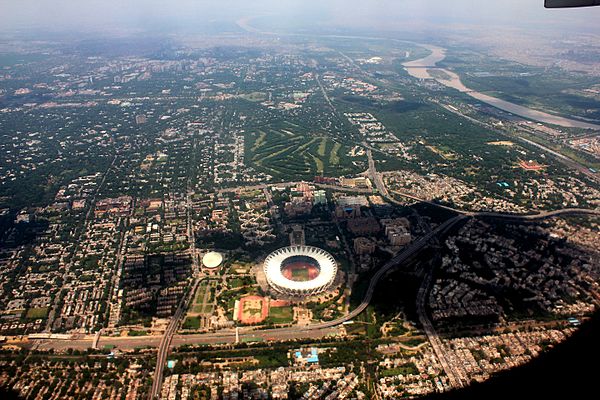
Aerial view of Delhi
Economy and Infrastructure
According to a study from 2014, the Greater Delhi area generated a gross domestic product of 293.6 billion US dollars (KKB). In the ranking of the economically strongest metropolitan regions worldwide, he came in 38th place. The GDP per capita was $ 12,747. Delhi was the largest economic area in India and had the highest per capita income.
In the Human Development Index , the Union Territory of Delhi achieved a value of 0.734 in 2015, compared to an average for all of India of 0.624.
economy
Delhi is one of the most important economic centers in the country. It has a diverse manufacturing industry. Textiles, electrical and electronic equipment, precision tools and automobiles are manufactured in the city. Delhi as a federal city has the largest concentration of civil servants in the country.
A wide range of handicrafts provides an almost comprehensive overview of India's cultural heritage. The shops sell goods from all over the country - everything from Tibetan carpets, antiques and jewelry to modern art and designer clothing is available.
After years of economic isolation caused by the strict trade laws enacted after independence from Britain, Delhi is now experiencing a rapid economic boom.
The area around the city was traditionally used for agriculture. Wheat, pulses, fruits and vegetables are grown. Dairy farming is an important industry. The considerable land consumption and the rising land prices around Delhi are leading to the displacement of many small businesses to more distant areas.
The territories bordering Delhi have primarily oriented their development towards cooperation with the federal capital. In the last few decades large satellite towns such as Gurgaon , Dwarka or Noida have emerged, in which up-and-coming economic sectors such as electrical and computer industry, software development, industrial administration etc. have settled down. The associated social and transport infrastructure is z. Partly still incomplete, but where available, on a par with the facilities in Delhi. In this “bacon belt” of Delhi, an above-average number of young, well-educated people are settling in modern new housing estates. This immigration from across the country forms the core of a rapidly growing Indian middle class.
The Ghazipur landfill opened in 1984 is one of the four municipal landfills .
In a ranking of cities according to their quality of life, Delhi was ranked 162nd out of 231 cities worldwide in 2018.
traffic

Delhi is a national and international transport hub with highways , intercity bus terminals, railway lines, a subway and two airports. The international flights land at 23 kilometers southwest of the city center located Indira Gandhi International Airport , domestic flights on the 15 kilometers southwest of the city located Domestic Airport .
Public transportation has so far failed to meet the needs of the growing Delhi metropolitan area. Therefore, a further expansion of the underground network ( Metro ) is planned. The network is to be expanded to a length of 240 kilometers by 2021. The subway, which went into operation on December 24, 2002, only covered a 22-kilometer section in 2004. In February 2011, after great efforts at the 2010 Commonwealth Games, the length was 181.8 km. The Indira Gandhi International Airport has also been connected to the subway network since February 23, 2011.
The satellite cities that are developing around the metropolis are poorly connected to the motorway network. A major road construction program has been started to reduce traffic jams. In order to curb the rampant pollution, local public transport has been switched to natural gas (CNG: Compressed Natural Gas). This measure affected public buses, taxis and motor rickshaws.
Traffic structures
education
The five main universities in Delhi are the University of Delhi , Jawaharlal Nehru University , Guru Gobind Singh Indraprastha University , Jamia Millia Islamia and Indira Gandhi National Open University . Other important educational institutions are the All India Institute of Medical Sciences , the Indian Institute of Technology Delhi , the Delhi School of Economics , the Shri Ram College of Commerce, the Lady Shri Ram College for Women, the Netaji Subhas Institute of Technology, the Delhi College of Engineering and St. Stephen's College .
Personalities
Sons and daughters of the town:
- Patrick Nair (1932–2017), Indian clergyman, Roman Catholic bishop of Meerut
- Paddy Ashdown (1941-2018), British politician
- Peter Sarstedt (1941–2017), British singer-songwriter and guitarist
- Pervez Musharraf (* 1943), Pakistani politician
- Tariq Anwar (* 1945), British film editor
- Deepak Chopra (* 1946), author on spirituality, alternative medicine and Ayurveda
- Shabana Azmi (* 1950), Indian film actress
- Arun Jaitley (1952–2019), politician (BJP), finance and defense minister
- Geet Sethi (* 1961), Indian billiards player and world champion
- Michael Bennet (* 1964), American politician
- Amar Kanwar (* 1964), Indian film director and contemporary artist
- Shah Rukh Khan (born 1965), Indian Bollywood actor
- Peter Plate (* 1967), German singer, songwriter and producer (Rosenstolz)
- Saif Ali Khan (* 1970), Indian actor
- Bif Naked (* 1971), Canadian punk rock singer
- Chetan Bhagat (* 1974), Indian writer
- Zascha Moktan (* 1981), German-Nepalese songwriter and singer
- Parimarjan Negi (* 1993), Indian chess player
literature
- Dietmar Rothermund : Delhi, August 15, 1947 . Dtv, 1998, ISBN 3-423-30608-4 .
Web links
Individual evidence
- ↑ a b c Census of India 2011: States Census 2011. Retrieved on February 19, 2015 (English, data for the Union territory).
- ↑ dsal.uchicago.edu ( Memento from July 9, 2012 in the web archive archive.today ) Sir Henry Yule_ Hobson-Jobson: A glossary of colloquial Anglo-Indian words and phrases, New ed. Edited by William Crooke, BA London 1903, keyword "Delhi".
- ↑ RS McGregor: Oxford Hindi-English Dictionary, New Delhi 1993, keywords "²दिल dil " and "दिल्ली dillī ".
- ↑ Monier Monier-Williams: Sanskrit-English Dictionary, Oxford 1899, keyword "देहली dehalī ".
- ↑ dsal.uchicago.edu ( Memento from July 10, 2012 in the web archive archive.today ) Francis Joseph Steingass: A Comprehensive Persian-English dictionary, London 1892, keyword "دهلیز dihlīz, دهلیزه dihlīza ".
- ↑ Oxford Hindi-English Dictionary, keyword "¹दिल dil "
- ^ The Times of India. June 19, 2009: Delhi or Dilli: Gill triggers debate .
- ^ Giles Tillotson: Delhi Darshan . Penguin, Gurgaon 2019, ISBN 9780670091911 , p. 6
- ^ Giles Tillotson: Delhi Darshan . Penguin, Gurgaon 2019, ISBN 9780670091911 , p. 7
- ^ Giles Tillotson: Delhi Darshan . Penguin, Gurgaon 2019, ISBN 9780670091911 , p. 8
- ↑ Census of India 2011: Cities having population 1 lakh and above. (PDF; 154 kB)
- ↑ Census of India 2011: Urban Agglomerations / Cities having population 1 lakh and above. (PDF; 141 kB)
- ^ A b Census of India 2011: Primary Census Data Highlights - India. Chapter 1 (Population, Size and Decadal Change) (PDF; 9.2 MB).
- ^ Census of India 2011: Constituents of Urban Agglomerations having Population 1 Lakh & Above. (PDF; 165 kB)
- ↑ Times of India, October 20, 2011: "Delhi topples Mumbai as maximum city".
- ^ Census of India 2001: (Provisional) Slum Population in Million Plus Cities (Municipal Corporations): Part A.
- ^ Census of India 2011: Primary Census Data Highlights - India. Chapter 3 (Literates and Literacy Rate) (PDF; 2.7 MB).
- ^ Census of India 2001: Distribution of 10,000 Persons by Language - India, States and Union Territories .
- ^ Census of India 2001: Distribution of the 22 Scheduled Languages - India, States & Union Territories .
- ↑ Census of India 2011: Population by religious community.
- ^ The Tribune, June 25, 2003: "Punjabi 2nd official language in Delhi".
- ↑ DreamGuides.de: Rajghat - The Gandhi Monument.
- ↑ Swaminarayan Akshardham, New Delhi. Retrieved June 14, 2016 .
- ↑ a b GENERAL ELECTION TO VIDHAN SABHA TRENDS & RESULT FEB-2020: NCT OF Delhi. Indian Election Commission, accessed February 17, 2020 .
- ^ Kejriwal takes oath promising power to people. In: The Hindu , December 28, 2013 (English).
- ^ President's rule imposed in Delhi. In: The Hindu February 16, 2014 (English).
- ^ Delhi Election Results 2015. The Times of India, accessed October 16, 2015 .
- ↑ Times of India, September 12, 2012: "2 new revenue districts on capital's map".
- ^ Census of India 2011: Primary Census Abstract - NCT of Delhi. (PDF; 383 kB)
- ^ Website of the New Delhi Municipal Council . ( Memento of the original from March 2, 2008 in the Internet Archive ) Info: The archive link was automatically inserted and not yet checked. Please check the original and archive link according to the instructions and then remove this notice.
- ^ Alan Berube, Jesus Leal Trujillo, Tao Ran, and Joseph Parilla: Global Metro Monitor . In: Brookings . January 22, 2015 ( brookings.edu [accessed July 19, 2018]).
- ^ Sub-national HDI - Area Database - Global Data Lab. Retrieved August 12, 2018 .
- ↑ Mercer's 2018 Quality of Living Rankings. Retrieved July 30, 2018 .
- ^ Delhi Metro Rail Corporation Ltd.
| Today's states |
Andhra Pradesh • Arunachal Pradesh • Assam • Bihar • Chhattisgarh • Goa • Gujarat • Haryana • Himachal Pradesh • Jharkhand • Karnataka • Kerala • Madhya Pradesh • Maharashtra • Manipur • Meghalaya • Mizoram • Nagaland • Odisha • Punjab • Rajasthan • Sikkim • Tamil Nadu • Telangana • Tripura • Uttarakhand • Uttar Pradesh • West Bengal |
|
| Union Territories |
Andaman and Nicobar Islands • Chandigarh • Dadra and Nagar Haveli and Daman and Diu • Delhi • Jammu and Kashmir • Ladakh • Lakshadweep • Puducherry |
|
| Former states |
Ajmer • Andhra • Bhopal • Bilaspur • Bombay • Coorg • Hyderabad • Jammu and Kashmir • Kachchh • Madhya Bharat • Mysore • Patiala and East Punjab States Union • Saurashtra • Travancore-Cochin • Vindhya Pradesh |
Coordinates: 28 ° 36 ' N , 77 ° 12' E