
Chhattisgarh
 |
|
| status | State |
| Capital | Raipur |
| founding | November 1, 2000 |
| surface | 135,000 km² |
| Residents | 25,540,196 (2011) |
| Population density | 189 inhabitants per km² |
| languages | Hindi |
| governor | Anusuiya Uikey |
| Chief Minister | Bhupesh Baghel ( INC ) |
| Website | chhattisgarh.nic.in |
| ISO code | IN-CT |
  |
|
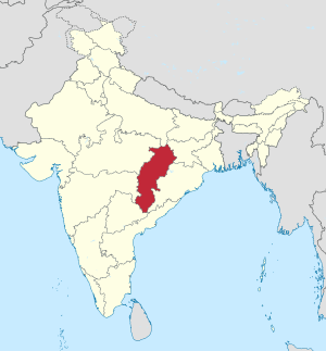
Chhattisgarh ( Hindi छत्तीसगढ़ IAST Chattīsgaṛh [ ʧʰʌttiːsgʌɽʰ ]; literally: "thirty-six fortresses") is an Indian state with an area of 135,000 km² and 25.5 million inhabitants (2011 census). The capital of Chhattisgarh is Raipur , but the planned city of Naya Raipur is currently being developed , which will serve as the seat of government in the future.
geography

Chhattisgarh borders the states of Uttar Pradesh , Jharkhand , Odisha , Telangana , Maharashtra, and Madhya Pradesh (clockwise, starting in the north).
Biggest cities
(Status: 2011 census)
| city | Residents |
|---|---|
| Raipur | 1,010,433 |
| Bhilai Nagar | 625,700 |
| Korba | 363,390 |
| Durg | 268,806 |
| Bilaspur | 265.178 |
| Rajnandgaon | 163.114 |
| Raigarh | 137.126 |
| Jagdalpur | 125,463 |
| Ambikapur | 112,449 |
| Bhilai Charoda | 98.008 |
| Dhamtari | 89,860 |
| Chirmiri | 85,317 |
| Bhatapara | 57,537 |
| Dalli-Rajhara | 44,363 |
history
After India's independence, a province of Chhattisgarh was formed on August 15, 1947, which was incorporated into the Central Provinces and Berar on January 1, 1948 , which then became part of Madhya Pradesh . The state of Chhattisgarh was formed on November 1, 2000 by a majority vote of both chambers of the federal parliament and the parliament of Madhya Pradesh by splitting off the eastern districts of this state.
Maoist rebels, the Naxalites, are active in the state. The activities of the Naxalites are directed against institutions and representatives of state power. For several years there has been a steady decline in Naxalite activities.
population
Demographics
According to the 2011 Indian census, Chhattisgarh has 25,540,196 inhabitants. The population density is 189 inhabitants per square kilometer, well below the national average. 23.2% of Chhattisgarh's residents live in cities. 71 percent of the population can read and write (men: 1.584 percent, women: 0.66 percent). The literacy rate is thus below the Indian average of 74 percent. Between 2010 and 2014, the average life expectancy was 68.6 years (the Indian average was 67.9 years). The fertility rate was 2.21 children per woman (as of 2016) while the national average was 2.23 children in the same year.
With a value of 0.586, Chhattisgarh achieved 24th place among the 29 states of India in the human development index in 2015 and is thus below average.
Population development
Chhattisgarh census population (within today's boundaries) since the first census in 1951.
| Census year | population |
|---|---|
| 1951 | 7,457,700 |
| 1961 | 9,154,330 |
| 1971 | 11,637,800 |
| 1981 | 14.010.110 |
| 1991 | 17,615,600 |
| 2001 | 20,834,530 |
| 2011 | 25,540,196 |
Adivasi

Chhattisgarh lies in the heart of the Indian tribal land. The 2001 census recorded 31.8% of the state's population , or around 6.6 million people, as Adivasi . H. Members of the tribal people. In the districts of Dantewada , Bastar , Jashpur , Kanker and Surguja , the majority of the population is Adivasi. The largest tribal peoples are the Gond , who with 3.7 million members make up over half of the tribal population, followed by the Kawar , Oraon , Halba and Bhattra .
The Adivasi used to live withdrawn in inhospitable forest and mountain regions. The development of this area began in the colonial times. The family groups of the Adivasi were pushed out of their settlement areas and the resources of their areas - tropical wood, mineral resources, water supplies - were released for exploitation. While they were free to use forests, rivers and fields during the time of British colonial rule, today these mainly belong to large private landowners or are controlled by the National Mineral Development Corporation . This works closely with the international timber groups.
languages
| Languages in Chhattisgarh | ||||
|---|---|---|---|---|
| language | percent | |||
| Hindi | 82.7% | |||
| Gondi | 4.3% | |||
| Oriya | 3.9% | |||
| Halabi (Halbi) | 2.6% | |||
| Kurukh (Oraon) | 2.1% | |||
| Bengali | 1.0% | |||
| Other | 3.4% | |||
| Distribution of languages (2001 census) | ||||
Chhattisgarh's main language is Hindi , India's national language and the most widely spoken language in the country. According to the 2001 census, 82.7% of the state's residents speak Hindi as their first language. This number also includes the 13.2 million speakers of the Hindi-related regional language Chhattisgarhi , which is classified as a Hindi dialect in official statistics.
Various minor languages are spoken among the tribal population: Gondi , a Dravidian language, is spoken by part of the Gond population (4.3% of the population of Chhattisgarh). The Kurukh (2.1%), which is spoken by the Oraon tribe, also belongs to the Dravidian language family . 3.9% of the state's residents are classified in the census as speakers of Oriya , the language of the neighboring state of Orissa. In fact, these are mostly speakers of the tribal language Bhatri, which is closely related to the Oriya . Also closely related is the halabi spoken by the halba (2.6%).
Hindi is the official language of Chhattisgarh. As everywhere in India, English is ubiquitous as a communication and educational language.
Religions
| Religions in Chhattisgarh | ||||
|---|---|---|---|---|
| religion | percent | |||
| Hinduism | 93.2% | |||
| Islam | 2.0% | |||
| Christianity | 1.9% | |||
| Other | 2.9% | |||
| Distribution of religions (2011 census) | ||||
The vast majority of Chhattisgarh's residents are Hindus : According to the 2011 census, they make up 93 percent of the state's population. Muslims and Christians are small minorities with around 2 percent each.
environment
Deforestation and environmental pollution from the mining of natural resources (especially hard coal) have also narrowed the habitat of wild elephants, which have withdrawn from neighboring Jharkhand into the forests of Chhattisgarh since the 1980s and have increasingly been causing destruction in remote villages since the year 2000 are responsible.
politics
Political system
The Chhattisgarh State Legislature consists of a unicameral parliament , the Chhattisgarh Legislative Assembly, or Chhattisgarh Vidhan Sabha . The parliament has 91 members, 90 of whom are elected by direct election every five years and one is appointed by the governor to represent the Anglo-Indian minority. The seat of parliament is in Raipur . The Chhattisgarh State Chief Minister is elected by Parliament. But is appointed by the President of India Governor (at the head of the State Governor ). Its main tasks are to appoint the Chief Minister and to entrust him with the formation of the government. Chhattisgarh's highest court is the Chhattisgarh High Court , based in Bilaspur .
In the all-India parliament , Chhattisgarh has eleven members in the Lok Sabha , the lower house, and five seats in the Rajya Sabha , the upper house.
Parties
| Distribution of seats after the 2018 parliamentary elections |
|
|---|---|
| INC | 68 |
| BJP | 15th |
| E.G | 7th |
| total | 90 |
Chhattisgarh's party politics is dominated by two supraregional parties, the Indian National Congress (INC) and the Bharatiya Janata Party (BJP). The first government of the state, founded in 2000, was the Congress Party. The BJP won the new elections in 2003 and then ruled with Chief Minister Raman Singh for the following 15 years.
In the all-India parliamentary elections in 2014 , the nationwide victorious BJP was able to build on its previous successes in Chhattisgarh. The party won all eleven constituencies in the state.
A small sensation in January 2015 was the election of the non-party transsexual ( Hijra ) Madhu Kinnar as mayor of the district capital (see above) Raigarh (approx. 150,000 inhabitants) - with a narrow lead of only 4,500 votes over the BJP candidate.
The election to the parliament of Chhattisgarh on November 12 and 20, 2018 was lost for the BJP. The Congress Party achieved a convincing election victory by winning 68 of the 90 constituencies. The BJP had 15 constituencies and the Bahujan Samaj Party (BSP) had 7 constituencies. On December 17, 2018, Bhupesh Baghel , the congress party's top candidate, was sworn in as the new Chief Minister.
Administrative division
Districts and Divisions

The federal state of Chhattisgarh is divided into the five divisions Bastar , Durg , Raipur , Bilaspur , Surguja and the following 27 districts (population and population density according to the 2011 census):
| District | administrative seat |
Area [km²] |
Population (2011) |
Population density [ inhabitants / km² ] |
division |
|---|---|---|---|---|---|
| Balod * | Balod | - | - | - | Durg |
| Balodabazar * | Balodabazar | - | - | - | Raipur |
| Balrampur * | Balrampur | - | - | - | Surguja |
| Bastar ** | Jagdalpur | (10,083) | (1,411,644) | (140) | Bastar |
| Bemetara * | Bemetara | - | - | - | Durg |
| Bijapur | Bijapur | 6,543 | 255.180 | 39 | Bastar |
| Bilaspur ** | Bilaspur | (8,267) | (2,662,077) | (322) | Bilaspur |
| Dantewada ** | Dantewada | (9,030) | (532,791) | (59) | Bastar |
| Dhamtari | Dhamtari | 3,386 | 799.199 | 236 | Raipur |
| Durg ** | Durg | (8,550) | (3,343,079) | (391) | Durg |
| Garment band * | Garment tape | - | - | - | Raipur |
| Janjgir-Champa | Naila-Janjgir | 3,849 | 1,620,632 | 421 | Bilaspur |
| Jashpur | Jashpur | 5,836 | 852.043 | 146 | Surguja |
| Kabirdham *** | Kawardha | 4,217 | 822.239 | 195 | Durg |
| Kanker | Kanker | 6,510 | 748,593 | 115 | Bastar |
| Condagaon * | Condagaon | - | - | - | Bastar |
| Korba | Korba | 6,593 | 1,206,563 | 183 | Bilaspur |
| Koriya | Baikunthpur | 6,590 | 659.039 | 100 | Surguja |
| Mahasamund | Mahasamund | 4,779 | 1,032,275 | 216 | Raipur |
| Mungeli * | Mungeli | - | - | - | Bilaspur |
| Narayanpur | Narayanpur | 7,010 | 140.206 | 20th | Bastar |
| Raigarh | Raigarh | 7,079 | 1,493,627 | 211 | Bilaspur |
| Raipur ** | Raipur | (13,104) | (4,062,160) | (310) | Raipur |
| Rajnandgaon | Rajnandgaon | 8,050 | 1,537,520 | 191 | Durg |
| Sukma * | Sukma | - | - | - | Bastar |
| Surajpur * | Surajpur | - | - | - | Surguja |
| Surguja ** | Ambikapur | (15,742) | (2,361,329) | (150) | Surguja |
* Newly founded after the 2011 census, figures are not available.
** Reduced in size after the 2011 census due to the splitting off of new districts, figures refer to the district within the boundaries of 2011.
*** In 2003, name changed from Kawardha to Kabirdham.
Local self-government
At the beginning of 2015, Chhattisgarh had 10 Municipal Corporations ( Nagar Nigam ), 44 Municipal Councils ( Nagar Palika Parishad ) and 113 Nagar Panchayats .
Municipal Corporations :
Municipal Councils :
- Ahiwara
- Akaltara
- Arang
- Bath Bacheli
- Bagbahra
- Baikunthpur
- Balod
- Balodabazar
- Balrampur
- Bemetara
- Bhatapara
- Champa
- Dalli-Rajhara
- Dipka
- Dongargarh
- Garment tape
- Gobra Nawapara
- Jashpur
- Katghora
- Kawardha
- Kerudung
- Kharsia
- Kirandul
- Condagaon
- Kumhari
- Naila-Janjgir
- Manendragarh
- Mungeli
- Ratanpur
- Sakti
- Saraipali
- Shivpur Charcha
- Surajpur
- Takhatpur
- Tifra
- Tilda Newra
*** Bhilai Charoda, Birgaon, Dhamtari and Mahasamund were promoted to municipal corporations after 2014 .
Web links
Individual evidence
- ↑ http://www.nayaraipur.com/
- ↑ Census of India 2011: Distribution of population, sex ratio, density and decadal growth rate of population: 2011 ( Memento of April 9, 2011 in the Internet Archive )
- ^ Census of India 2011: Provisional Population Totals - India - Rural-Urban Distribution. (PDF file; 7.7 MB)
- ^ Census of India 2011: Primary Census Data Highlights - India. Chapter 3 (Literates and Literacy Rate) (PDF; 2.7 MB).
- ^ Indian States by Life Expectancy 2010-2014. (PDF) Retrieved March 19, 2018 .
- ^ Fertility Rates. (PDF) (No longer available online.) Archived from the original on June 18, 2018 ; accessed on March 19, 2018 . Info: The archive link was inserted automatically and has not yet been checked. Please check the original and archive link according to the instructions and then remove this notice.
- ^ Sub-national HDI - Area Database - Global Data Lab. Retrieved August 12, 2018 .
- ^ Population of Indian States | Indian states population 1901-2011 - StatisticsTimes.com. Retrieved March 19, 2018 .
- ↑ Census of India 2001: Chhattisgarh. Data highlights: The Scheduled Tribes. (PDF file; 40 kB)
- ↑ Indian census 2001
- ↑ Census of India 2011: Population by religious community.
- ↑ Rakesh K. Singh: Elephants in Exile. A Rapid Assessment of the Human-Elephant Conflict in Chhattisgarh. Wildlife Trust of India, Occasional Report No. January 5, 2002.
- ↑ a b Chhattisgarh Election results. Times of India, accessed December 13, 2018 .
- ↑ Article "Transsexual Mayoress"
- ↑ Bhupesh Baghel takes oath as the chief minister of Chhattisgarh. The Economic Times, December 17, 2018, accessed December 17, 2018 .
- ^ Census of India 2011: Provisional Population Totals. Paper 1 of 2011: Chhattisgarh. (PDF file; 184 kB)
- ↑ answerkeyresults2015.in ( Memento of the original from March 28, 2016 in the Internet Archive ) Info: The archive link was inserted automatically and has not yet been checked. Please check the original and archive link according to the instructions and then remove this notice.
- ↑ Chhattisgarh State Election Commission ( Memento of the original from April 5, 2016 in the Internet Archive ) Info: The archive link was inserted automatically and has not yet been checked. Please check the original and archive link according to the instructions and then remove this notice.
| Today's states |
Andhra Pradesh • Arunachal Pradesh • Assam • Bihar • Chhattisgarh • Goa • Gujarat • Haryana • Himachal Pradesh • Jharkhand • Karnataka • Kerala • Madhya Pradesh • Maharashtra • Manipur • Meghalaya • Mizoram • Nagaland • Odisha • Punjab • Rajasthan • Sikkim • Tamil Nadu • Telangana • Tripura • Uttarakhand • Uttar Pradesh • West Bengal |
|
| Union Territories |
Andaman and Nicobar Islands • Chandigarh • Dadra and Nagar Haveli and Daman and Diu • Delhi • Jammu and Kashmir • Ladakh • Lakshadweep • Puducherry |
|
| Former states |
Ajmer • Andhra • Bhopal • Bilaspur • Bombay • Coorg • Hyderabad • Jammu and Kashmir • Kachchh • Madhya Bharat • Mysore • Patiala and East Punjab States Union • Saurashtra • Travancore-Cochin • Vindhya Pradesh |
Coordinates: 21 ° 6 ′ N , 81 ° 24 ′ E