
National Capital Region (India)
.svg)
The National Capital Region (NCR) is a planning region around the National Capital Territory of Delhi (NCT) in India. It covers the entire area of Delhi including the national capital New Delhi and several surrounding districts of the states of Haryana , Uttar Pradesh and Rajasthan . The NCR and the associated National Capital Region Planning Board were established in 1985 to plan and promote joint development in the region.
According to the 2011 census, around 46 million people (comparable to Spain ) live in the region in an area of around 50,000 square kilometers (comparable to Slovakia ). In addition to Delhi, Gurgaon , Greater Noida and Faridabad are important population centers. The urbanization rate in the region is around 62%, making it one of the most urbanized parts of India.
The Delhi Extended Urban Agglomeration , part of the NCR, contributed 370 billion international dollars or around 4% to the Indian economy (measured in purchasing power parity ) in the period 2015/16 . The region is experiencing strong population growth due to its economic importance.
history
The Delhi region has a long history as an administrative and political center. Delhi already acted as the capital of the Sultanate of Delhi and the Mughal Empire . In 1931 New Delhi was inaugurated as the planned capital of British India . Before that, Delhi had been declared the administrative capital in 1911.
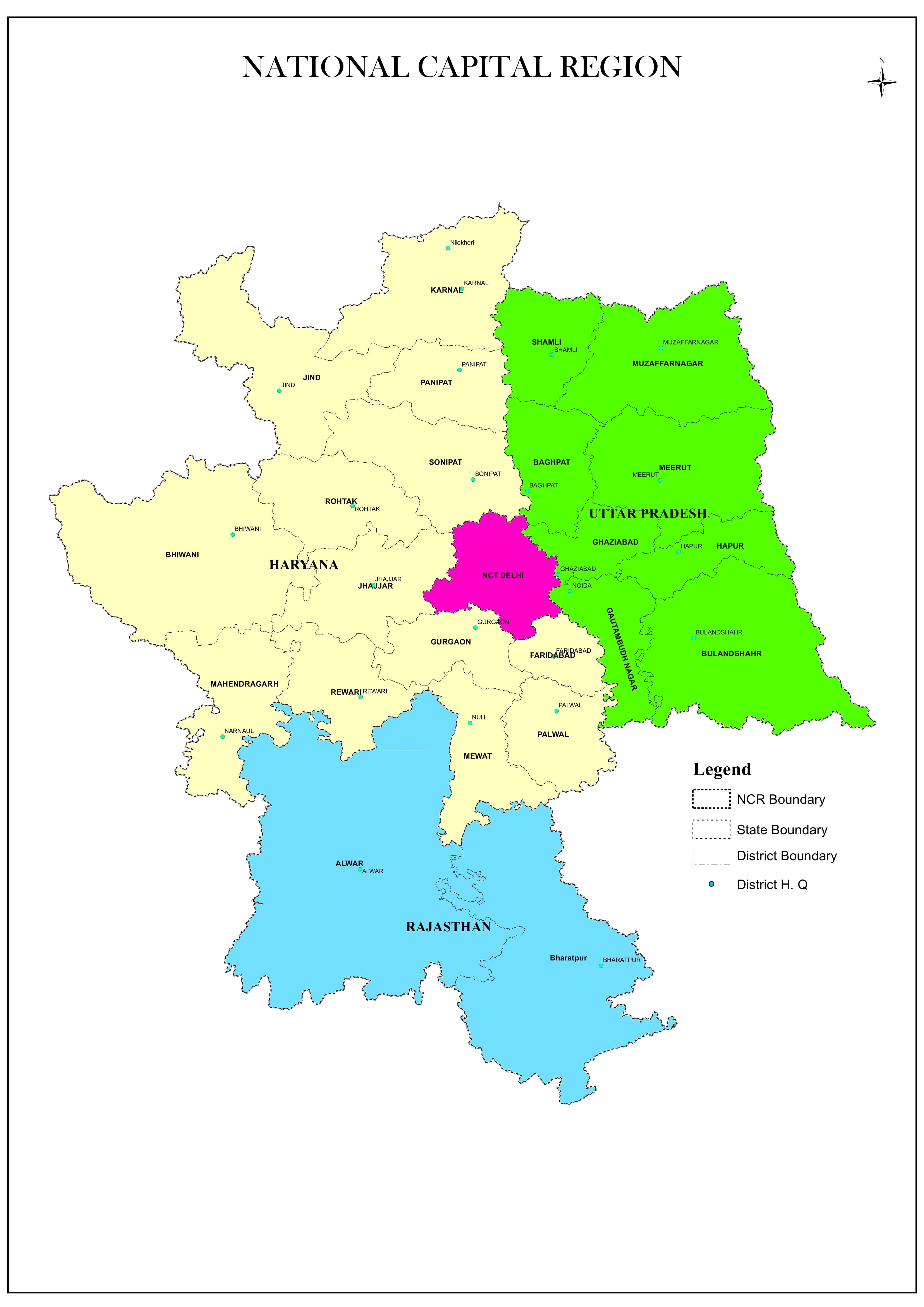
Plans to establish a planning region to promote the region around Delhi have been in existence since 1956. The National Capital Region and its planning commission were created under the 1985 National Capital Region Planning Commission Act. In that 1985 Act, the NCR was designated as the entire NCT of Delhi, Gurgaon , Faridabad , Sonipat , Rohtak (then including Jhajjar ) and Mahendragarh (then including Rewari ) districts in Haryana; the districts of Bulandshahr , Meerut (then including Baghpat ) and Ghaziabad (then including Hapur) in Uttar Pradesh and part of the Alwar district in Rajasthan . Since then, the area of the planning region has been continuously expanded. An expansion of the region to parts of Punjab and other districts of Uttar Pradesh is currently being discussed.
So far, two regional plans have been issued, the "Regional Plan 2001" approved in 1988 and the "Regional Plan 2021" approved in 2005. The themes of the 2001 plan were transport, telecommunications, energy and water supply, sanitation, education, health, the environment and housing. The plan for 2021 expanded these to include the additional topics of social infrastructure, cultural heritage, tourism, rural development and disaster management.
Districts and Territories
The following districts and territories make up the National Capital Region (as of 2019):
Districts in Uttar Pradesh:
Districts in Haryana:
- Bhiwani
- Charkhi Dadri
- Faridabad
- Gurgaon
- Jhajjar
- Jind
- Karnal
- Mahendragarh
- Mewat
- Palwal
- Panipat
- Rewari
- Rohtak
- Sonipat
Districts in Rajasthan:
Web links
Individual evidence
- ↑ With GDP of $ 370 billion, Delhi-NCR muscles out Mumbai as economic capital of India. In: The Financial Express. November 29, 2016. Retrieved August 15, 2019 (American English).
- ↑ THE NATIONAL CAPITAL REGION PLANNING BOARD ACT, 1985
- ↑ Harveer Dabas | TNN | Updated: Jan 10, 2018, 2:29 PM Is: UP government sends proposal to include Bijnor, Mathura, Aligarh and Hathras in NCR | Meerut News - Times of India. Retrieved August 15, 2019 .
- ^ Regional plan 2001. Retrieved on August 15, 2019 (Hindi, English).
- ^ National Capital Region. Retrieved August 15, 2019 .