Ghaziabad (District)
| Ghaziabad | |
|---|---|

|
|
| State | Uttar Pradesh |
| Division : | Meerut |
| Administrative headquarters : | Ghaziabad |
| Area : | 1933.3 km² |
| Residents : | 4,681,645 (2011) |
| Population density : | 2422 people / km² people / km² |
| Website : | ghaziabad.nic.in |
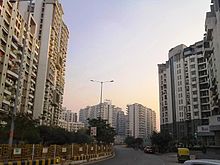
Ghaziabad is a district in the Indian state of Uttar Pradesh in the Meerut division .
Ghaziabad is located in the far west of Uttar Pradesh in the urban agglomeration of Delhi , which borders the district to the west. The district extends between Yamuna and Ganges over an area of 1933.3 km² (as of 2011).
Ghaziabad District was established on November 14, 1976. For this purpose, the then Tehsil Ghaziabad was separated from the Meerut district . In 1997 part of the district was again given to the newly founded Gautam Buddha Nagar district . At the end of 2011, the eastern part of the district was split off and now forms the newly founded district of Hapur .
The district administration of Ghaziabad is located in the city of Ghaziabad . At the 2011 census, the population in Ghaziabad district was 4,681,645. In the 2001 census, the population was 3,290,586.

