
Kanpur Dehat
| Kanpur Dehat District | |
|---|---|

|
|
| State | Uttar Pradesh |
| Administrative headquarters : | Akbapur |
| Area : | 3021 km² |
| Residents : | 1,796,184 (2011) |
| Population density : | 595 inhabitants / km² |
Kanpur Dehat is a district in the northern Indian state of Uttar Pradesh .
The area is 3021 km². The administrative seat is the city of Akbarpur .
history
Kanpur District was divided into two districts in 1977, namely Kanpur Nagar and Kanpur Dehat. The two were reunited in 1979 and separated again in 1981. The government of Uttar Pradesh decided to rename the Kanpur Dehat district to Ramabai Nagar on July 1, 2010. In July 2012 he was renamed back to Kanpur Dehat.
population
The population is 1,796,184 (2011). The population growth rate in the period from 2001 to 2011 was 17.02%. Kanpur Dehat has a gender ratio of 865 women per 1000 men. The district has a literacy rate of 75.78% in 2011, an increase of almost 10 percentage points compared to 2001. The literacy rate is thus above the average of Uttar Pradesh. Almost 90% of the population are Hindus and around 9% are Muslims .
Almost 9.7% of the population live in cities.
gallery

Bara Toll Plaza
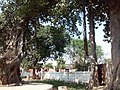
Banyan tree
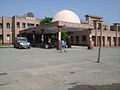
hospital

Kapaleshwr Temple

Waneshwar mahadev

Durga Devi Temple Rura
bridge

Parhul Devi Temple

Kalika Devi Mandir
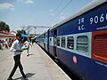
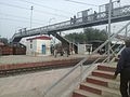
Pukhrayan Railway Station

Parhul Devi Temple-1

Lucknow -Jhansi Road

Dharma Garh Temple

Dharma Garh Temple Rasulabad

%3D%3D.jpg)

.jpg)
.JPG)


Web links
Individual evidence
- ↑ 2011 census (PDF; 398 kB)
- ^ Indian Districts by Population, Sex Ratio, Literacy 2011 Census. Retrieved April 16, 2019 .

Agra | Aligarh | Ambedkar Nagar | Amethi | Amroha | Auraiya | Azamgarh | Badaun | Baghpat | Bahraich | Ballia | Balrampur | Banda | Barabanki | Bareilly | Basti | Bijnor | Bulandshahr | Chandauli | Chitrakoot | Deoria | Etah | Etawah | Faizabad | Farrukhabad | Fatehpur | Firozabad | Gautam Buddha Nagar | Ghaziabad | Ghazipur | Gonda | Gorakhpur | Hamirpur | Hapur | Hardoi | Jalaun | Jaunpur | Jhansi | Kannauj | Kanpur Dehat | Kanpur Nagar | Kasganj | Kaushambi | Kushinagar | Lakhimpur Kheri | Lalitpur | Lucknow | Mahamaya Nagar | Maharajganj | Mahoba | Mainpuri | Mathura | Mau | Meerut | Mirzapur | Moradabad | Muzaffarnagar | Pilibhit | Pratapgarh | Prayagraj | Raebareli | Rampur | Saharanpur | Sambhal | Sant Kabir Nagar | Sant Ravidas Nagar | Shahjahanpur | Shamli | Shravasti | Siddharthnagar | Sitapur | Sonbhadra | Sultanpur | Unnao | Varanasi