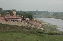
Pratapgarh (District, Uttar Pradesh)
| Pratapgarh District प्रतापगढ़ जिला |
|
|---|---|

|
|
| State | Uttar Pradesh |
| Division : | Allahabad |
| Administrative headquarters : | Bela Pratapgarh |
| Area : | 3717 km² |
| Residents : | 3,209,141 (2011) |
| Population density : | 863 inhabitants / km² |
| Website : | pratapgarh.nic.in |
The district of Pratapgarh ( Hindi : प्रतापगढ़ जिला ; formerly Partabgarh ) is a district of the Indian state of Uttar Pradesh . The administrative center is Bela (Bela Pratapgarh), the district is named after the city of Pratapgarh .
geography
The Pratapgarh district is located in the southeast of the Awadh (Oudh) region in central Uttar Pradesh and is part of the Allahabad division . In the southwest the Ganges , India's largest river, borders the district, in the northeast it is briefly touched by the Gomti River . The district area is traversed by the Sai , a tributary of the Gomti and belongs to the flat and intensively agricultural Ganges plain . The area of the district is 3717 km².
Neighboring districts are Allahabad in the south, Kaushambi in the southwest, Raebareli in the northwest, Amethi in the north, Sultanpur in the northeast and Jaunpur in the east.
The Pratapgarh District is divided into the five Tehsils Lalganj, Kunda, Pratapgarh, Patti and Raniganj.
history
The district of Pratapgarh (Partabgarh) was created by the British in 1858 after they annexed the princely state of Oudh , to which the area had previously belonged, as a result of the Indian uprising of 1857 . In 1902 Oudh became part of the United Provinces , from which the state of Uttar Pradesh emerged after Indian independence in 1947.
population
According to the 2011 census, the Pratapgarh district has 3,209,141 inhabitants. Between 2001 and 2011, the population grew by 16 percent, which is more slowly than the Uttar Pradesh mean (20 percent). The population density of 863 inhabitants per km² is still slightly above the already high average of the state (829 inhabitants per km²). The district is very rural: only a little over five percent of the population lives in cities. The degree of urbanization is just a quarter of the Uttar Pradesh mean (22 percent). At 70 percent, the literacy rate is above the state average (68 percent).
According to the 2001 census, Hindus make up the majority of the district's residents at 86 percent. There is also a Muslim minority of 14 percent.
Cities
| city | Population (2001) |
|---|---|
| Antu | 7,740 |
| Bela Pratapgarh | 71,835 |
| Katra Medniganj | 7,815 |
| Kunda | 22,331 |
| Manikpur | 13,455 |
| Patti | 8,798 |
| Pratapgarh | 12,339 |
Individual evidence
- ↑ Census of India 2011: Primary Census Abstract - Uttar Pradesh (PDF; 1.7 MB).
- ^ Census of India 2001: Basic Data Sheet. District Pratapgarh (43), Uttar Pradesh (09). (PDF; 54 kB)
- ↑ Census of India 2001: Population, population in the age group 0-6 and literates by sex - Cities / Towns (in alphabetic order) ( Memento from June 16, 2004 in the Internet Archive )
literature
- The Imperial Gazetteer of India. Volume 20: Pārdi to Pusad. New edition. Clarendon Press, Oxford 1908, pp. 12-21 , keyword: Partabgarh District .

