Prayagraj (district)
| Prayagraj District इलाहाबाद जिला |
|
|---|---|

|
|
| State | Uttar Pradesh |
| Division : | Allahabad |
| Administrative headquarters : | Prayagraj |
| Area : | 5482 km² |
| Residents : | 5,954,391 (2011) |
| Population density : | 1086 inhabitants / km² |
| Website : | prayagraj.nic.in |
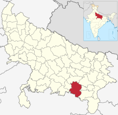
The district of Prayagraj ( Hindi : इलाहाबाद जिला ), until 2018 district of Allahabad (Hindi: इलाहाबाद जिला ), is a district of the Indian state of Uttar Pradesh . The administrative center is the metropolis of Prayagraj (Allahabad).
geography
The Prayagraj district is located in the south of Uttar Pradesh and belongs to the Allahabad division . Neighboring districts are Chitrakoot and Kaushambi in the west, Pratapgarh in the north, Jaunpur in the northeast, Sant Ravidas Nagar in the east, Mirzapur in the southeast and Rewa in the south. The latter already belongs to the neighboring state of Madhya Pradesh .
The district area has an area of 5482 km² and includes the area to the left and right of the rivers Ganges and Yamuna , which meet at Allahabad. In addition, the Tamsa (Tons) river, which comes from the south, flows into the Ganges in the Prayagraj district . The northern part of the district belongs to the Ganges plain and is completely flat, to the south the terrain rises to the Vindhya plateau and the landscape already resembles the neighboring Bundelkhand area.
The Prayagraj District is divided into the eight Tehsils Koraon, Soraon, Meja, Handia, Phulpur, Bara, Sadar and Karchhana.
history
The Allahabad district was established by the British after the Nawab of Oudh ceded the territory to British India in 1801 . In 1826 part of the area came to the Fatehpur District . During the British rule, the district was part of the Ceded and Conquered Provinces ( Northwestern Provinces from 1836 ), which became part of the United Provinces of Agra and Oudh in 1902 . After Indian independence in 1947, the United Provinces became the state of Uttar Pradesh. 1997 broke the western part of the district area as Kaushambi District from the Allahabad district.
In 2018, both the district and the eponymous city were renamed Prayagraj .
population
According to the 2011 Indian census, the Prayagraj district has 5,954,391 inhabitants. This makes it the most populous district of Uttar Pradesh. Between 2001 and 2011, the population grew by 21 percent, about the same speed as the state average (20 percent). The population density of 1086 inhabitants per km² is above the already high Uttar Pradesh average of 829 inhabitants per km². With the metropolis of Prayagraj, the district is home to the seventh largest city in Uttar Pradesh. Nonetheless, the degree of urbanization, at 25 percent, is only slightly above the state average (22 percent). At 72 percent, the literacy rate is higher than the Uttar Pradesh mean (68 percent) and almost exactly corresponds to the overall Indian average (73 percent).
According to the 2001 census , Hindus make up the majority of the inhabitants of the Prayagraj district with 87 percent. There is also a Muslim minority of 13 hundredths.
Cities
| city | Population (2011) |
|---|---|
| Prayagraj | 1,168. 385 |
| Allahabad Cantonment | 26,944 |
| Bharatganj | 16,345 |
| Chak Imam Ali | 4,641 |
| Handia | 21,798 |
| Jhusi | 13,878 |
| Jhusi Kohna | 20,023 |
| Koraon | 14,821 |
| Lal Gopalganj Nindaura | 28,288 |
| Mau Aima | 19,645 |
| Phulpur | 22,998 |
| Shankargarh | 17.785 |
| Sirsa | 12.686 |
literature
- The Imperial Gazetteer of India. Volume 5: Abāzai to Arcot. New edition. Clarendon Press, Oxford 1908, pp. 227–236 , keyword: Allahābād District .
Web links
Individual evidence
- ↑ https://prayagraj.nic.in/
- ↑ Census of India 2011: Primary Census Abstract - Uttar Pradesh (PDF; 1.7 MB).
- ^ Census of India 2001: Basic Data Sheet. District Allahabad (45), Uttar Pradesh (09). (PDF; 55 kB)
- ↑ Census of India 2001: Population, population in the age group 0-6 and literates by sex - Cities / Towns (in alphabetic order) ( Memento from June 16, 2004 in the Internet Archive )

