
Babar (island)
| Babar | ||
|---|---|---|
 |
||
| Waters | Banda Sea , Timor Sea | |
| Archipelago | Babar Islands | |
| Geographical location | 7 ° 52 ′ S , 129 ° 36 ′ E | |
|
||
| Highest elevation | 833 m | |
| main place | Tepa , Letwurung | |
 |
||

Babar (in old literature also Baba or Babber; Indonesian Pulau Babar ) is an Indonesian island.
geography
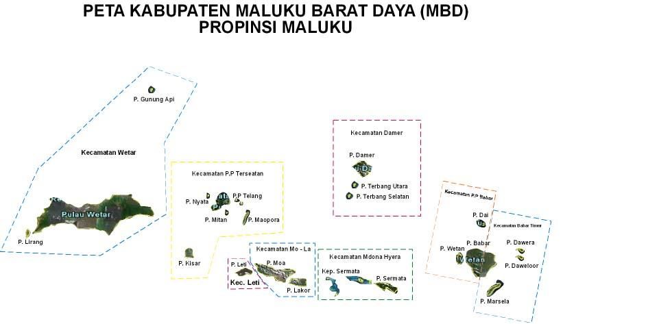
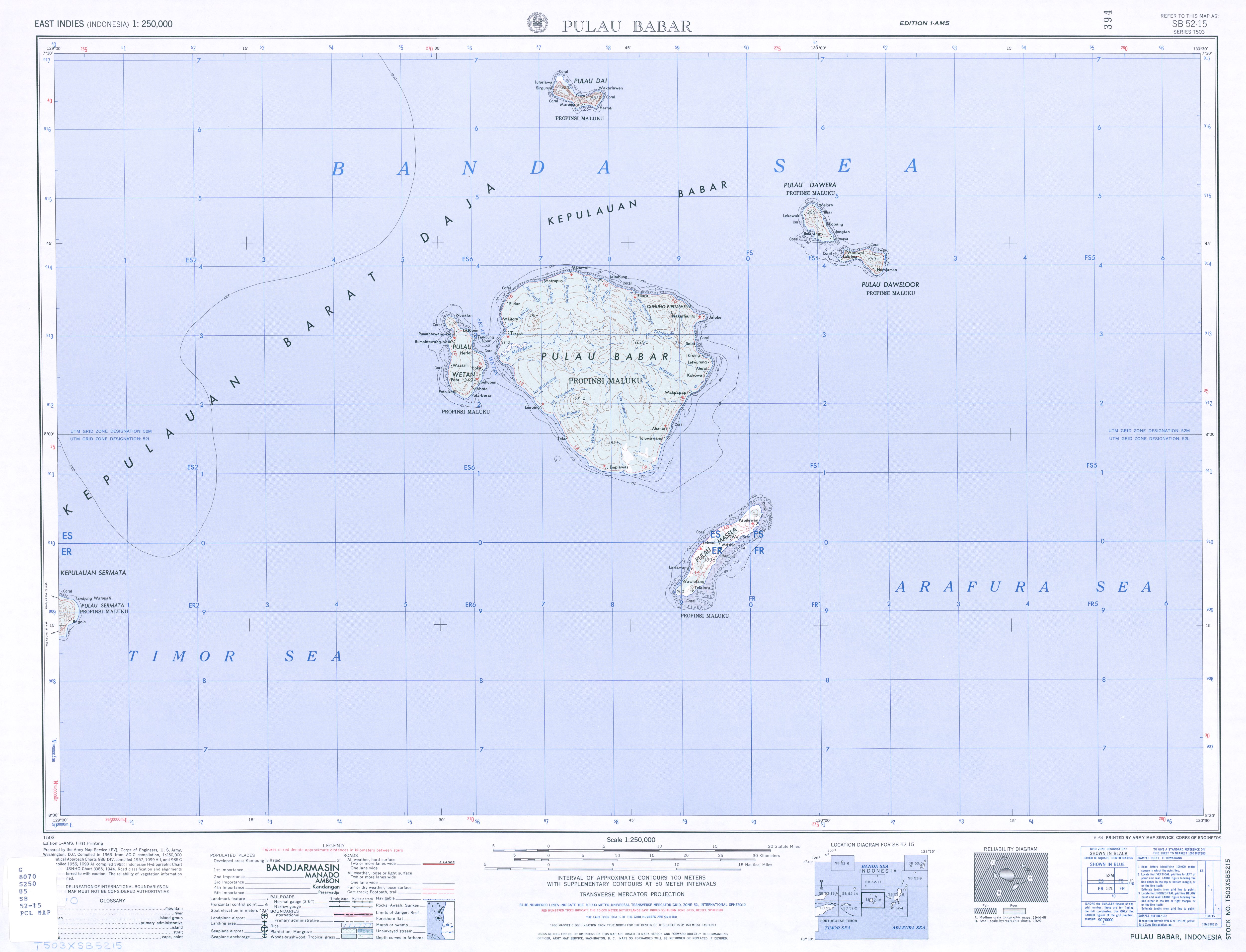
With a diameter of 32 kilometers, the circular island of Babar is the largest of the Babar Islands . They belong to the administrative district ( Kabupaten ) of the southwestern Moluccas ( Maluku Province ). In the north-south direction, the island is divided into the two sub-districts ( Kecamatan ) Pulau-Pulau Babar in the west and Babar Timur ( East Babar ) in the east. The main town of Pulau-Pulau Babar is Tepa on the west coast of Babar and of Babar Timur Letwurung ( Tutuwawang ) on the east coast. To the south are the Timor Sea and the Arafura Sea , to the north the Banda Sea .
The hilly Babar reaches a height of 833 m near the center of the island and is thinly forested with mountain forests with teak trees and lianas . Babar has fresh water springs even in the dry season from September to December. Heavy rainfall occurs in the rainy season. Several small rivers flow from the hills towards the fertile coastline.
Residents

Various dialects of the Babar languages from the language family of the Central Malayo-Polynesian languages are spoken on Babar : Luang on the west coast, Imroing, Tela-Masbuar and Emplawas on the southwest coast, southeast Babar on the southeast coast and north Babar on the north coast .
The original inhabitants of Babar are Melanesians . The majority of them belong to the Protestant Church of the Moluccas ( Gereja Protestan Maluku, GPM), an offshoot of the Dutch Reformed Church . There is also a mosque in Tepa .
history
In the 17th century the Dutch East India Company established a military base on Babar, which was subordinate to the governor of Banda. This consisted of a corporal and two soldiers. In the 18th century, Babar was ruled by an upper orang kaya and various orang kayas. At the same time, the Upper Orang-Kaya of Babar ruled the island of Wetan .
In October 1944 , 710 civilians were murdered by Japanese troops in Emplawas , on the south coast of Babar . At that time the village was an important tobacco growing area with an annual production of 6000 kg. The Japanese military tried forcibly to take control of tobacco production. When the villagers resisted, almost the entire population was killed by the Japanese.
Economy and transportation
The main agricultural products are sago and corn .
Babar can only be reached by ship. There is no airport.
Web links
Individual evidence
- ↑ a b c d e f g Britannica: Babar Island
- ^ Map of the Southwest Moluccas
- ↑ Map of the Southwest Moluccas ( Memento of the original from November 22, 2011 in the Internet Archive ) Info: The archive link was inserted automatically and has not yet been checked. Please check the original and archive link according to the instructions and then remove this notice.
- ↑ Map of the Babar Islands
- ^ Ethnologue: Language map of southern Moluccas
- ^ Ernst Christoph Barchewitz : East Indian Travel Description , Chemnitz 1730, pp. 492-494
- ↑ The global review: Massacre of 710 Civilians in Babar Islands remains unknown to Indonesia's Public