Sabie (South Africa)
| Sabie | ||
|---|---|---|
|
|
||
| Coordinates | 25 ° 6 ′ S , 30 ° 47 ′ E | |
| Basic data | ||
| Country | South Africa | |
| Mpumalanga | ||
| District | Ehlanzeni | |
| ISO 3166-2 | ZA-MP | |
| local community | Thaba Chweu | |
| Residents | 9148 (2011) | |
| Website | www.sabie.co.za (English) | |
|
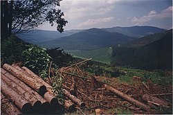
Landscape near Sabie
|
||
Sabie is a small town in the municipality Thaba Chweu in the district of Ehlanzeni in South Africa . It is located 350 kilometers east of Pretoria and 64 kilometers west of the Kruger National Park on the Sabie River . In 2011 Sabie had 9,148 inhabitants.
history
The history of the original village of Sabie dates back to the mid-19th century when it was established on the Grootfontein farm. In 1871 gold was discovered ten kilometers southeast of Sabie at Spitzkop . It was the first commercially usable amount in the South African Republic . In 1880 the big game hunter Henry Thomas Glynn bought the farm. Together with JC Ingle he founded the Glynns-Lydenburg Gold Mining Company, which mined gold until 1960. Glynn became the first mayor of Sabie.
traffic
Sabie is located on the Mbombela - Graskop railway line , which is only used for freight traffic. The roads R532, R536 and R537 run through the city. The N4 national road runs 40 kilometers south of Sabie .
economy
Due to its location on the Panorama Route and because of the many waterfalls, Sabie is now a popular tourist destination. The main industry is forestry.
Web links
- History of Sabie (English)
- Information on forestry (English)
- Komatiland Forestry Museum in Sabie (English)
Individual evidence
- ↑ 2011 census , accessed November 16, 2013

