Saint-Pierre (Seychelles)
| Saint-Pierre | ||
|---|---|---|
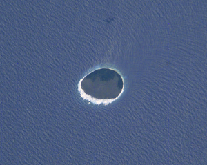
| NASA image of Saint-Pierre | ||
| Waters | Indian Ocean | |
| Archipelago | Farquhar group | |
| Geographical location | 9 ° 19 '52 " S , 50 ° 43' 38" E | |
|
|
||
| length | 1.6 km | |
| width | 1.4 km | |
| surface | 1.68 km² | |
| Highest elevation | 12 m | |
| Residents | uninhabited | |
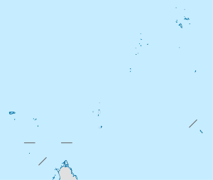
| Saint-Pierre is located west of the Providence Atoll | ||
Saint-Pierre is a small island in the Indian Ocean , which is one of the so-called Outer Islands of the Republic of the Seychelles . It lies within the Farquhar Group and is about 35 km west of the Providence Atoll . It is about 700 kilometers to Mahé , the main island of the Seychelles in the northeast, and about 500 kilometers to the Aldabra Atoll in the southwest.
Saint-Pierre is an approximately round island with a length of 1.6 km in east-west direction and a width of 1.4 km in north-south direction and has an area of 1.68 km². The island is an upscale atoll with a steeply sloping coast, which makes landing with boats difficult. On the cliff coast, Saint-Pierre reaches a height of up to 12 m above sea level, in the interior of the island, however, the surface is about sea level.
On the now uninhabited island, guano was intensively mined from 1906 to 1972 and the former vegetation, which mainly consisted of Pisonia trees ( Pisonia grandis ), was largely destroyed. The northwest of the island is of up to 12 m high Kasuarinen ( Casuarina coverage).


