Salāma wa-Banātuhā
| Salāma wa-Banātuhā | ||
|---|---|---|
| Little Quoin from the west (1909, still without the lighthouse built in 1914, far left (north) the landing place) | ||
| Waters | Strait of Hormuz , Persian Gulf | |
| Geographical location | 26 ° 29 ′ N , 56 ° 31 ′ E | |
|
|
||
| Number of islands | 3 | |
| Main island | Dīdāmar (Little Quoin) | |
| Total land area | 0.28 km² | |
| Residents | uninhabited | |
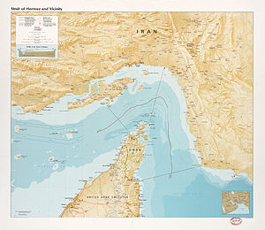
| As Salāmah wa Banātuhā on the CIA card from 1987 | ||
Salāma wa-Banātuhā ( Arabic سلامة وبناتها), Salāma and her daughters , also known as Quoin Islands or The Quoins , are a small uninhabited Omani island chain in the far north of the country, on the Strait of Hormuz in the Persian Gulf .
history
Earlier the islands were inhabited by people of the section Bani Shatair the tribe of Shihūh as in Kumzar live.
Until 1979 ships traveled between the island of Dīdāmar (Little Quoin) and the Omani mainland coast. This year, the government of Oman demanded that shipping routes be taken north of the archipelago (which, however, are still in Omani territorial waters), as the previous routes were dangerous because of their proximity to the islands and the mainland.
geography
The three islands are between 13 and 17 kilometers north of the Omani mainland on the Musandam peninsula and extend over a length of 4.4 km from northwest to southeast. They form the northernmost land masses of the Sultanate of Oman.
The largest and northernmost island is As Salāma or Great Quoin Island. It has an approximately triangular floor plan, is around 770 meters long and up to 530 meters wide, with an area of 22 hectares . Great Quoin also marks the narrowest point of the Strait of Hormuz: the distance to the island of Larak , which belongs to Iran, is 38.7 km.
On the southern island, Dīdāmar or Little Quoin Island, which is around 2.9 hectares in size, there is the Didamar Light lighthouse built by Great Britain in 1914 , the first lighthouse built in Oman.
Between the two lies Fanakū or Gap Island, the smallest of the three islands at 2.6 hectares. It reaches a height of 78 meters, while Litte Quoin is 51 meters and Great Quoin is 164 meters high.
administration
Administratively, the archipelago belongs to the Wilāyat al-Chasab in the Musandam governorate.
panorama
Web links
- Official Omani website for Didamar Light
- Lighthouse Explorer: Didamar Light
- Photo by Didamar Light (close-up January 2007)
- Oblique aerial view of Dīdāmar from the north
- Oblique aerial view of Dīdāmar from the south
- Oblique aerial view of Dīdāmar from the east
literature
- John Gordon Lorimer: Gazetteer of the Persian Gulf. Vol. II. Geographical and Statistical, p. 1652: SALĀMAH-WA-BINĀT-HA ( online scan , online text )


