Kumzar
Coordinates: 26 ° 20 ' N , 56 ° 25' E
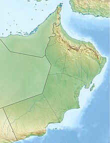
Kumzar ( Arabic كُمزار, DMG Kumzār ) is a city in Musandam Governorate in Oman , and the northernmost settlement on mainland Oman. Only the village of Jazīrat Umm al-Ghanam on the island of the same name lies further north. It is located at the mouth of the Wadi Marwāni (مرواني) in the bay of the same name Khor Kumzār on the Strait of Hormuz , a strait only a few nautical miles wide that connects the Persian Gulf with the Gulf of Oman and the Arabian Sea . At the census on December 7, 2003 there were 1,412 inhabitants, and at the subsequent census on December 12, 2010 there was a slight decrease to 1,378 inhabitants.
The residents of Kumzar belong to the section Bani Shatair the tribe of Shihūh who live mainly on fishing. There are around 600 low stone houses, as well as two mosques.
The residents of Kumzar also own the island of Jazīrat Umm al-Ghanam , five kilometers west of the town center , on which they used to send goats to graze after rain.
In the past, members of the same ethnic group also populated the small, now uninhabited Quoin Islands further north .
Kumzar has no road connection to other places and can only be reached by boat.
In Kumzar, Kumzari is spoken, the language of the Shihūh tribe, the only Iranian language spoken on the Arabian Peninsula .
See also
Individual evidence
- ↑ http://citypopulation.de/php/oman-musandam.php
- ↑ Brill Online Reference Works: Kumzar
- ↑ Brill Online Reference Works: Ghanam
- ↑ Blog
Web links
- The village "Camufa" and its connection to Portuguese colonial history ( Memento from December 7, 2016 in the Internet Archive )


