Jazīrat Umm al-Ghanam
| Jazīrat Umm al Ghanam | ||
|---|---|---|
| Sheep Island on the map of the Musandam Peninsula from 1904 | ||
| Waters | Persian Gulf | |
| Geographical location | 26 ° 21 '12 " N , 56 ° 21' 12" E | |
|
|
||
| length | 5 km | |
| width | 1.47 km | |
| surface | 5.63 km² | |
| Highest elevation | Qarn ath-Thaur 185 m |
|
| Residents | 68 (December 12, 2010) 12 inhabitants / km² |
|
| main place | Jazīrat Umm al-Ghanam | |
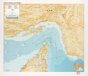
| Jazīrat al Ghanam on the CIA map of the Strait of Hormuz | ||
Jazīrat Umm al-Ghanam , Arabic جزيرة أم الغنم, DMG Ǧazīrat Umm al-Ġanam , also Jazirat Umm al Ghanam ; English Goat Island , German goat island , is an island in the northwest of the Musandam peninsula belonging to Oman . The island erroneously appears as Sheep Island on some old English-language maps . This can be explained by the fact that the Arabic word الغنم / Ġanam can mean both goat and sheep.
geography
The island is five kilometers long from the northern tip of Ra's Qiyaq (رأس قيق) to the southern tip, up to 1.47 km wide, and has an area of 5.63 km². She is from the mainland by the 480 to 1200 meters wide strait Khor al-Quwai' (خور القويع, also Chaur Quwayy /خور قوي, European name Discovery Strait ), and is located 2.5 km southwest of Ra's Schuraita (رأس شريطة), the northernmost mainland point of Oman. The highest point of the otherwise relatively flat island is the Qarn ath-Thaur (قرن الثور / Qarn aṯ-Ṯaur / 'Stierhorn') in the south, which reaches a height of 185 meters.
The village of the same name Jazīrat Umm al-Ghanam in the north of the island had 68 inhabitants at the census on December 12, 2010, after 45 inhabitants at the previous census on December 7, 2003. The village is the northernmost settlement of the Sultanate of Oman. Further north is only the unmanned lighthouse Didamar Lighthouse on Little Quoin Island .
The US - Sailing Directions in the region of 2017 describes the island as barren and uninhabited, with a high hill that drops steeply at its southern end.
Also in the north of the island is the small Salib naval base . This is now known as the Musandam Naval Base ( Arabic البحـرية مسنـدم قاعـدة) known. It was opened in 1986 under the name Ras Musandam Naval Base . A runway around 940 meters long can be seen on the satellite image .
Jazīrat Umm al-Ghanam is largely without vegetation and has no natural water resources. In the past, after rain, the residents of the small town of Kumzar , who own Jazīrat Umm al-Ghanam, brought goats to graze on the island, according to a description from 1904. Hence the name meaning goat island .
Administration and ownership
Administratively, the island belongs to the Wilaya al-Chasab of the Musandam governorate. They traditionally one resident in Kumzar Bani Shatair from the tribe of Schihūh which kumzari language speaks, the only Iranian language , on the Arabian Peninsula is spoken.
panorama
Individual evidence
- ^ PNAS Islands Database
- ^ Willem Floor: First Contacts between the Netherlands and Masqat or A Report on the Discovery of the Coast of 'Oman in 1666: Translation and Introduction. Journal of the German Oriental Society, Vol. 132, No. 2 (1982), pp. 289-307, here p. 300, footnote 13.
- ↑ Jask to Dubai (Dubayy) and Jazireh-ye Qeshm (Marine Chart: SA_2888_0)
- ↑ Citypopulation.de: OMAN: Musandam Governorate
-
^ National Geospatial Intelligence Agency: Red Sea and the Persian Gulf. Pub 172 Sailing Directions (Enroute), Springfield, Virginia, 2017 , p. 262:
13.9 Jazirat Umm al Ghanam (26 ° 22'N., 56 ° 21'E.), Located 1.5 miles SW of Ras Shuraytah, is a barren and uninhabited island, with a high hill dropping off to a sheer cliff at its S end. - ↑ Joseph Kostiner: Conflict and Cooperation in the Gulf region. Springer 2009, ISBN 3-531-91337-9 , p. 197 (Google Books preview)
- ↑ Oman notices to mariners (attachment) Edition 01/2016 of January 28, 2016, p. 9 (English, Arabic).
- ^ Royal Navy of Oman: About Royal Navy of Oman
- ^ John Gordon Lorimer: Gazetteer of the Persian Gulf, Oman and Central Arabia: GHANAM (JAZĪRATAL-) , p. 645.
- ^ John Gordon Lorimer: Gazetteer of the Persian Gulf, Oman and Central Arabia: Kumzar , p. 1040


