San Gabriel (Ecuador)
| San Gabriel | ||
|---|---|---|
|
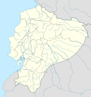
Coordinates: 0 ° 37 ′ N , 77 ° 50 ′ W San Gabriel on the map of Ecuador
|
||
| Basic data | ||
| Country | Ecuador | |
| province | Carchi | |
| City foundation | 1901 | |
| Residents | 12,575 (2013) | |
| - in the metropolitan area | 28,576 | |
| Detailed data | ||
| height | 2870 m | |
| Post Code | 040550 | |
| prefix | (+593) 6 | |
| License Plate | C. | |
| Time zone | UTC -5 | |
San Gabriel is a city in the province of Carchi in Ecuador . It is the capital and with 12 575 inhabitants at the same time the largest city of the canton of Montúfar and was founded in 1901.
Geographical location
San Gabriel is located in northern Ecuador, about 20 km from the Colombian border. Within the province it is located in the south-east of Carchi.
National cultural heritage
The city of San Gabriel was named a National Heritage Site by UNESCO on November 11, 1992 because of the colonial facades of its buildings . An example of the architecture of San Gabriel is the Iglesia Matriz (German: Mother Church ), which stands next to the main square.
sons and daughters of the town
- Segundo Navarrete (* 1985), road cyclist
Web links
Individual evidence
- ↑ a b c Information on population, foundation and province ( memento of the original from June 19, 2015 in the Internet Archive ) Info: The archive link has been inserted automatically and has not yet been checked. Please check the original and archive link according to the instructions and then remove this notice.
- ↑ Postcode
- ↑ Prefix ( Memento of the original from March 4, 2016 in the Internet Archive ) Info: The archive link was inserted automatically and has not yet been checked. Please check the original and archive link according to the instructions and then remove this notice.
- ^ Iglesia Matriz de San Gabriel (Information on Appointment to National Heritage, Spanish), accessed April 12, 2017.
