San Miguel (El Salvador)
| San Miguel de la Frontera | ||
|---|---|---|
|
Coordinates: 13 ° 30 ′ N , 88 ° 11 ′ W San Miguel de la Frontera on the map of El Salvador
|
||
|
Location of San Miguel de la Frontera in El Salvador
|
||
| Basic data | ||
| Country | El Salvador | |
| Department | San Miguel | |
| Residents | 218,410 (2007) | |
| City insignia | ||
| Detailed data | ||
| height | 129 m | |
| Waters | Río Grande de San Miguel | |
| Time zone | UTC −6 | |
| City Presidency | José Wilfredo Salgado García | |
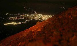
| At night from the Chaparrastique | ||
San Miguel (originally San Miguel de la Frontera , named after the Archangel Michael ) is the largest city in the east of the Central American state of El Salvador . It is the capital of the Department of San Miguel .
history
San Miguel de la Frontera was founded on May 8, 1530 by Captain Luis de Moscoso as a base against rival conquistadors operating from what is now Nicaragua . A Lenca settlement with the name Chaparrastique ("Square with wonderful gardens") was probably located on the site . After the place survived some uprisings, it became rich after 1537 from gold discoveries. In 1574 it was made a town and in March 1586 it was largely destroyed by fire. San Miguel was then rebuilt at a nearby location. It still has numerous colonial buildings and the Cathedral of San Miguel , which was completed in 1962 after 100 years .
In 1878 San Miguel had 9,842 residents. In 2005, 181,819 people lived there.
geography
San Miguel is 107 m above sea level. M., at the foot of the 1975 m high, very active volcano of San Miguel, also known as Chaparrastique . The Chinameca volcano is also nearby .
additional
San Miguel is known for its Carnival in November.
Town twinning
- Arlington County , Virginia, USA


