
Sanipass
| Sanipass | |||
|---|---|---|---|
 View from the Sanipass towards South Africa |
|||
| Compass direction | west | east | |
| Pass height | 2873 m | ||
| Thaba-Tseka District , Lesotho | Province of KwaZulu-Natal , South Africa | ||
| Watershed | Sani ( Orange ) | Mkhomazana ( Mkomazi ) | |
| Valley locations | Mokhotlong | Underberg | |
| expansion | Pass road | ||
| Built | 1955 | ||
| Winter closure | in bad weather | ||
| Mountains | Drakensberg | ||
| particularities | highest pass in South Africa, third steepest pass road in the world | ||
| profile | |||
| Denzel scale | SG 1 | SG 4 | |
| Ø pitch | 1.3% (90 m / 6.7 km) | 5% (1344 m / 33 km) | |
| Max. Incline | 25% | ||
 |
|||
| map | |||
|
|||
| Coordinates | 29 ° 35 ′ 5 ″ S , 29 ° 17 ′ 15 ″ E | ||

The Sanipass , English Sani Pass , is a 2873 meters above sea level mountain pass in the Drakensberg between the east of Lesotho and South Africa . It is the highest pass in South Africa.
course
The road leads over the Sanipass from Mokhotlong in the Mokhotlong district in Lesotho to the South African Underberg in the province of KwaZulu-Natal and is thus the only road connection from the eastern border of Lesotho to South Africa. The pass road leads on the western side in the Thaba-Tseka district through the highlands of the Drakensberg, which in Lesotho are known as the Maloti Mountains. On the South African side, the road leads through the Ukhahlamba-Drakensberg Park . It winds in numerous serpentines down the rugged slope of the Drakensberg until the valley of the Mkhomazana is reached. The road here is the third steepest pass road in the world with an altitude difference of 1330 meters over 6.5 kilometers.
The road is only partially paved. The hard surface extends on the South African side to the Old Good Hope Trading Post, on the Lesotho side to the border post. [outdated]
The highest pub in Africa is located at the top of the pass.

View from South Africa towards the top of the pass

Hairpin turns

Sanipass sign
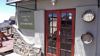
Highest bar in Africa


Border post
The South African border post is not located at the actual border at the pass, but at the foot of an eight-kilometer stretch. According to a law from 1987, the road between the border post and the top of the pass may only be used with four-wheel drive vehicles, which is made known on signs along the road.

South African border post

Lesotho border post

Sign indicating four-wheel drive


history
The Sanipass was created in 1913 as a mule track for local trade between South Africa and Mokhotlong. The goods were transported on pack donkeys . The muleers usually brought replacement animals with them, which could replace lame animals. After the border was re-basted, they were pushed into the abyss where they perished on a reserve animal. These days the pass was visible from afar because of the bearded vultures circling over the area , waiting for their next meal.
Even before the road was built, Godfrey Edmonds entered the pass for the first time in a military jeep on October 26, 1948 . The trip was intended as an advertisement for the off-road capabilities of the vehicles with which the South African traded. He had served as a bomber pilot for the RAF during World War II , but had an accident with a Spitfire during night flight training , where he was severely burned. On this first trip, Godfrey reached the top of the pass after five and a half hours, with the help of Basotho , who stood by him with mules , ropes and various pulleys .
In 1952 the pass was used for the first time with a Land Rover . The trip was carried out by Alwyn Bisschoff, a South African agricultural officer. The British colonial government first installed it in Maseru and later in Mokhotlong. Land Rover provided the colonial administration with two vehicles that were to be tested at altitude. Because there was no road connection between Maseru and Motkhotlong within Basutoland , the only way to transfer the vehicles entrusted to Alwyn was to drive via South Africa and the Sani Pass.
In 1955, under the direction of David Alexander, some locals founded the Mokhotlong Mountain Transport Company, which turned the mule track into a pass road that they could drive with land rovers to carry out transports between Himeville in Natal and Mokhotlong in Basutoland. From 1960 the road was driven by all-wheel drive 8-ton trucks. The company still exists today under the name Sani Pass Tours and offers trips for tourists.
Since 1994 the road Butha-Buthe- Mokhotlong was paved, transports to Mokhotlong no longer use the Sani pass. Since then, it has been used mainly for recreational purposes in four-wheel drive vehicles, but is also used as a hiking trail or used by bicycles. Only the transport of workers between Lesotho and South Africa still serves commercial purposes.
The lower part of the pass road on the South African side has been paved since 2012. In 2014 it was decided to upgrade and asphalt the remaining part of the road for 887 million rand . The project should be completed in 2019 (status 2015). [outdated]
See also
Web links
Individual evidence
- ↑ South Africa. In: www.hakuna-matatta.ch. Retrieved December 9, 2015 .
- ^ A b Sani Pass road upgrade project, South Africa. In: Engineering News. Retrieved December 13, 2015 .
- ↑ Sani Mountain Lodge. In: www.sanimountain.co.za. Retrieved December 9, 2015 .
- ↑ a b c d The History of Sani Pass. In: The Blanket Wrap. March 2, 2011, accessed December 13, 2015 .
- ^ Tribute to Godfrey Edmonds. January 21, 2015, accessed December 13, 2015 .
- ^ A little bit of history: first Landy up Sani Pass. Land Rover Owners Club of Southern Africa, February 9, 2006, accessed December 13, 2015 .
- ^ Sani Pass Tours - Southern Drakesberg. In: www.sanipasstours.com. Retrieved December 13, 2015 .