Sarıçay
| Sarıçay | ||
|
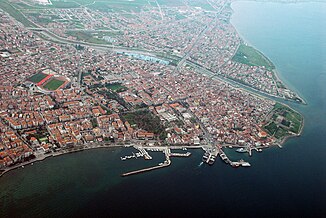
The course of the Sarıçay in the lower half of the picture with its mouth in Çanakkale |
||
| Data | ||
| location | Çanakkale ( Turkey ) | |
| River system | Sarıçay | |
| Headwaters | 25 km west of Çan 40 ° 0 ′ 21 ″ N , 26 ° 45 ′ 36 ″ E |
|
| Source height | approx. 500 m | |
| muzzle | in the Dardanelles coordinates: 40 ° 8 '39 " N , 26 ° 23' 52" E 40 ° 8 '39 " N , 26 ° 23' 52" E |
|
| Mouth height | 0 m | |
| Height difference | approx. 500 m | |
| Bottom slope | approx. 13 ‰ | |
| length | approx. 40 km | |
| Catchment area | 394 km² | |
| Reservoirs flowed through | Atikhisar dam | |
| Big cities | Çanakkale | |
| Communities | Kirazlı, Ortaca, Serçiler, Kurşunlu | |
|
Sarıçay in the city of Çanakkale |
||
The Sarıçay is a river in the Çanakkale Province in northwestern Turkey . The name Sarıçay is derived from "yellow river".
The Sarıçay rises 25 km west of Çan . It flows in a predominantly west-northwest direction past the places Kirazlı, Ortaca and Serçiler. The D210 trunk road (Çan – Çanakkale) follows the course of the river. The Sarıçay is dammed in the middle reaches of the Atikhisar dam . The river passes through Kurşunlu and reaches the provincial capital Çanakkale . It flows through the city and flows into the Strait of the Dardanelles . The course of the river is entirely in the Çanakkale merkezi district . The Sarıçay has a length of approx. 40 km. The catchment area covers 394 km².
Individual evidence
- ↑ a b - ( Memento of the original from December 27, 2014 in the Internet Archive ) Info: The archive link was inserted automatically and has not yet been checked. Please check the original and archive link according to the instructions and then remove this notice. Akarsu Ekosistemlerin Ötrofikasyon Oluşumuna Karşı Hassasiyeti: Sarıçay ve Karamenderes Örnekleri. Esra KOÇUM (BIBAD) (PDF)

