Scharfenstein (Zittau Mountains)
| Scharfenstein | ||
|---|---|---|
|
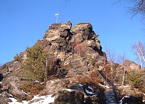
The Scharfenstein with stairs |
||
| height | 569.4 m above sea level HN | |
| location | Saxony ( Germany ) | |
| Mountains | Zittau Mountains | |
| Coordinates | 50 ° 50 ′ 27 " N , 14 ° 45 ′ 29" E | |
|
|
||
| rock | Sandstone | |
|
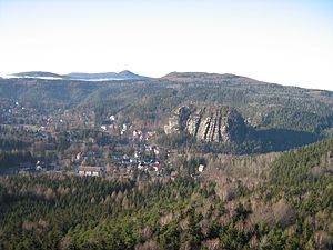
View from the Scharfenstein summit to Oybin and Lausche |
||
The Scharfenstein is a rock about 25 meters high in the Zittau Mountains . Its top is 569 meters. Because of its distinctive shape, it is also called "Lausitzer Matterhorn" or "Oberlausitzer Matterhorn". The rock has been made accessible with ladders and stairs on the south side and is one of the most famous lookout rocks in the Zittau Mountains.
Location and surroundings
The Scharfenstein is located east of the health resort Oybin on the ridge between the Brandhöhe in the south and the Töpfer in the north, at the intersection of several hiking trails. The nearby rock formations are Felsengasse and Kleine Felsengasse . At the foot of the rock there is a plaque with geological information and a shelter.
geology
The rock tower of the Scharfenstein protrudes about 25 meters from the area. The east-west facing reef is about 40 meters wide. This is due to the silicification of the sandstone by rising thermal solutions. The softer ashlar sandstone in the area weathered faster, exposing the “harder” sharp stone. In front of the Scharfenstein there is another smaller rock tower, the Scharfensteinnadel.
view
Due to its exposed location, from the summit you have an undisturbed panoramic view of the Oybin , Lausche , Hochwald , Jeschken in the Czech Republic and, with good visibility, as far as the Giant Mountains .
history
Due to its outstanding shape, the Scharfenstein was probably used as an observation point as early as the Middle Ages. The carved steps on the north side probably date from this time. The Scharfenstein received its first climbing system around 1900. The Scharfenstein has also been used for climbing since the mid-1950s. In the 1970s the climbing system was renewed and at the 1st Scharfenstein Festival in 1993 a summit book was laid out for tourists and a new weather vane was set up. At the western tip there is a book and a rope eyelet for the climbing paths out of the valley.


