Schattberg (Saalbach-Hinterglemm)
| Schattberg | ||
|---|---|---|
|
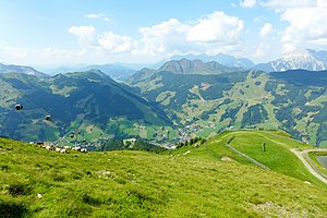
View from the central summit to Saalbach-Hinterglemm |
||
| height | 2097 m above sea level A. | |
| location | Salzburg , Austria | |
| Mountains | Kitzbühel Alps | |
| Dominance | 1.1 km → Stemmerkogel | |
| Notch height | 106 m ↓ Marxtenscharte | |
| Coordinates | 47 ° 21 '46 " N , 12 ° 37' 39" E | |
|
|
||
| Normal way | marked hiking trail | |
The Schattberg is a 2097 m above sea level. A. high mountain in the Kitzbühel Alps in the Austrian state of Salzburg .
Location and surroundings
The Schattberg is considered the local mountain of the Pinzgau municipality of Saalbach-Hinterglemm , which is about 3 kilometers north. It forms the end of a mountain ridge that stretches north from the 2249 m high Hochkogel over the 2092 m high Saalbachkogel and the 2123 m high Stemmerkogel . In the west the Schwarzachgraben, in the east the valley of the Löhnersbach down to the Glemmtal . The mountain has three peaks: the Schattberg-West 2096 m , the Middle Summit 2097 m and the Schattberg-East 2018 m , which is upstream of the Dillinger Eck ( 1875 m ) to the northeast .
Development
The Schattberg-West and Schattberg-Ost are accessible from Hinterglemm and Saalbach with ski lifts, which are part of the Saalbach-Hinterglemm- Leogang ski area . Before erected in 2002 circulating cable car Schattberg X-Press, which in 1960 built led Schattbergbahn of Saalbach on the middle peak. After the renovation in 1973, this aerial tramway was the largest gondola lift (100 people per cabin) in Austria with the strongest suspension cable (63 mm) in the world.
There are several alpine huts around the mountain . The area is accessible by numerous hiking trails. To the main summit, the middle summit, marked trails lead from the northwest and northeast. Gravel roads that are popular with mountain bikers lead to the west and east peaks . A marked path or ski route leads south to the Pinzgauer Walk , a popular high-altitude trail .

