Quick and easy
| Quick and easy | ||
|---|---|---|
|
Schellschlicht (south side) |
||
| height | 2052.3 m above sea level NHN | |
| location | Bavaria , Germany | |
| Mountains | Ammergau Alps | |
| Coordinates | 47 ° 30 '35 " N , 10 ° 55' 0" E | |
|
|
||
| Normal way | Griesen - Schellalm - Hoher Brand - Schellschlicht | |
|
Schellschlicht (east side) |
||
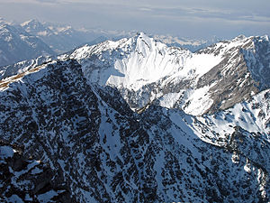
The Schellschlicht is a 2052.3 m above sea level. NHN high mountain in the Kreuzspitze group of the Ammergau Alps . It is located in the German state of Bavaria , but very close to the border with the Austrian Tyrol .
location
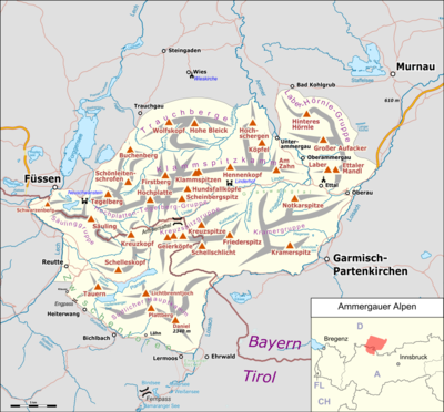
Location of the Schellschlicht in the Ammergau Alps (left)
and within the entire Alps (right).
Summit trails
The summit can be reached as a mountain tour for sure-footed hikers from Griesen ( Ausserfernbahn train station between Garmisch-Partenkirchen and Ehrwald ) on two routes: either via the Schellalm ( 1479 m above sea level ), the Hohen Brand and over the ridge to the summit or over the Sunkensattel ( 1672 m above sea level ). Both paths are mostly good climbs with short exposed sections and a short insured section.
view
From the summit you have a comprehensive view, for example to the west to the south side of the Tiroler Geierköpfe and, if the visibility is good, also to the Nebelhorn (see picture on the left).
literature
- Dieter Seibert: Alpine Association Guide Allgäu Alps and Ammergau Alps , Rother Verlag Munich 2004, ISBN 3-7633-1126-2
Web links
- Tour description at steinmandl.de .
Individual evidence
- ↑ Federal Office for Cartography and Geodesy , State Office for Surveying and Geoinformation Bavaria : Digital Topographical Map 1:25 000, [1] , accessed on January 9, 2016


