
Nebelhorn (Allgäu Alps)
| Foghorn | ||
|---|---|---|
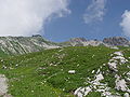
 View of the Nebelhorn |
||
| height | 2224 m above sea level NHN | |
| location | Bavaria , Germany | |
| Mountains | Thumb group , Allgäu Alps | |
| Dominance | 0.5 km → West Wengenkopf | |
| Notch height | 24 m ↓ notch to the west. Wengenkopf | |
| Coordinates | 47 ° 25 '18 " N , 10 ° 20' 33" E | |
|
||
| Development | since 1930 by the Nebelhornbahn | |

Nebelhorn is the name of a 2224 m above sea level. NHN high mountain peaks belonging to the thumb group in the Allgäu Alps . It can be reached from Oberstdorf with a cable car , the Nebelhornbahn . The summit area of the Nebelhorn offers entry to the Hindelang via ferrata .
Location and surroundings
The Nebelhorn rises in a mountain ridge that runs from the Geißfuß ( 1981 m above sea level ) in a north-easterly direction over the Wengenköpfe to the Großer ( 2280 m above sea level ) and Little Thumb ( 2197 m above sea level ). The Nebelhorn lies between Geißfuß and the western Wengenkopf .
The height of the Nebelhorn is at least 24 meters, its dominance 500 meters, whereby the western Wengenkopf is the reference mountain.
geology
The Nebelhorn owes its special character to the location on the border between the Northern Limestone Alps and the flysch mountains in front : the summit is made up of the main dolomite of the Limestone Alps, the lower slope of flysch.
Origin of name
The Nebelhorn was first mentioned in 1811 in a tax cadastre of the Oberstdorf tax district. In 1819 it was mentioned in the first recording sheet of the Bavarian land survey, both times as a fog horn . It is named after the view of the mountain from the upper Illertal . From here the mountain could have been used to predict a change in weather if the summit was shrouded in fog.
The Edmund Probst House
As early as May 25, 1890, the German Alpine Association eV (DAV) inaugurated a mountain hut as Nebelhorn-Haus and later named it Edmund-Probst-Haus after the section chairman . The mountain hut is in an avalanche-proof location at the foot of the summit ascent and has had to be enlarged again and again. It lies at an altitude of 1,932 meters and is open to skiers and snowshoeers in winter and hikers and climbers in summer.
Winter sports
The first ascent of the Nebelhorn on skis was achieved in January 1901 by the photographer Fritz Heimhuber and the councilor Dr. Max Madlener.
In winter, the ski area can be reached with two chair lifts , three gondola lifts and a drag lift from the valley town of Oberstdorf . The range of slopes includes slopes of various degrees of difficulty. There is also a half pipe at the Höfatsblick station and a toboggan run from the Seealpe station into the valley.
Accessibility
There is a barrier-free restaurant and toilets for the disabled at the Höfatsblick station and the summit station . In the 2005 calendar year, a panorama path for wheelchair users and parents with prams was built at the Höfatsblick station. The Nordwandsteig at the summit, which opened in 2016, is also barrier-free.
photos

- Picture gallery

Summit cross
View from Edmund-Probst-Haus to the Nebelhorn

Nebelhorn in the center of the shadow mountain . On the left the goat's foot , in between the Gundkopf .

Emerging fog on the Nebelhorn

Paraglider pilots on the Nebelhorn, view from the Panoramaweg (winter route)

Höfatsblick cable car station and chairlift to the summit

Höfatsblick cable car station and summit station

Nebelhorn and Rubihorn from the Riedberger Horn

New summit building

Access to the Nordwandsteig

Nordwandsteig


Web links
- Edmund Probst House
- Nebelhornbahn
- Livecam
- The foghorn
- GPS route of the Nebelhorn mountain run (also suitable for hiking and mountain biking)
Individual evidence
- ↑ Map services of the Federal Agency for Nature Conservation ( information )
- ↑ Exact value not known, stated value is a minimum value (can be up to 19 meters higher). It was determined from the distance between the contour lines (20 meters in altitude ) on a topographic map ( scale 1: 25,000).
- ^ Thaddäus Steiner : Allgäu mountain names . 2nd Edition. Kunstverlag Josef Fink, Lindenberg 2008, ISBN 978-3-8987-0389-5 (p. 148).
- ↑ Art, Culture & History , on tramino.s3.amazonaws.com
- ↑ Gerd Falkner: 100 Years of the German Ski Association: Chronicle of German skiing from the beginning to the end of WWII in 1945 . German Ski Association, 2005, ISBN 978-3-938963-01-2 , p. 13.
- ↑ Nebelhorn ski area , accessed on April 5, 2012