Thumb group
| Thumb group | |
|---|---|
| Highest peak | Big Thumb ( 2280 m ) |
| location | Bavaria , Germany |
| part of | Allgäu Alps |
| Classification according to | Alpine Club Guide Allgäu Alps |
| Coordinates | 47 ° 25 ' N , 10 ° 21' E |
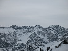
The thumb group is a subgroup of the Allgäu Alps in Germany . The name is derived from the Big Thumb , the highest mountain in the group at 2280 m . Many of the peaks in the group are frequently visited destinations and most of them have hiking trails. The most famous tourist destinations are the Nebelhornbahn and the Hindelanger via ferrata . There are challenging climbing tours on the Schneck ( 2268 m ) and Himmelhorn ( 2111 m ). At the foot of the Schattenberg ( 1845 m ) near Oberstdorf , the opening competition of the Four Hills Tournament takes place annually on the Schattenbergschanze .
Boundaries and surroundings
The valley of the Ostrach borders the group of thumbs to the north and east . The eastern border is completed by the Bärgündeletal , which culminates in the Himmelecksattel (2007 m) to the south . From here it goes down into the Oybachtal , which leads west to the Illertal near Oberstdorf . From there the Iller border runs downwards to Sonthofen , where the Ostrach joins from the east. Surrounding subgroups of the Allgäu Alps are the Vilsalpseeberge , Hochvogelgruppe , with which the thumb group is connected via the Himmelecksattel and the Höfatsgruppe .
The thumb group is divided into three further small groups, which are characterized by their characteristic appearance. The north-western part is formed by relatively low mountain ranges that have more of a “pre-alpine character”. This is bordered to the east by the Retterschwanger valley . There follows a chain of striking rock peaks and a karst plateau , the Koblat , to the southeast . This part goes over again to the southeast to the well-known Allgäu steep grass mountains, which form the third small group.
The entire area of the thumb group is on German territory and in the state of Bavaria . Comprehensive municipal areas are Bad Hindelang , Oberstdorf and Sonthofen.
mountains
The highest mountain in the group is the Big Thumb (2280 m) in the center of the group. Next to it, three other mountains reach a height of over 2200 meters: Schneck ( 2268 m ), Westlicher Wengenkopf ( 2235 m ) and the Nebelhorn ( 2224 m ). Other striking mountains in the group are the Lachenkopf ( 2111 m ), Entenkopf ( 2043 m ), Rotspitze ( 2034 m ), Rubihorn ( 1957 m ), Schnippenkopf ( 1833 m ) and Imberger Horn ( 1655 m ).
geology
The geological structure of the thumb group can be described analogously to the three-part subdivision mentioned above . The northwest part around the Schnippenkopf (1833 m) belongs to the flysch zone , which builds mountains of marls , sandstones and claystones . Although this ridge moves to the northeast as an optical unit , the Imberger Horn, which is made up of the main dolomite , shows the thrust of the flysch zone with calcareous alpine layers. This thrust builds up the peaks of the ridge around the Wengenköpfe and the Großer Daumen from main dolomite, underneath are Kössen layers and spotted marl . The layers fall to the south, from which the precipices to the north and the gentler terrain, for example on the Koblat, arise. Even further to the southeast, in the area around the snail, are the steep grass mountains. Here the visible surface is formed from marl, aptych limestone and red chert , all of which produce botanical diversity.
Lakes
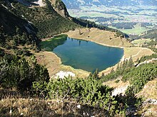
Some of the geological strata found in the thumb group have water-retaining properties. For example, lakes can form where they occur relatively close to the surface. They are increasingly found in the vicinity of the middle part of the thumb group. The largest lake is the Seealpsee (1622 m) with an area of 7.5 hectares . It is followed by the 3.3 hectare Unteren Gaisalpsee (1508 m) and the 3 hectare Engeratsgundsee (1876 m). Other lakes are the Laufbichlsee (2012 m), the Koblatsee (1966 m) and the Obere Gaisalpsee (1769 m).
nature
There where chert, marl and aptych limestone characterize the subsoil, there is a great botanical diversity. On the northern ridge of the snail there are yellow alpine cow puffs ( Anemone sulphurea ). On the ridge from the Salober (2088 m) over the Berggächtle (2007 m) to the gable (1948 m) there are cobweb houseleek ( Sempervivum arachnoideum ) and a hybrid of it with the mountain houseleek , called Sempervivum arachnoideum × montanum . The roof houseleek ( Sempervivum tectorum ) also grows . The rare real moon rue ( Botrychium lunaria ) and the ostrich bellflower ( Campanula thyrsoides ) thrive on the ridge above the peaks between Zeiger (1995 m) and Lachenkopf (2111 m ).
A large part of the thumb group is located in the Allgäu High Alps nature reserve .
Alpinism
Alpine club huts in the Thumb Group are the Edmund-Probst-Haus (1927 m) at the foot of the Nebelhorn and the Schwarzenberghütte (1380 m) above the Hintersteiner Tal .
Hiking and mountaineering
Cable cars on the Nebelhorn ( Nebelhornbahn from Oberstdorf) and Imberger Horn ( Hornbahn from Bad Hindelang) allow easy access to the peaks of the Thumb group. Many hiking trails lead to lakes and peaks in the area.
The Laufbacher-Eck-Weg leads from Nebelhorn and Edmund-Probst-Haus under Großem- (2085 m) and Kleinem Seekopf (2096 m), the Schochen (2100 m) to Laufbacher Eck (2178 m) and from there to Prinz-Luitpold -House (1846 m). From Oberstdorf, a geological teaching and hiking trail runs under the Nebelhornbahn up to the Nebelhorn.
Hindelanger via ferrata
The Hindelanger via ferrata (difficulty B / C and I-II ) is one of the most popular via ferratas in Bavaria and leads along the ridge between Nebelhorn and Breitenberg ( 1893 m ) through the thumb group.
Climb
Allgäu climbing history was written on some walls of the thumb group. In 1922 Philipp Risch and his companions opened a tour through the east face of the Schneck, which for a long time was the most difficult route (VI-, A0) in the Allgäu Alps. A "milestone" in Allgäu climbing history was achieved in 2000 by the brothers Jürgen and Michael Schafroth together with Toni Steurer on the Schneck Ostwand: The gray element (VIII +).
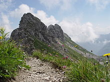
On the Himmelhorn (2111 m), the Rädlergrat is a difficult classic (V, A0 or VI), which famous climbers such as Gaston Rébuffat or Hermann Buhl climbed. In 1958 Michael Tauscher and W. Teufele started a route (VI-, A3) on the south face of the Himmelhorn, which is still a "free climbing problem " today. In 2000 Matthias Robl opened the Sky Ride (XI-) route on the edge of the south face. On the south face of the eastern Wengenkopf (2207 m), Robert Jasper and Stefan Meineke opened the La Traviata (VIII +) route on the south face in 1994 .
literature
- Dieter Seibert: Alpine Club Guide alpine - Allgäu Alps and Ammergau Alps . 17th edition. Bergverlag Rother , Munich 2008, ISBN 978-3-7633-1126-2 (pp. 274–297)
- Ernst Zettler, Heinz Groth: Alpine Club Guide - Allgäu Alps . 12th, completely revised edition. Bergverlag Rudolf Rother , Munich 1985, ISBN 3-7633-1111-4 (pp. 413–451)
Web links
References and comments
- ↑ a b c Dieter Seibert: Alpine Club Guide alpine - Allgäu Alps and Ammergau Alps . 17th edition. Bergverlag Rother, Munich 2008 (p. 275).
- ↑ Compass hiking, bike and ski tour map: Sheet 04 Tannheimer Tal (1: 35,000). ISBN 978-3-85491-644-4 (as of February 2007).
- ↑ This list includes mountains with a secured notch height of over 100 meters.
- ^ Herbert Scholz: Building and Becoming the Allgäu Landscape . E. Schweizerbart'sche Verlagbuchhandlung (Nägele and Obermiller), Stuttgart 1995, ISBN 3-510-65165-0 (p. 74).
- ^ Herbert Scholz: Building and Becoming the Allgäu Landscape . E. Schweizerbart'sche Verlagbuchhandlung (Nägele and Obermiller), Stuttgart 1995 (pp. T5, T17).
- ^ Herbert Scholz: Building and Becoming the Allgäu Landscape . E. Schweizerbart'sche Verlagbuchhandlung (Nägele and Obermiller), Stuttgart 1995 (p. T12).
- ↑ Ernst Zettler, Heinz Groth: Alpine Club Guide - Allgäu Alps . 12th, completely revised edition. Bergverlag Rudolf Rother, Munich 1985 (p. 413ff).
- ↑ Ernst Zettler, Heinz Groth: Alpine Club Guide - Allgäu Alps . 12th, completely revised edition. Bergverlag Rudolf Rother, Munich 1985 (p. 53).
- ↑ Ernst Zettler, Heinz Groth: Alpine Club Guide - Allgäu Alps . 12th, completely revised edition. Bergverlag Rudolf Rother, Munich 1985 (pp. 416, 423, 425f).
- ↑ Compass hiking, bike and ski tour map: Sheet 03 Oberstdorf, Kleinwalsertal (1: 25,000). ISBN 978-3-8549-1231-6 (status: 2009).
- ^ Eugen E. Hüsler : Tourentipp.de: Hindelanger via ferrata . Retrieved June 4, 2010.
- ↑ Dieter Seibert: Rother hiking guide - Allgäu Alps: high-altitude trails and via ferratas . 13th edition, Bergverlag Rother, Munich 2008, ISBN 978-3-7633-3120-8 (p. 54ff).
- ^ Stefan Meineke: Climbing in the Allgäu . In: Bergsteiger special 14: Allgäu . Bruckmann, Munich 2007, ISBN 978-3-7654-4647-4 (pp. 60-70).
- ↑ Stefan Meineke: Allgäu Climbing Chronicle ( Memento of the original from July 19, 2012 in the Internet Archive ) Info: The archive link was inserted automatically and has not yet been checked. Please check the original and archive link according to the instructions and then remove this notice. . Retrieved June 3, 2012.


