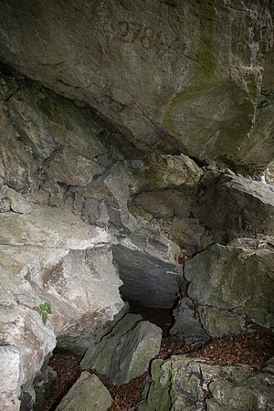
Layer boundary cave (Kugelstein)
| Layer boundary cavity
|
||
|---|---|---|
| Location: | Kugelstein near Frohnleiten , Styria / A | |
| Height : | 456 m above sea level A. | |
|
Geographic location: |
47 ° 13 '38.6 " N , 15 ° 20' 4.8" E | |
|
|
||
| Cadastral number: | 2784/11 | |
| Geology: | Schöcklkalk | |
| Lighting: | No | |
| Overall length: | 8 m | |
| Level difference: | -3 m | |
The layer boundary cave at Frohnleiten is 456 m above sea level. A. im Kugelstein north of the main town of Deutschfeistritz and west of Badl , Styria in Austria .
location
The layer boundary cave is located on the north-western slope of the globular stone, at the foot of an ivy-covered rock wall and below the armor cave . The access to the cave is not far from the road which leads around the Kugelstein.
description
The 8-meter-long layer boundary cave runs along a stratification disturbed by a cleft . The cave ceiling is stratified. There is a second entrance next to the main entrance, which is not passable. There are numerous stone blocks in the entrance area.
The cave floor consists of dry and earthy sediment, which is interspersed with fallen blocks.
swell
- Heinrich Kusch : The caves in Kugelstein near Peggau (Styria) . In: The cave . tape 023 , 1972, p. 145–157 ( PDF (4.3 MB) on ZOBODAT ).

