
Schillerwiese (Regensburg)
| Schillerwiese | |
|---|---|
|
|
|

|
|
| Bathing bay on the Danube | |
| Basic data | |
| place | regensburg |
| use | |
| User groups | Pedestrians, cyclists |
The Schillerwiese in Regensburg is an elongated park along the Danube in the western quarter within the urban area of Regensburg.
geography
The Schillerwiese is located in the Danube arch at the northernmost point of the Danube , about one kilometer west of the old town of Regensburg in the western quarter at an altitude of about 335 m above sea level. NN. Today the Regensburg hydropower plant and the Pfaffenstein Danube bridge are in the immediate vicinity .
history
Until the 19th century there were lush pastures and meadows in the Danube bank area of today's Schillerwiese. The area was also called “cow meadow” by the population. The name Schillerwiese dates back to 1905, when the Regensburg Beautification Association planted numerous trees, including a Schiller linden tree, and a memorial stone was erected in honor of the 100th anniversary of Friedrich Schiller's death .
Until the 1930s, there were "bathing establishments" separated by sex on the Schillerwiesen, floating plateaus with wooden surrounds around the bathing areas within the Danube. While the Schillerwiesen are now embedded between the Danube and the surrounding buildings, there were only a few buildings in the direction of the old town at that time. It was not until 1933 that the Westheimsiedlung was built in the west of Schillerwiese and the Messerschmitt factory in 1937 . In the post-war period, in addition to the “bathing establishments”, the Danube beach on the Schillerwiesen was increasingly used for bathing by the Regensburg residents.
As a result of the construction of the Danube bridge, the weir system and the damming of the Danube in 1977, the bathing establishments disappeared. It was not until the turn of the millennium that a citizens' initiative achieved the renaturation of the shore zone, which again resulted in bathing bays on the banks of the Danube towards the west. Thus, from the Danube Park to the “Baggerweiher”, a green area lined with works of art and the largest park in the city of Regensburg was created .
The densely overgrown eastern area of the Schillerwiese, right next to the Regensburg City Gardening Office, is today a paradise for bats . A street near the Danube Cycle Path bears the name "An der Schillerwiese" to this day.
gallery

View of winemakers with winemaker heights in the background

Northernmost point of the Danube on the south bank near the Schillerwiese

View of the Nicholas statue at the northernmost point of the Danube

View from the Schillerwiese towards the old town
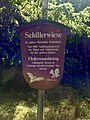
Information board of the city of Regensburg to the Schillerwiese

Danube bridge Pfaffenstein today on the Schillerwiese

Schiller monument with Schiller linden tree in the bat habitat of the Schillerwiese

Schiller monument on the Schillerwiese


Web links
literature
- City of Regensburg (Ed.): Street directory - city districts . December 7, 2015 ( digitized version [PDF]).
- Karl Bauer : Regensburg. Art, culture and everyday history . 5th expanded edition, MZ-Verlag, Regensburg 1997, ISBN 3-931904-19-9
- Peter Schmoll: The Messerschmitt Works in World War II. The aircraft production of Messerschmitt GmbH Regensburg from 1938 to 1945 , MZ-Verlag Regensburg, 2004, ISBN 3-931904-38-5
Individual evidence
- ^ The subdistricts of the city of Regensburg. City of Regensburg, accessed on September 14, 2016 .
- ^ Daniel Steffen: Newspaper clipping Mittelbayerische Zeitung - northernmost point of the Danube . In: Mittelbayerische.de . September 9, 2016. Retrieved May 19, 2018.
- ↑ Newspaper clipping "Swimming, cycling and strolling on the northernmost bend of the Danube" . Excerpt from the municipal article "Bei uns" of the city of Regensburg. September 2017
- ↑ 50 years Westheimsiedlung 1933-1983 , (1983)
- ^ Information board Donaupark City of Regensburg
- ↑ Information board Schillerwiese City of Regensburg
Coordinates: 49 ° 1 '43.7 " N , 12 ° 3' 54" E