Schlicker Scharte
| Schlicker Scharte | |||
|---|---|---|---|
|
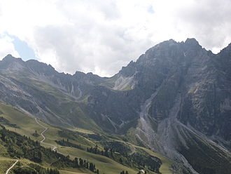
Schlicker Scharte (center) between Hohem Burgstall (left) and Schlicker Seespitze (right) |
|||
| Compass direction | Northwest | east | |
| Pass height | 2456 m above sea level A. | ||
| state | Tyrol | ||
| Valley locations | Seejöchl | Silt | |
| expansion | Alpine route (alpine transition) | ||
| Mountains | Stubai Alps | ||
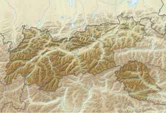
| Map (Tyrol) | |||
|
|
|||
| Coordinates | 47 ° 8 '24 " N , 11 ° 16' 32" O | ||
The Schlicker Scharte is a 2456 m above sea level. A. high transition in the Stubai Alps in Tyrol from the Schlick to the Seejöchl, from where the Franz-Senn-Hut and the Adolf-Pichler-Hut can be reached. It lies between the 2804 m high Schlicker Seespitze in the northwest and the Hohen Burgstall (2611 m) in the southeast.
The Schlicker Scharte is part of the Stubai High Trail , which leads from the Starkenburger Hut to the Franz Senn Hut (approx. 7 hours).
Individual evidence
- ↑ Info Schlicker Scharte , carto.net
- ↑ Stubai High Trail , bergwandern.net

