
Stubai High Trail
| Stubai High Trail | |
|---|---|
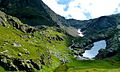
 Stubai High Trail below the Schlicker Seespitze |
|
| Data | |
| length | approx. 120 km |
| location | Tyrol , Austria |
| Starting point | Neustift in the Stubaital 47 ° 6 ′ 37 ″ N , 11 ° 18 ′ 21 ″ E |
| Target point | Neustift in the Stubaital 47 ° 6 ′ 37 ″ N , 11 ° 18 ′ 21 ″ E |
| Type | Höhenweg |
| Lowest point | 994 m |
| Level of difficulty | medium |
| season | summer |
| Months | Mid-June to mid-September |
| particularities | Created as a circular route |
The Stubai High Trail is a high- altitude hiking trail of around 120 km in length that can be covered in eight to nine stages. It is designed as a circular route with start and finish in Neustift . The beginning and the end are also possible in other places, for example Fulpmes .
Almost without exception, the path leads through alpine and high alpine terrain at an altitude between 2000 and 3000 m and is partially secured with wire ropes and steel stirrups, but without touching glaciers. According to the Tyrolean hiking and mountain trail concept of the Tyrolean provincial government, it is a so-called black mountain trail.
The Starkenburger Hütte , Franz-Senn-Hütte , Neue Regensburger Hütte , Dresdner Hütte , Sulzenauhütte , Nürnberger Hütte , Bremer Hütte and Innsbrucker Hütte serve as bases on the way .
Stages
| begin | target | Walking time | Summit opportunities | |
|---|---|---|---|---|
| 1 | Fulpmes or Neustift |
Starkenburger Hut | 1½ hours from Kreuzjoch (cable car) 2½ hours from Froneben (cable car) 3 hours from Fulpmes 3½ hours from Neustift |
Schlicker Seespitze ( 2804 m , 3 h) Hoher Burgstall ( 2611 m , 1 h), if necessary, crossing on the way from Kreuzjoch |
| 2 | Starkenburger Hut | Franz Senn Hut | 6 h |
Rinnenspitze ( 3000 m , 3 h) Aperer Tower ( 2986 m , 3½ h) |
| 3 | Franz Senn Hut | New Regensburg Hut | 4 h |
Ruderhofspitze ( 3474 m , 4½ h) Eastern Knotenspitze ( 3101 m , 2½ h) |
| 4th | New Regensburg Hut | Dresden hut | 6 h |
Zuckerhütl ( 3507 m , 4½ h) Stubai Wildspitze ( 3341 m , 3 h) |
| 5 | Dresden hut | Sulzenauhütte | 2½ h (via Peiljoch , 2672 m ) 3½ h (via Großer Trögler , 2902 m ) |
Zuckerhütl ( 3507 m , 5 h) Wilder Freiger ( 3418 m , 4 h) |
| 6th | Sulzenauhütte | Nuremberg Hut | 3 h (via Niederl, 2629 m ) 3½ h (via Mairspitze, 2743 m ) |
Wilder Freiger ( 3418 m , 4 h) Eastern Flint ( 3268 m , 4 h) |
| 7th | Nuremberg Hut | Bremer Hut | 3 h | Inner weather peak ( 3053 m , 1½ h) |
| 8th | Bremer Hut | Innsbruck hut | 7 h |
Habicht ( 3277 m , 2½ h) Kalkwand ( 2564 m , 1 h) |
| 9 | Innsbruck hut | Neustift bus from Neder to Fulpmes |
4 h | Elferspitze ( 2505 m ) |
The specified walking times are always pure net walking times (without breaks).

Stubaier Höhenweg stage between Dresdner Hütte and Sulzenau Hütte

Stubai Höhenweg stage between Innsbrucker Hütte and Neustift.
Last ascent before reaching the Bremer Hütte

Stubaier Höhenweg stage between Franz-Senn-Hütte and Neue Regensburger Hütte

Stubaier Höhenweg stage between Neue Regensburger Hütte and Franz-Senn-Hütte

Stubai Höhenweg stage between Nürnberger Hütte and Bremer Hütte


Web links
- Detailed description of the mountain trail and the huts. Retrieved September 17, 2017 .
- Description of the high trail with pictures, videos and the hiking trail in Google Maps. Retrieved September 17, 2017 .
Individual evidence
- ↑ Hiking and mountain path concept of the state of Tyrol. (PDF; 1.45MB) Retrieved September 17, 2017 .
- ↑ Information on the character of the Stubai High Trail. Retrieved September 17, 2017 .