Nuremberg Hut
| Nürnberger hut DAV hut category I. |
||
|---|---|---|
|
Nuremberg Hut |
||
| location | Rear Stubai Valley ; Tyrol , Austria ; Valley location: Ranalt | |
| Mountain range | Stubai Alps | |
| Geographical location: | 46 ° 59 '37 " N , 11 ° 13' 3" E | |
| Altitude | 2278 m above sea level A. | |
|
|
||
| owner | DAV - Section Nuremberg | |
| Built | 1886 | |
| Construction type | hut | |
| Usual opening times | Late June to early October | |
| accommodation | 48 beds, 80 camps , 2 emergency camps | |
| Winter room | 10 bearings | |
| Web link | Hut / section | |
| Hut directory | ÖAV DAV | |
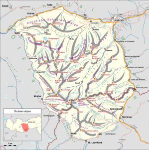
The Nürnberger Hütte is an Alpine Club hut of the Nuremberg section of the German Alpine Club in the Stubai Alps in Tyrol . It lies at an altitude of 2278 m above sea level. A. , is open from mid-June to early October and offers space for around 130 people.
The most popular tour destination from the Nürnberger Hütte is the Wilde Freiger , which can only be reached via glaciers. The hut is still a stage destination on the Stubai High Trail . There is a climbing garden and a via ferrata not far from the hut .
history
The first, still relatively small hut with only 8 mattress beds was built in 1886. The hut was expanded in 1898 and 1908. As early as 1927, a small water turbine system for generating electricity for lighting was put into operation. In 1960 after the construction of a material ropeway and in 1962 after an extension and the construction of the hydropower plant, the hut was given its present form. The kitchen and dining room in the Nürnberger Hütte are not on the same floor, but are connected by a hand-operated material elevator.
Approach
The Nürnberger Hütte can be reached on foot in about 2½ hours from the car park south of Ranalt in the Stubai Valley ( 1390 m above sea level ), the path initially leading through the Langental to the Bsuchalm . This lies on a valley floor at an altitude of 1580 m above sea level. A. and is cultivated. Then the path winds its way up the western side of the valley in bends to the hut.
Transitions
Direct crossings to a number of huts are possible from the Nürnberger Hütte:
- Becherhaus ( 3195 m above sea level ), via Wilder Freiger, walking time 5 hours
- Müllerhütte ( 3143 m above sea level ), via Wilder Freiger, walking time 5 hours
- Magdeburger Hut ( 2423 m above sea level )
- Bremer Hütte ( 2411 m above sea level ), via Simmingjöchl, walking time 3½ hours
- Sulzenauhütte ( 2191 m above sea level ), via Niederl (walking time 2½ hours) or Mairspitze (walking time 3½ hours)
- Teplitzer Hut ( 2586 m above sea level ), over the Roter Grat, walking time 5 hours
summit
- Mairspitze ( 2780 m above sea level ), walking time 1½ hours
- Urfallspitze ( 2805 m above sea level )
- Gamsspitzl ( 3050 m above sea level )
- Wilder Freiger ( 3418 m above sea level ), over the Seescharte, easy climbing, walking time 4½ hours
- Feuerstein ( 3268 m above sea level )
- Aperer Feuerstein ( 2967 m above sea level )
- Roter Grat ( 3,099 m above sea level ) via Freiger- or Rotgratscharte, summit ridge of both variants ( difficulty level I UIAA ), over glacier, to the Freiger See , then Steinmandl, walking time 3 or 2½ hours
Maps and literature
- Alpine Club Map 1: 25,000, sheet 31/1 Stubai Alps, Hochstubai (2011)
- Walter Klier : Alpine Club Guide Stubai Alps Alpine . 13th edition. Bergverlag Rother , Munich 2006, ISBN 3-7633-1271-4 .
- Andreas Franke: 125 years Nürnberger Hütte - room music stage in the Stubaiern . In: DAV Panorama . tape 63 , no. 5 , October 2011, ISSN 1437-5923 , p. 80–83 ( alpenverein.de [PDF]).
- DAV section Nuremberg (ed.): 125 years Nürnberger Hütte . ( dav-nuernberg.de [PDF]).
Web links
- Nürnberger Hütte in the historical Alpine archive of the Alpine clubs in Germany, Austria and South Tyrol (temporarily offline)
- Hut page of the DAV section Nuremberg
- http://www.nuernbergerhuette.at
- Via ferrata Nürnberger Hütte
Individual evidence
- ↑ a b Height according to AMap (BEV) (reload link if necessary)
- ^ Walter Klier : Alpine Club Guide Stubai Alps alpine . 13th edition. Bergverlag Rother , Munich 2006, ISBN 3-7633-1271-4 . , P. 129 (Freilerscharte), p. 132 (Rotgratscharte) and p. 347 (summit ridge); Designation determined during inspection in 2012.


