Schottheide
|
Schottheide
Community Kranenburg
Coordinates: 51 ° 46 ′ 12 ″ N , 6 ° 2 ′ 24 ″ E
|
|
|---|---|
| Height : | 21 m |
| Residents : | 663 (Jan. 1, 2018) |
Schott Heide is a municipality Kranenburg in the district of Kleve , Region of Dusseldorf , North Rhine-Westphalia . The place has 663 inhabitants.
location
Schottheide is located directly on the Reichswald nature reserve .
traffic
The federal highway 504 runs next to the village . Buses of the Verkehrsgemeinschaft Niederrhein connect the town with the 55 line to the surrounding towns.
history
The name Schottheide appears for the first time in 1414 as "Schoetscheheye". However, the area was uninhabited until the 18th century and served as the community heath of Frasselt . In 1783 the heath was parceled out as part of the Prussian colonization and gradually settled.
In the nearby Reichswald and in the vicinity of today's town, the so-called battle in the Reichswald raged in the spring of 1945 . In this battle for the Lower Rhine, the place was badly affected.
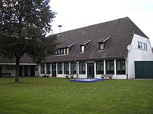
Until the 20th century, Schottheide remained strongly related to the town of Frasselt , to which it also belonged to the parish. It was only after the Second World War that Schottheide gained a closed appearance due to a large influx. The elementary school established in 1953 was closed again in 1968. Since 1975 she is a community center used.
societies
Clubs with a large number of members, such as the Bürgererschützenverein, the carrier pigeon club “Über Wald und Heide” and the sports club “SV Schottheide-Frasselt 1860/30” offer many recreational opportunities.
Web links
- Presentation on the website of the municipality of Kranenburg
Individual evidence
- ↑ Data and facts . In: kranenburg.de . Retrieved December 22, 2019
