
Shchara
|
Shchara Шчара, ара |
||
 The Shchara in Masty Raion |
||
| Data | ||
| location | Breszkaja Woblasz , Hrodsenskaja Woblasz ( Belarus ) | |
| River system | Memel | |
| Drain over | Memel → Baltic Sea | |
| origin |
Lake Koldycheva 53 ° 16 ′ 2 ″ N , 26 ° 4 ′ 29 ″ E |
|
| Source height | approx. 183 m | |
| muzzle | Opposite Daschkautsy in the Memel coordinates: 53 ° 26 '25 " N , 24 ° 44' 20" E 53 ° 26 '25 " N , 24 ° 44' 20" E |
|
| Mouth height | 108 m | |
| Height difference | approx. 75 m | |
| Bottom slope | approx. 0.23 ‰ | |
| length | 325 km | |
| Catchment area | 9990 km² | |
| Drainage location: 63 km above the mouth |
MQ |
31 m³ / s |
| Left tributaries | Hryuda , Wedsma | |
| Right tributaries | Myschanka , Lipnjanka | |
| Reservoirs flowed through | Tschamjalynskaje reservoir , Damanauskaje reservoir | |
| Medium-sized cities | Slonim | |
The Shchara ( Belarusian Шчара ; Russian Щара ) is a 325 km long tributary of the Memel in the Woblaszen Brest and Hrodna in Belarus .
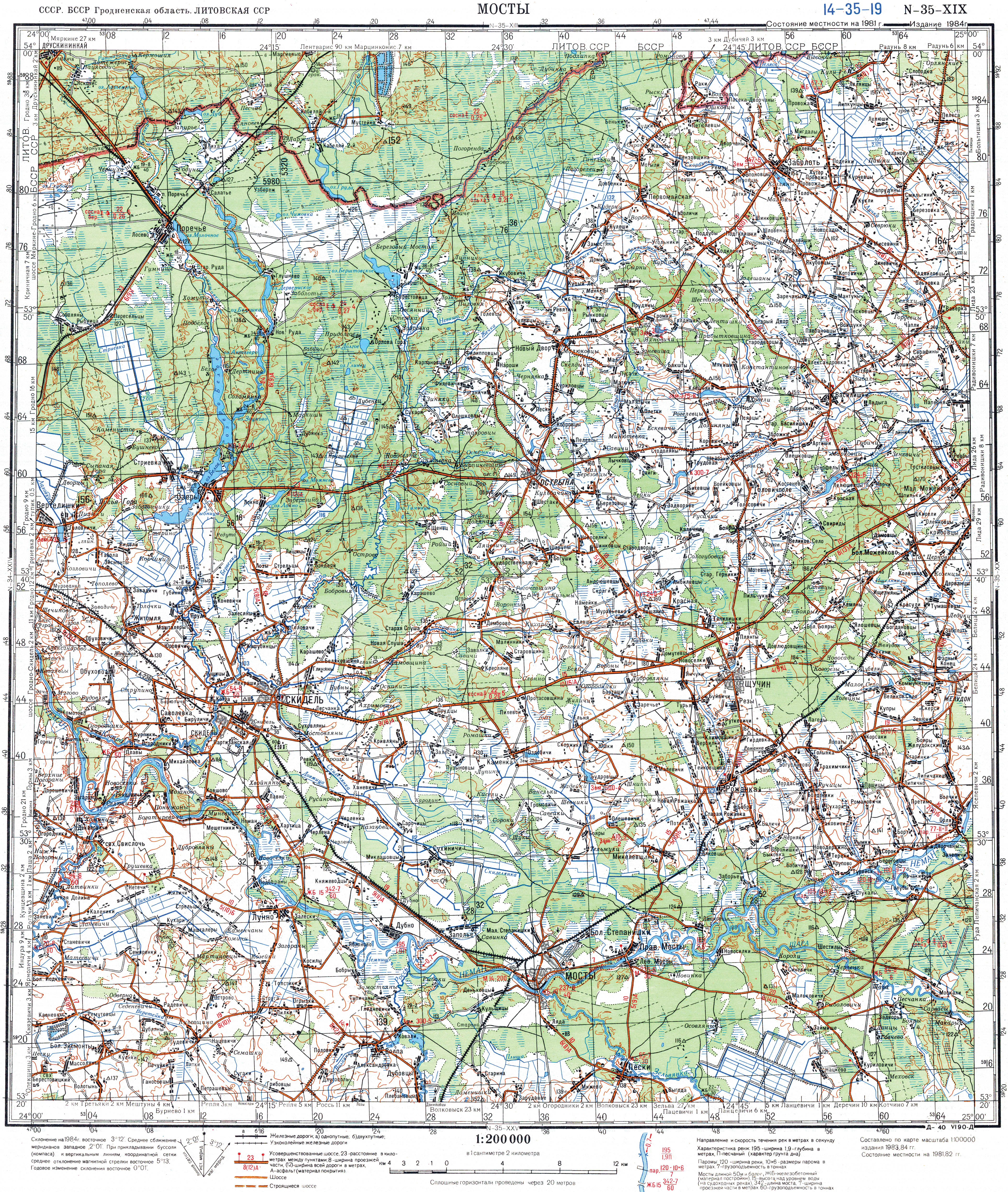
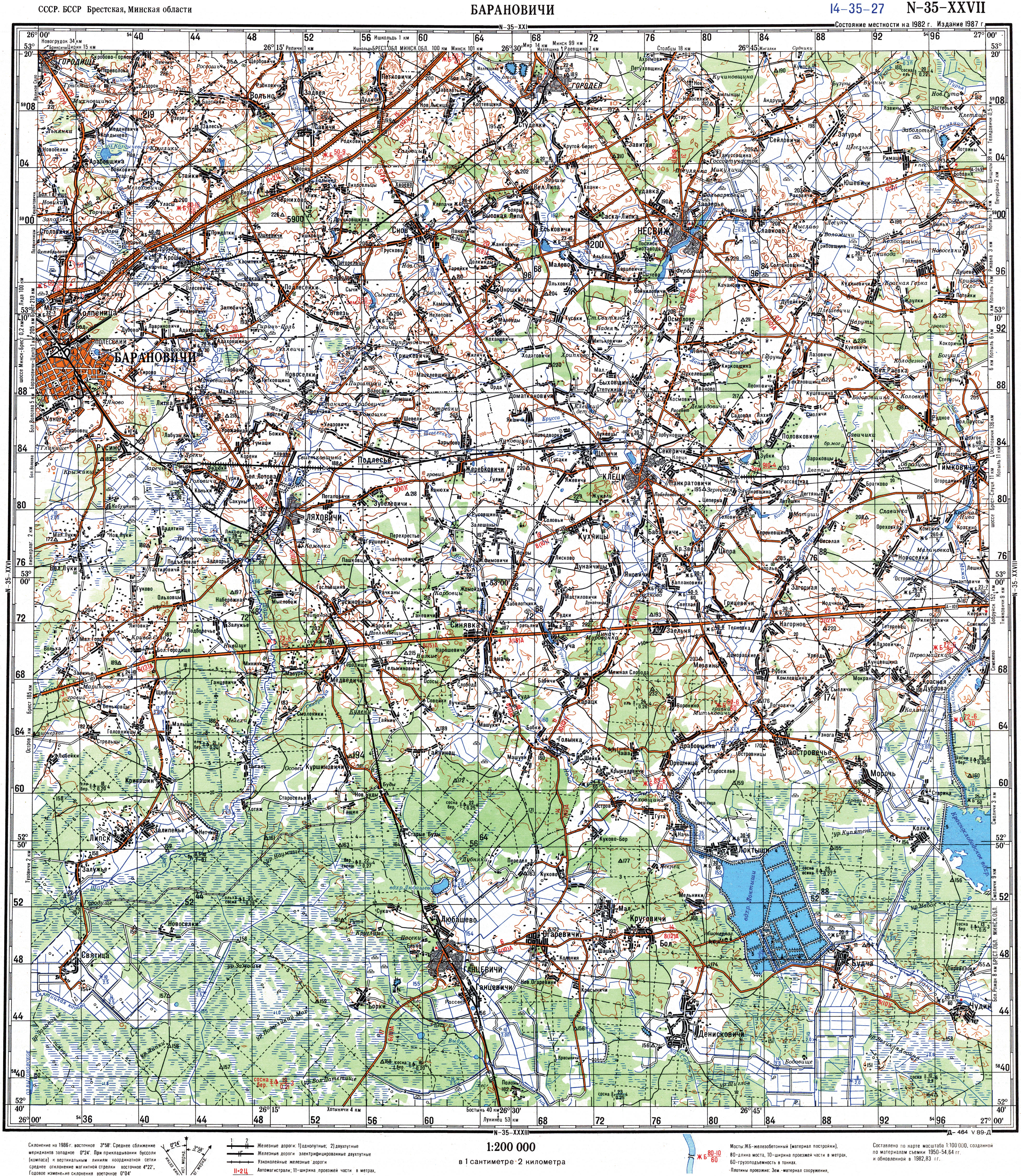
The river rises about 5 kilometers north of the city of Baranavichy ( Belarusian Барановичи ), on the Nawahrudak Heights from Lake Koldichewa in Baranavichy district and flows into the Memel about 12 kilometers east of the town of Masty , southwest of the village of Daschkautsy in Masty district .
The largest tributaries of Shchara are Myschanka , Lipnjanka , Wedsma , Lasochwa , Hryuda , Lukoniza , Sipa .
There are two reservoirs on the river: Tschamjalynskaje reservoir 14 km northwest of the city of Ivazewitschy and Damanauskaje reservoir at the mouth of the Hryuda River in the Shchara.
Web links
- TK sheet N-35-19 (МОСТЫ) (underflow)
- TK sheet N-35-26 (СЛОНИМ) (middle run)
- TK sheet N-35-112 (БЫТЕНЬ) (middle course)
- TK sheet N-35-113 (ГАНЦЕВИЧИ) (upper course)
- TK sheet N-35-27 (БАРАНОВИЧИ) (source area)
- The Shchara River (Russian)
Individual evidence
- ↑ a b c Article Shchara in the Great Soviet Encyclopedia (BSE) , 3rd edition 1969–1978 (Russian)