
Schwedenschanze (refuge)
The Schwedenschanze is a fortress in the village of Zuflucht , which belongs to Bad Peterstal-Griesbach , on the L 402, the "Oppenauer Steige", which branches off from the B 500 ( Black Forest High Road). Nearby is the Röschenschanze and four kilometers southeast of the Alexanderschanze .
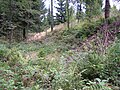
Despite the name "Schwedenschanze" there is no evidence that Swedish troops were ever in the area during the Thirty Years' War . The area of the ski jump is a ground monument according to the Baden-Württemberg Monument Protection Act .


history
According to Stälin , the Strasbourg bishop Johann von Dirpheim (bishop from 1306 to 1328) had fortifications built on Kniebis . Georg Gadner has drawn a “Württemberg camp Anno 1593” on his “Baiersbronner Forst” map shortly before the Oppenauer Steige, which can only be the facility now known as the Schwedenschanze. In this year 1593 the rule of the reigning Duke Friedrich in Mömpelgard (Montbeliard) began . He stationed soldiers in the redoubt in order to better represent his interests in the Strasbourg chapter dispute .
On the map by Stäbenhaber from 1674 you can see a fortification that was already in ruins. The comment on the map "The 3rd hill at the height above the climb, but mostly in ruins ...". On the right of the map excerpt you can see the 2nd hill, today's Alexanderschanze.
description
The system is designed as a rampart with a surrounding ditch and four bastions. The bastions have only slightly pronounced points, the angle between the faces is almost 90 degrees. Length of the individual wall components, measured in the middle of the wall: main wall 41 m, bastion flank 9 m, bastion face 21 m. Measured from the inside, the wall height is around 2 m, sometimes even less. It is around 3 m from the trench bottom running around the outside to the crest of the wall.
The ski jumping facility is easily accessible.
circumferential ditch

Main wall (curtain wall)


Individual evidence
- ^ Christoph Friedrich von Stälin: Württembergische Geschichte III, p. 95.
- ↑ Map "Baiersbronner Forst" [1]
- ^ Walter Kull: Freudenstädter contributions to historical regional studies, volume "fortress Freudenstadt" p. 11., publisher: Heimat- und Museumsverein für Stadt und Kreis Freudenstadt eV, 1985
- ^ Map by Georg Ludwig Stäbenhaber (also Stebenhaber) from 1674, source Landesarchiv Baden-Württemberg, Main State Archive Stuttgart: [2]
literature
- Manfred Eimer: Zu Kniebis auf dem Walde, historical summary about the Kniebis and the Kniebis baths , Erwin Schmieder's printing and publishing house, Baiersbronn, 1954
- A. Hiss: Der Kniebis and the Kniebisbäder today , Erwin Schmieder's printing and publishing house, Baiersbronn, 1954
- Map Actual ground plan of the Freudenstadt Forest with its curly marquets and boundary stones , made by Johann Mayer, Prelate of Murrhardt, 1712 [3]
See also
Web links
- Map of the historical entrenchment in August Meyer: Notes on the stretch of land between Lake Constance and Pfinz, thoughts on the fortification of the border between southern Germany and France . 1819. ( digitized version of the Baden State Library )
- Regional studies of Baden-Württemberg: The bishopric of Strasbourg
- Relief map of the Schwedenschanze (refuge) in the Baden-Württemberg geoportal
Coordinates: 48 ° 29 ′ 26 " N , 8 ° 14 ′ 33.8" E