Scoat fur
| Scoat fur | ||
|---|---|---|
|
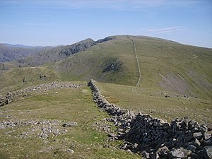
Scoat Fell from the Haycock with the steeple in the background |
||
| height | 841 m ASL | |
| location | Cumbria , England | |
| Mountains | Cumbrian Mountains | |
| Coordinates | 54 ° 29 '28 " N , 3 ° 18' 8" W | |
|
|
||
| Type | Wainwright | |
The Scoat Fell is a mountain in the Lake District , Cumbria , England . The Ordnance Survey divides the summit of Scoat Fell into Great Scoat Fell and Little Scoat Fell . At 841 m, Little Scoat Fell is the higher but smaller of the two summit plateaus. The Great Scoat Fell summit plateau is only 802 m high.
The Scoat fur lies at the intersection of two mountain ridges . From the south a ridge made up of Red Pike and Yewbarrow meets Scoat Fell. To the east the ridge continues to the Pillar and to the west to the Haycock . The Scoat Fell slopes south over the steeple to the Ennerdale valley.
There are opportunities to climb the Scoat Fell over the two mountain ridges, but also directly from Wast Water along the Nether Beck and from Ennerdale starting from Deep Gill .
The Scoat Tarn is located on the southern flank of the Scoat Fell below the Red Pike.
swell
- Alfred Wainwright , A Pictorial Guide to the Lakeland Fells, Vol. 7 The Western Fells , Frances Lincoln, 2nd revised edition, 2009, ISBN 978-0711221994

