Sebago Lake
| Sebago Lake Sebago Lake Dam |
|||||||
|---|---|---|---|---|---|---|---|
|
|||||||
|
|
|||||||
| Coordinates | 43 ° 50 '44 " N , 70 ° 32' 59" W | ||||||
| Data on the structure | |||||||
| Operator: | US Army Corps of Engineers | ||||||
| Data on the reservoir | |||||||
| Altitude (at congestion destination ) | 82 m | ||||||
| Water surface | 117 km² | ||||||
| Maximum depth | 96 m (mean depth 30 m) | ||||||
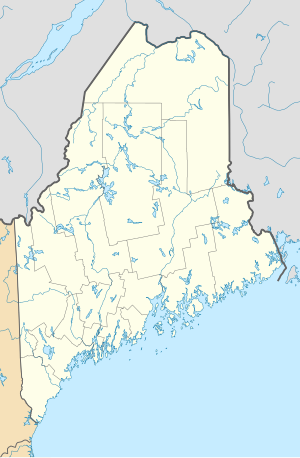
The Sebago Lake is the deepest and second largest lake in the US -Bundesstaat Maine .
The reservoir is dammed by the Sebago Lake Dam ( ⊙ ). At its deepest point the lake, whose water level has been raised by damming , is 96 m deep and has an average depth of 30 m. Its surface is 117 km², its length 19.3 km. The shore length is 169 km. Since the surface is about 82 m above sea level, the lowest point is below sea level.
In 1938 the State of Maine opened the Sebago Lake Conservation Area . The area had been a recreational area before. The mostly forested nature reserve, which covers 557 hectares, has two public boat docks, campsites and cabins. Sebago Lake is in what the tourism industry calls the "Lakes Region" of Maine.
The lake is located in Cumberland County and is bordered by the small towns of Casco , Naples , Raymond , Sebago , Standish, and Windham .
Web links
- Sebago Lake in the United States Geological Survey's Geographic Names Information System
- Sebago Lake Dam in the United States Geological Survey's Geographic Names Information System
- Sebago Lake State Park , Maine Division of Parks and Public Lands
- The Geology of Sebago Lake State Park

