Seebigsrain
| Seebigsrain | ||
|---|---|---|
|
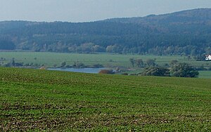
View from Burghardtroda, |
||
| height | 328.6 m above sea level HN | |
| location | Thuringia ( Germany ) | |
| Coordinates | 50 ° 52 '31 " N , 10 ° 12' 8" E | |
|
|
||
| rock | Red sandstone | |
| particularities | Old landmarks | |
The Seebigsrain mountain is a 328.6 m high, wooded elevation and is located in the Frauenseer Forst in the Wartburg district in Thuringia .
The mountain forms the western valley edge of the historic moorland near Ettenhausen an der Suhl and belongs to the Weißendiez area of the Tiefenort community . A paved forest path leads from Weißendiez to the hamlet of Hetzeberg and Ettenhausen an der Suhl. The forest division belonging to the Schöne Aussicht mountain begins south of this forest road .
Between the Seebigsrain and the neighboring mountain Die Harth to the west is the "Albertsgrund" with its southern side valley "Igelsgrund". In this area, both grounds form a narrow notch valley that marks the former state border between the duchies of Saxony-Meiningen and Saxony-Weimar-Eisenach (field name "Grenzgraben" and some beautiful heraldic stones on the hiking trail).
Individual evidence
- ↑ Official topographic maps of Thuringia 1: 10,000. Wartburgkreis, district of Gotha, district-free city of Eisenach . In: Thuringian Land Survey Office (Hrsg.): CD-ROM series Top10 . CD 2. Erfurt 1999.

