Transmitter Kirchheim / Swabia
|
Transmitter Kirchheim / Swabia
|
||
|---|---|---|
 Image wanted
|
||
| Basic data | ||
| Place: | Kirchheim in Swabia | |
| Country: | Bavaria | |
| Country: | Germany | |
| Altitude : | 582 m above sea level NHN | |
| Coordinates: 48 ° 11 ′ 1.7 ″ N , 10 ° 29 ′ 0.4 ″ E | ||
| Use: | Broadcasting station | |
| Owner : | Bavarian radio | |
| Demolition : | 1969 | |
| Mast data | ||
| Construction time : | 1950 | |
| Building material : | steel | |
| Operating time: | 1950-1969 | |
| Total height : | 108 m | |
| Data on the transmission system | ||
| Waveband : | AM station | |
| Radio : | MW broadcasting | |
| Position map | ||
|
|
||
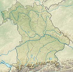
The Kirchheim / Schwaben transmitter was a facility of the Bavarian Broadcasting Corporation that was put into operation in 1950 to broadcast a radio program on the medium wave frequency 1602 kHz with a transmission power of 20 kW in Kirchheim in Swabia and was only in operation at night. The transmitter used as transmission antenna a 108 meter high, insulated against earth itself radiant steel truss mast with a square cross-section. The Kirchheim / Schwaben transmitter was shut down in 1969. The transmitter was located on a hill about 700 m east of the outskirts. A factory has been located on the site of the former transmitter since 1970. Only the name "Senderweg" for the access road still reminds of the transmitter.
Individual evidence
- ↑ a b Skyscaperpage: Kirchheim Transmitter. Retrieved April 15, 2014 .
- ↑ Collection of historical broadcast tables, views as PDF
- ^ Rudolf Puryear: Medium-wave transmitter list 1958. Retrieved on August 23, 2013 .
- ↑ Josef Hölzle: Known throughout the world, difficult to find in Kirchheim. Augsburger Allgemeine Online, October 4, 2011, accessed on August 13, 2013 .
- ↑ Federal Office for Cartography and Geodesy , State Office for Surveying and Geoinformation Bavaria : Digital Topographical Map 1:25 000, [1] , accessed on August 13, 2013

