Seret (river)
|
Seret Серет |
||
|
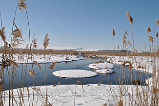
Mouth of the Seret (right in the picture) into the Dniester at Horodok |
||
| Data | ||
| location | Ternopil Oblast ( Ukraine ) | |
| River system | Dniester | |
| Drain over | Dniester → Black Sea | |
| Confluence of |
Right and Left Seret 49 ° 50 ′ 17 ″ N , 25 ° 18 ′ 54 ″ E |
|
| muzzle | near Horodok in the Dniester Coordinates: 48 ° 37 '12 " N , 25 ° 51' 25" E 48 ° 37 '12 " N , 25 ° 51' 25" E |
|
| Mouth height |
140 m
|
|
| length | 248 km (with the right Seret) | |
| Catchment area | 3900 km² | |
| Outflow location: 77 km above the mouth |
MQ |
12 m³ / s |
| Left tributaries | Nischla | |
| Big cities | Ternopil | |
| Medium-sized cities | Chortkiv | |
|
Seret (Ternopil District) |
||
The Seret ( Russian and Ukrainian Сере́т ) is a 248 kilometers (including the source river Right Seret ) long, left tributary of the Dniester in the Ukraine (Eastern Europe).
Its catchment area is 3900 km². It rises on the northwestern edge of the Podolian plate around 100 kilometers east of Lviv and 40 kilometers northwest of Ternopil and flows almost north-south, leaving a deep notch valley in its lower reaches of the Dniester. The estuary is near the village of Horodok .
In the immediate vicinity of its banks below the town of Chortkiv are the gypsum karst caves Uhrin and Werteba .
Web links
Commons : Seret - collection of images, videos and audio files
Individual evidence
- ↑ a b c Article Seret in the Great Soviet Encyclopedia (BSE) , 3rd edition 1969–1978 (Russian)

