Seven Ranges Terminus
Coordinates: 40 ° 39 ′ 7 ″ N , 81 ° 19 ′ 5 ″ W.
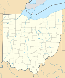
Seven Ranges Terminus is a stone survey point near Magnolia , Ohio , that marked the first step in the development, sale and settlement of the land northwest of the Ohio River . This was the first time the right-angled plan was used to subdivide the land.
history
After the victory in the American Revolutionary War , the United States received the land north of the Ohio River, south of the Great Lakes and east of the Mississippi River in the Treaty of Paris ; this was known as the Northwest Territory . The United States Congress passed the Land Ordinance of 1785 as the method for the survey, sale, and settlement of this area. The ordinance laid down the method according to which the land to be surveyed was divided up using a grid of square survey townships with an edge length of six miles (around 9.6 km). These squares were arranged in vertical rows called “ ranges ”. The first ranges were measured from a longitude along the western border of Pennsylvania . The townships of each range were measured from a baseline running in an east-west direction . This process gave rise to the technique used in the Public Land Survey System .
The decree issued in 1785 commissioned Thomas Hutchins , then Geographer of the United States , to personally oversee the first surveys. She gave him instructions to establish a point of beginning on the north bank of the Ohio River, where it leaves Pennsylvania. From there the baseline was to be determined according to the width of seven ranges at a length of 42 miles (around 68 km), the so-called "Geographer's Line" , and based on this, north-south lines were to be measured to determine the sides of the range and finally to determine the southern border of the township identified in this way. After the seven ranges were completed, Hutchins had to return the parceling plan to the federal government of the United States so that it could promote and sell the area.
Hutchins began surveying the Geographer's Line in 1785 with congressional land surveyors from ten states . In 1785, however, he had to quit his job after a few miles because the Indians were causing problems. In 1786, Hutchins resumed work, taking the protection of soldiers from Fort Steuben . In September 1786, Hutchins placed a stone cadastral survey point on the western edge of the seventh range on the Geographer's Line . This point later became known as the Seven Ranges terminus . After the surveying of the first seven ranges was completed a few years later , this surveying section became known as the Seven Ranges or also as the Old Seven Ranges .
The survey stone
The survey point is on the corner of four townships , three counties, and three survey sections:
- Rose Township, Carroll County , Township 16, Range 7 of the Old Seven Ranges
- Sandy Township, Stark County , Township 17, Range 7 of the Congress Lands North of Old Seven Ranges
- Pike Township, Stark County , Township 8, Range 8 of the Congress Lands North of Old Seven Ranges
- Sandy Township, Tuscarawas County , Township 10, Range 1 of the United States Military District
The survey point is owned by the federal government but is surrounded by privately owned land. It is located about 88 m west of a public road.
The cadastral marker is made of granite . It is square, measures six inches diagonally and protrudes about 30 cm above the ground, but a large part of the stone is in the ground.
The Seven Ranges terminus was added to the National Register of Historic Places on August 12, 1976 because it is associated with the historical significance of Thomas Hutchins.
Web links
- Library of Congress - Land Ordinance of 1785 text
- Ohio History Central- Seven Ranges
- Ohio History Central- Thomas Hutchins
- photos of surveyors marker
supporting documents
- ^ The Official Ohio Lands Book ( English , PDF) Auditor of State of Ohio. Pp. 10-12. Retrieved July 10, 2012.
- ^ William E. Peters: Ohio Lands and Their Subdivisions . WE Peters, 1918, pp. 65-68.
- ^ HJ Eckley, WT Perry: History of Carroll and Harrison Counties . The Lewis Publishing Co, 1921, p. 239.
- ↑ Rose Township History ( English , PDF) S. 3. Accessed on 10 July 2012 found.
- ↑ Archived copy ( Memento of the original from September 29, 2012 in the Internet Archive ) Info: The archive link was inserted automatically and has not yet been checked. Please check the original and archive link according to the instructions and then remove this notice. , Ohio Historical Society
- ^ National Register Information System . In: National Register of Historic Places . National Park Service . Retrieved March 13, 2009.


