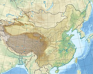
Shatuo Dam
| Shatuo | |||||||
|---|---|---|---|---|---|---|---|
|
|||||||
|
|
|||||||
| Coordinates | 28 ° 29 '45 " N , 108 ° 28' 16" O | ||||||
| Data on the structure | |||||||
| Lock type: | RCC dam | ||||||
| Construction time: | 2006-2009 | ||||||
| Height of the barrier structure : | 156 m | ||||||
| Power plant output: | 1 120 MW | ||||||
| Data on the reservoir | |||||||
| Storage space | 631 million m³ | ||||||
| Catchment area | 54 508 km² | ||||||
The Shatuo Dam ( Chinese 沙 沱 水电站 , Pinyin Shātuó Shuĭdiànzhàn ) is a dam on the Wu Jiang in the Yanhe autonomous region of the Chinese province of Guizhou .
Building
The groundbreaking ceremony for the structure took place on June 28, 2006 and excavation work began shortly afterwards. In 2008, after the river was shut off, part of the dam collapsed due to the karst foundation and had to be reconstructed. On April 19, 2009, the river was dammed and the reservoir began to fill up. A lock is planned; its completion is expected in 2020.
The hydropower plant went into operation in 2010. It should deliver an average of 4.55 billion kWh annually.
See also
- List of hydropower plants in China
- List of dams in China
- List of the largest dams on earth
- List of the largest reservoirs on earth
- List of the largest hydroelectric plants in the world
swell
- ↑ Wujiang Hydropower Station Successfully Shatuo Phase Closure, Forecasting Center Owners Do Their Utmost to Meet the Needs Of, ( Memento of the original from July 7, 2011 in the Internet Archive ) Info: The archive link was inserted automatically and has not yet been checked. Please check the original and archive link according to the instructions and then remove this notice. Hydrological Bureau of Changjiang Water Resources Commission, accessed October 8, 2012 (Chinese).
Web links
- Shatuo Dam (English / Chinese)
