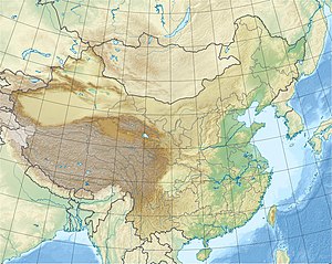
Goupitan dam
| Goupitan dam | |||||||
|---|---|---|---|---|---|---|---|
|
|||||||
|
|
|||||||
| Coordinates | 27 ° 22 '29 " N , 107 ° 38' 0" E | ||||||
| Data on the structure | |||||||
| Construction time: | 2003 to 2011 | ||||||
| Height above foundation level : | 232.5 m | ||||||
| Building volume: | 2.45 million m³ | ||||||
| Crown length: | 557 m | ||||||
| Power plant output: | 3000 MW | ||||||
| Data on the reservoir | |||||||
| Altitude (at congestion destination ) | 640.5 m | ||||||
| Water surface | 94.29 km² | ||||||
| Storage space | 6,380 million m³ | ||||||
| Catchment area | 43 250 km² | ||||||
The Goupitan Dam is a 232.5 m high arch dam that was built on the Wu Jiang River in China and completed in 2011.
The dam of Guizhou Goupitan Hydro , a water power plant having a power of 3000 (5 × 600) Megawatts. 9.192 billion kWh are to be generated per year.
The storage space is given in various sources as 6,455 or 6,380 million m³.
The dam is also used for flood protection and navigability. Every year, 2.928 million tons are to be transported by ship on the Wujiang. It is expected that 25,300 people will have to be relocated if the reservoir is dammed.
See also
- List of hydropower plants in China
- List of dams in China
- List of the largest dams on earth
- List of the largest hydroelectric plants in the world
swell
- ↑ a b c d Goupitan Hydropower Project ( Memento of the original from April 16, 2014 in the Internet Archive ) Info: The archive link was inserted automatically and has not yet been checked. Please check the original and archive link according to the instructions and then remove this notice. (PDF file; 351 kB)
