Sheffield, Alabama
| Sheffield | |
|---|---|
 Sheffield Downtown Commercial Historic District (2012) |
|
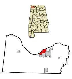
| Location in County and Alabama | |
| Basic data | |
| Foundation : | 1885 |
| State : | United States |
| State : | Alabama |
| County : | Colbert County |
| Coordinates : | 34 ° 46 ′ N , 87 ° 42 ′ W |
| Time zone : | Central ( UTC − 6 / −5 ) |
| Residents : | 9,200 (as of 2004) |
| Population density : | 541.2 inhabitants per km 2 |
| Area : | 17.1 km 2 (approx. 7 mi 2 ) of which 17.0 km 2 (approx. 7 mi 2 ) is land |
| Height : | 157 m |
| Postal code : | 35660 |
| Area code : | +1 256 |
| FIPS : | 01-69648 |
| GNIS ID : | 0153401 |
| Website : | www.sheffieldalabama.org |
| Mayor : | Billy Don Anderson |
Sheffield is an American city in Alabama . It is located in Colbert County and had a population of about 9200 in 2004. The Muscle Shoals Sound Studio, recognized in the music world, was located in Sheffield . Sheffield is also the birthplace of former Senator and presidential candidate Fred Thompson .
geography
Sheffield's geographic coordinates are 34 ° 46 ' N , 87 ° 42' W (34.759721, -87.694592).
According to the United States Census Bureau , the city has an area of 17.1 km², of which 17.0 km² is land and 0.1 km² (= 0.46%) is water.
history
Eight Sheffield structures and sites are listed on the National Register of Historic Places , including the Sheffield Downtown Commercial Historic District as of July 12, 2019.
Demographics
At the time of the United States Census 2000, Sheffield was inhabited by 9,652 people. The population density was 568.1 people per km ². There were 4760 housing units at an average of 280.2 per km ². The Sheffield population was 71.21% White , 26.21% Black or African American , 0.39% Native American , 0.28% Asian , 0.04% Pacific Islander , 0.57% said other races belong to and 1.30% named two or more races. 1.50% of the population declared to be Hispanic or Latinos of any race.
The residents of Sheffield were distributed in 4,243 households out of which 27.2% were living in children under 18 years of age. 43.3% of households were married, 16.7% had a female head of the household without a husband and 36.1% were not families. 32.5% of households were made up of individuals and someone lived in 15.5% of all households aged 65 years or older. The average household size was 2.27 and the average family size was 2.87 people.
The urban population was divided into 23.7% minors, 8.0% 18–24 year olds, 26.6% 25–44 year olds, 22.6% 45–64 year olds and 19.0% aged 65 and over or more. The median age was 39 years. For every 100 women there were 85.5 men. For every 100 women over the age of 18, there were 80.6 men.
The median household income in Sheffield was 26,673 US dollars and the median family income reached the amount of 33,877 US dollars. The median income for men was $ 30,378 compared to $ 18,033 for women. The per capita income in Sheffield was $ 16,022. 18.7% of the population and 16.5% of families had an income below the poverty line , including 27.5% of minors and 10.4% of those aged 65 and over.
sons and daughters of the town
- Willie Ruff (* 1931), jazz musician and university professor
- Fred Thompson (1942-2015), actor
- Jimmy Johnson (1943-2019), guitarist
Web links
Individual evidence
-
↑ Search mask database in the National Register Information System. National Park Service , accessed July 12, 2019.
Weekly List on the National Register Information System. National Park Service , accessed July 12, 2019.
