
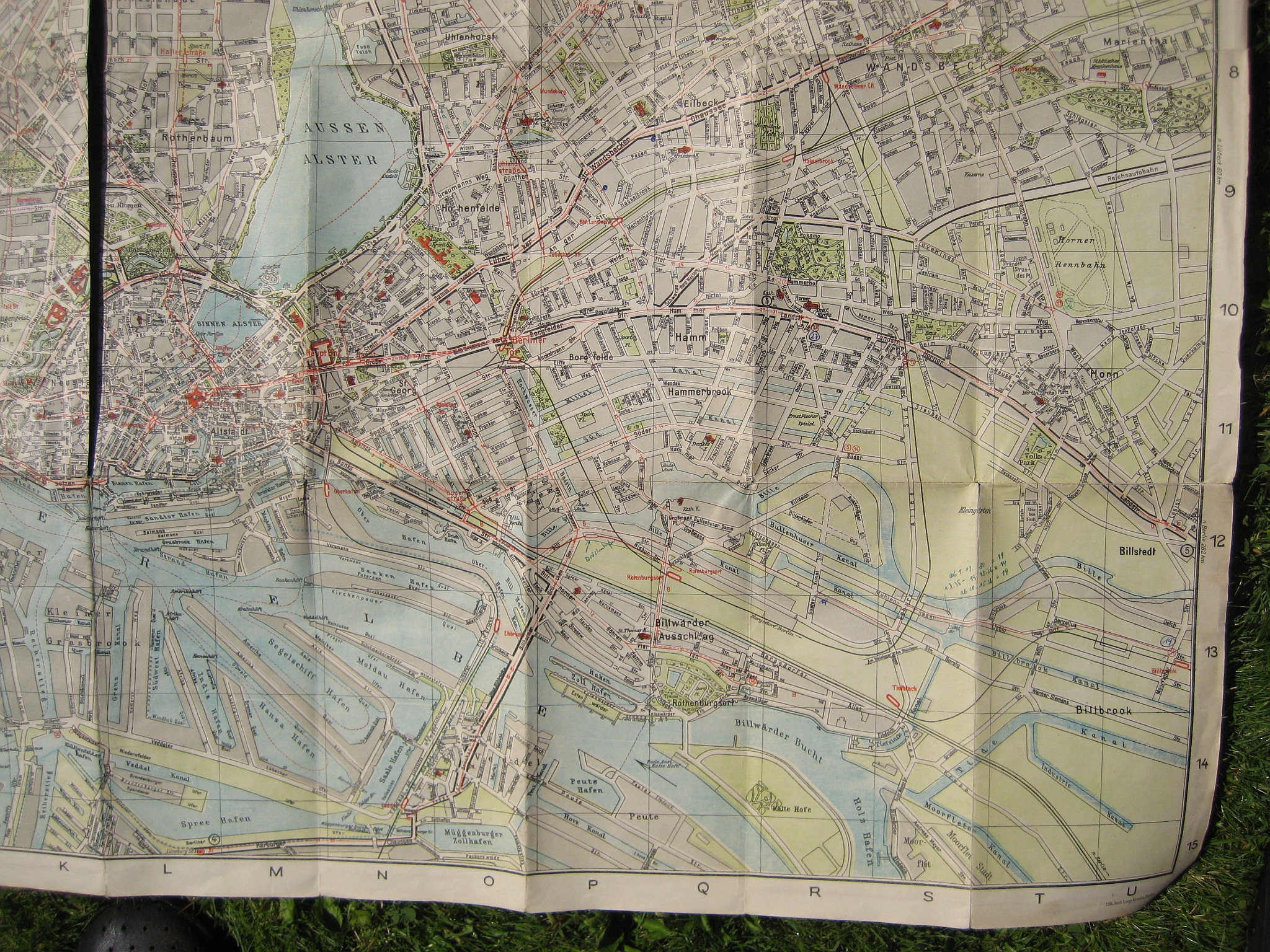
Sievekingdamm
.ajb.jpg)

.jpg)
The Sievekingdamm is an approximately 930-meter-long city road in Hamburg 's Hamm district. Your official key number is S440. It was created in the 1930s with the inclusion of an older road as a feeder to today's federal motorway 24 . It is named - like the neighboring Sievekingsallee - after the Hamburg council syndicate Karl Sieveking , who owned extensive land in the area, including today's Hammer Park .
Location and development
Sievekingdamm runs from the Burgstrasse underground station ( Lage ) in a north-easterly direction and connects Hammer Landstrasse , which runs below the Geesthangs , with Sievekingsallee ( Lage ), which is 8.6 meters higher . It has two lanes throughout in both directions and has a partially green central reservation.
Due to the extensive destruction of Hamm in the Second World War ( Operation Gomorrah ), the surrounding residential development mainly dates from the 1950s. In the far north, some new buildings have been added in recent years.
history
The northern section (between Carl-Petersen-Straße and Sievekingsallee) can be traced under the name “Hinter den Höfen” as one of the oldest paths in the area. It connected the village of Hamm, which was located on the Geest slope between today's underground stations Burgstrasse and Hammer Kirche , with the surrounding fields (Borgfeld, Peterskamp, Fahrenkamp). The southern section between Carl-Petersen-Strasse and Hammer Landstrasse, on the other hand, was only created in the 1930s as a feeder to the new “Reichsautobahn”. (The current connection between Sievekingsallee and Bürgerweide was not possible due to the existing housing development at the time and was only cut through the largely destroyed district after the Second World War .) At the same time, both street sections were combined under the name "Horst-Wessel-Straße". After 1945, the street was renamed Sievekingdamm, based on the neighboring Sievekingsallee.
Until 1976, the Hamburg tram , coming from Burgstrasse, drove through Sievekingdamm and Sievekingsallee to the Horner Rennbahn . Today it has been replaced by bus route 261.
Individual evidence
- ^ Statistics Office North: Street and area index of the Free and Hanseatic City of Hamburg
- ↑ Horst Beckershaus: The Hamburg street names. Where do they come from and what they mean. European Publishing House, Hamburg 2011, ISBN 978-3-86393-009-7 , p. 337 .
- ↑ City map section 1928. In: www.archiv-hhnv.de. Retrieved December 7, 2016 .
- ↑ G. Herman Sieveking : History of the Hammerhof . I. part. Hamburg 1899, p. 30, 34 .
- ^ City map section 1938. In: www.archiv-hhnv.de. Retrieved December 7, 2016 .
- ^ Goodbye tram. (No longer available online.) In: hamburger-wochenblatt.de. Archived from the original on December 7, 2016 ; Retrieved December 7, 2016 . Info: The archive link was inserted automatically and has not yet been checked. Please check the original and archive link according to the instructions and then remove this notice.